Elevation: 6,795 ft
Prominence: 295

This peak is not in the book. Published November 2020
Peak 6795 is situated just north of South Fork Rock Creek in the Sublett Mountains. It sits above five separate springs: Sager Spring, Young Spring, Wild Horse Spring, Yellow Jacket Spring, and Sunnyside Spring. You’ll never lack for water here. Peak 6795 is most easily accessed via FSR-583 to its south and FSR-720 to its west. It stands out as the highest scrub hump in this area. USGS Sublett Troughs
Peak 6795 as viewed from high on the south ridge. Livingston Douglas Photo
Access
From the junction of ID-38 and ID-37 in Holbrook, drive northwest on ID-37 to a [signed] junction with Meadowbrook Road/BLM-027. Turn left/southwest onto BLM-027 and drive 1.3 miles to a [signed] junction. Go right/north onto Kress Road and drive 6.5 miles to an unsigned junction. Go left onto Holloway Canyon Road/BLM-025 and reset your odometer. At 1.7 miles, reach BLM land at a cattle guard. At 3.3 miles, reach a [signed] junction of BLM-583 (right) and BLM-606 (straight). Park just past this junction in a large pullout area (5,960 feet).
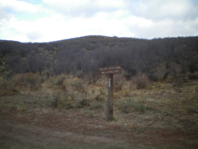
The base of the south ridge of Peak 6795 is at this road junction. Bushwhack dead ahead (northwest) from here. The tall, purplish bushes you see are particularly challenging. Livingston Douglas Photo
South Ridge, Class 2
The Climb
From the junction of BLM-583 and BLM-606, hike (or drive) up BLM-583 (a 2-track jeep road) as it heads north over a saddle and then drops to the South Fork Rock Creek drainage. The road turns left/west in a meadow when it reaches the drainage. There is an unsigned road junction here. Ignore the 2-track road in the meadow. Continue west on BLM-583 (which becomes FSR-583) for another mile until it reaches a [signed] junction with FSR-720. Leave the road here and bushwhack north-northwest up through thick sagebrush and other brush and bushes to reach the [better-defined] south ridge higher up. Follow the ridge north on easy, open scrub as it undulates and weaves a bit to reach the summit hump of Peak 6795. The summit has a large, but flattened, cairn.
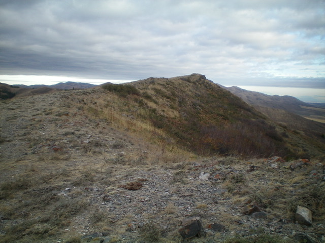
The final section of the south ridge of Peak 6795 is an easy stroll. The summit is right of center. Livingston Douglas Photo
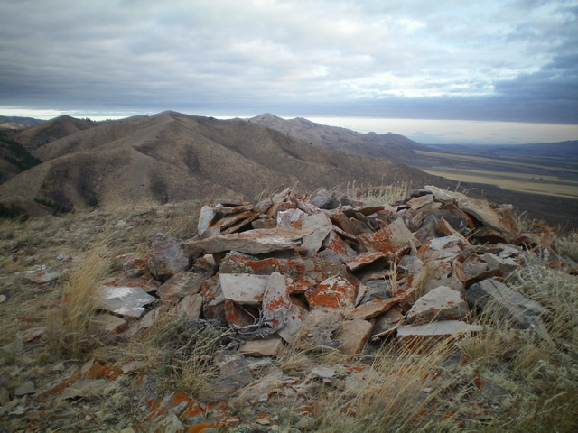
The flattened summit cairn atop Peak 6795, looking north. Livingston Douglas Photo
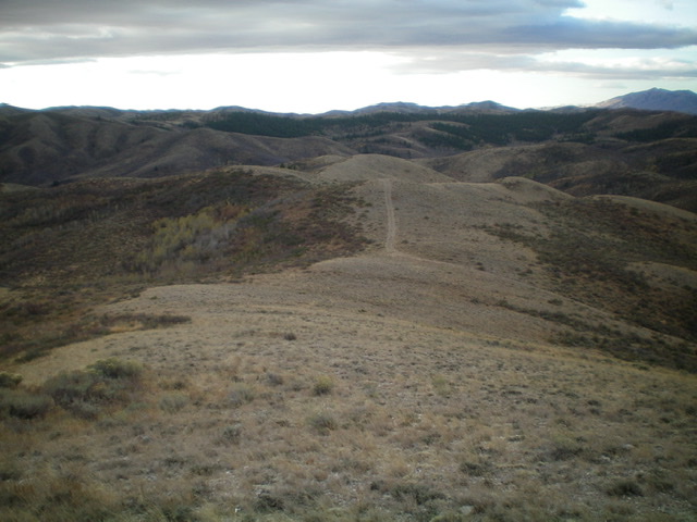
Looking down the south ridge from near the summit of Peak 6795. Livingston Douglas Photo
Additional Resources
Regions: SOUTHERN IDAHO->Sublett Range
Mountain Range: Sublett Range
Longitude: -112.90101 Latitude: 42.29019