Elevation: 6,796 ft
Prominence: 496
This peak is not in the book. Published November 2020
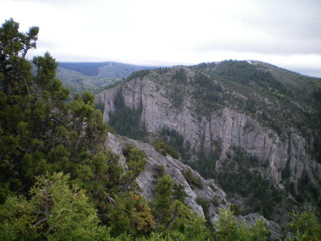
Peak 6796 is one of two peaks that tower over The Narrows: a rugged, cliff-faced section of Wolverine Canyon in the Blackfoot Mountains. The other peak is Peak 6420 to its northwest. Each has a combination of gentle sides and a wickedly-steep, cliffy side. Beware of the mix of private and public land around Peak 6796. The two routes described here are entirely on BLM land. USGS Wolverine
Peak 6796 and its cliffy northwest face as viewed from Peak 6420 to the northwest. Its summit is right of center. Livingston Douglas Photo
Access
From the south end of Firth, ID on US-91, drive 1.7 miles south on US-91 to [signed] East 600N. This is Wolverine Road. Turn left/east onto paved Wolverine Road and reset your odometer. At 10.4 miles, go straight at a junction with [signed] Blackfoot River Road to stay on Wolverine Road. At 14.9 miles, after driving through The Narrows, there is a small pullout, a fire ring, and an old jeep road on the right/south side of the road. Park here (5,475 feet). Wolverine Road is paved to just before entering The Narrows. It then becomes a well-graded, smooth dirt/gravel road.
North Ridge, Class 2
The Climb
From the parking pullout, cross Wolverine Creek on some boulders that are about 15 yards upstream from the old jeep road crossing of the creek. Bushwhack west up a very steep, forested slope to reach the crest of the north ridge. The forest is brushy initially but is more open (less trees) higher up. It is still steep and is always brushy. If you encounter ridge buttresses/cliffs, simply traverse left/south to get past them to reach the ridge crest. Once on the ridge, follow the ridge crest southwest (using an on-and-off use trail) up to a ridge hump which is also a ridge corner.
The ridge turns left-ish/south here. Descend 110 vertical feet to a saddle then scramble up over a minor hump to reach the final uphill. Scramble south up the forested face (the brush is not too bad here) until above tree line. A final section of brush-busting in open terrain gets you to the open scrub-and-broken-rock summit. The summit of Peak 6796 has a USGS benchmark and a small summit cairn.
East Ridge, Class 2
The Descent
From the summit, descend east down the open ridge (not too brushy) and eventually down through the forest (some deadfall but not too brushy) to cross a minor shoulder to reach the north gully. This gully is a dry gully with a good cattle/use trail in its center. Cruise down through the forest on the “gully trail” to reach a cattle fence near Wolverine Road. Jump the fence and hike a short distance down an old jeep road to reach the boulder-crossing of Wolverine Creek and your parked vehicle.
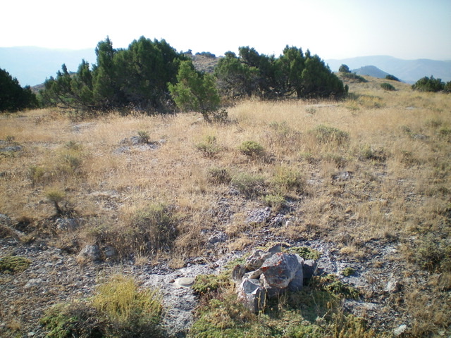
The summit area of Peak 6796. Livingston Douglas Photo
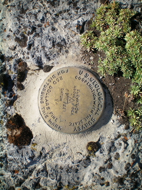
The USGS benchmark atop Peak 6796. Livingston Douglas Photo
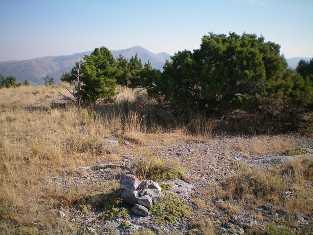
Another view of the summit area of Peak 6796 with Taylor Mountain in the distance. Livingston Douglas Photo
Additional Resources
Regions: Blackfoot Mountains->SOUTHERN IDAHO
Mountain Range: Blackfoot Mountains
Longitude: -111.95309 Latitude: 43.26709