Elevation: 6,805 ft
Prominence: 443
This peak is not in the book. Published January 2023
Peak 6805 is the high point on a long, narrow ridge that extends from US-30 to the north to a sharp bend in Pegram Road to the south. It is most easily climbed from Pegram Road to its west. This area is a mix of private and public land, so be careful. This climb is entirely on BLM land. USGS Pegram
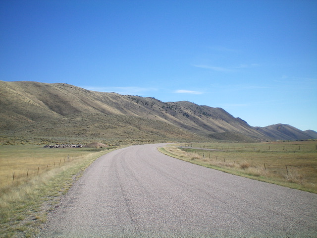
Peak 6805 (the high point on the high ridgeline in dead center) as viewed from Pegram Road to its north. Livingston Douglas Photo
Access
From the stoplight at the south end of Montpelier (Maverik and Broulim’s nearby), drive south then southeast on US-30 for 12.1 miles to a signed junction with Pegram Road. Turn right/south on Pegram Road and drive 1.5 miles to a large pullout on a bluff that overlooks Bear River at a diversion dam (shown on the USGS topo map). Park in this pullout (6,000 feet). GPS coordinates: 42⁰10’50”N, 111⁰08’56”W.
West Shoulder/West Face, Class 2
The Climb
From the large parking pullout, cross to the east side of Pegram Road and scramble up a steep hill to quickly reach a stiff, high cattle fence. Crawl under the fence and scramble up a steep, grassy shoulder to reach steeper, rockier, brusher terrain above. Scramble steeply up to the summit ridge, staying left/north on easier sections of scrub/rock. Follow the easy scrub ridge right/south for about 100 yards or so to the summit. The summit has a tall cairn and offers amazing views of the weaving, meandering Bear River.
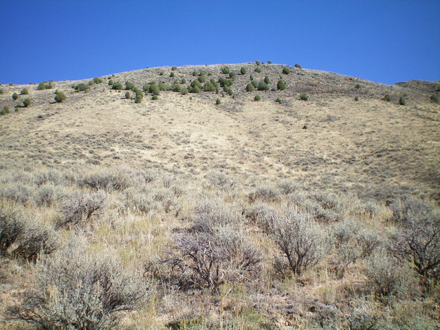
Peak 6805 and its steep west face (my ascent route) as viewed from its base. Livingston Douglas Photo

The tall cairn atop Peak 6805. Livingston Douglas Photo
Additional Resources
Regions: Peale Mountains->Pruess Range->SOUTHERN IDAHO
Mountain Range: Peale Mountains
Longitude: -111.1433 Latitude: 42.1795