Elevation: 6,812 ft
Prominence: 691
This peak is not in the book. Published June 2018
Peak 6812 is located north of Garden Valley, Idaho on a long, steep-sided ridge that divides the Middle Fork Payette River from Silver Creek. This area is characterized by deep canyons, thick forests and the occasional but spectacular granite slabs and spires. The peak is located 1.2 air miles north of the Silver Creek Fire Lookout, which is a low point on the peak’s South Ridge. USGS Bull Creek Hot Springs

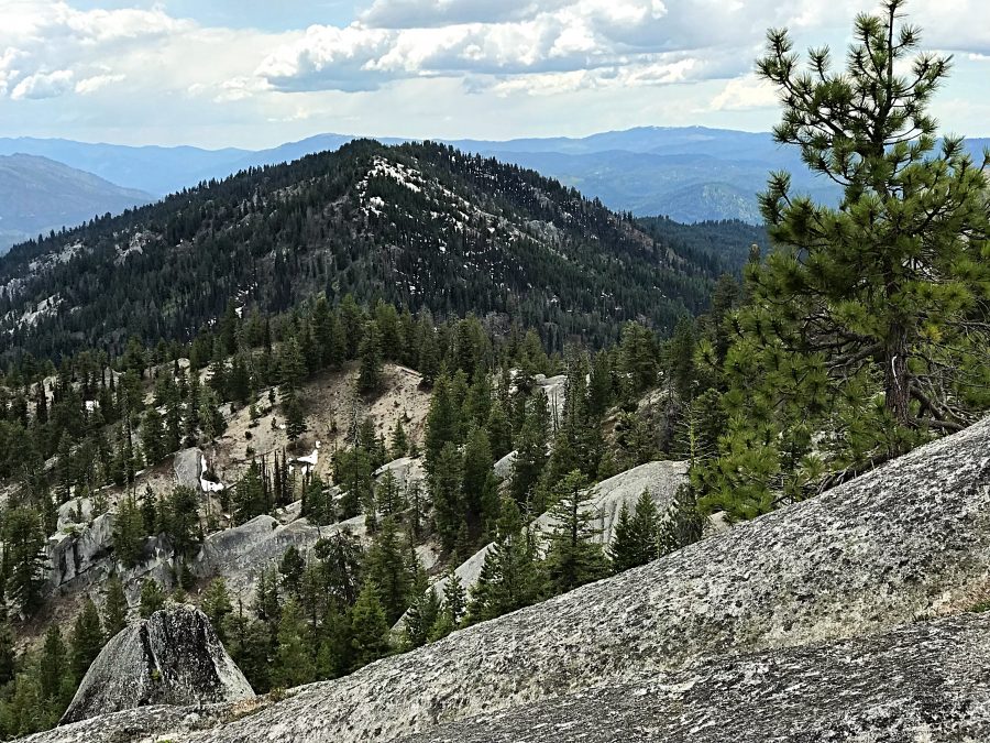
Peak 6812 as viewed from the north.
Access
Reach the peak from the Banks/Lowman Road by taking the Middle Fork Road/FS-698 [(D)(1.1) on Page 140] up the Middle Fork and then turning onto FS-671 which runs toward the Silver Creek Plunge Resort. From ID-55 at Banks, follow the Banks/Lowman Highway east for 8.3 miles Turn north onto the Middle Fork Road which quickly reaches downtown Crouch, Idaho. In 0.7 miles, the road makes a sharp left turn in town and then heads north again.
Continue following the road north for a total of 23.0 miles to the signed turn for the Silver Creek Lookout (FS-678). The Middle Fork Road is paved at first, then good gravel and then maintained dirt. FS-678 is a steep road with a lot of potholes. FS-678 reaches the ridge crest where there is a complicated intersection. Turn left and then immediately left again. This new road is designated FS-678B. Follow this road north to a junction in roughly 0.75 miles. FS-678B continues right and FS-678C continues straight. In good conditions, a 2WD with sufficient ground clearance and careful driving can reach this point. Park here as the road to the lookout is gated just above the junction.
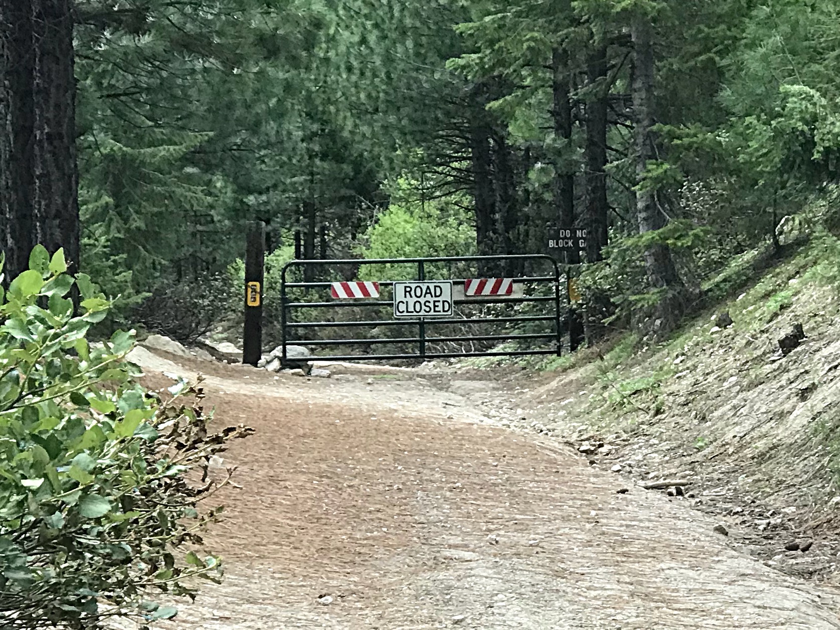
The gate closure on FS-678B.
South Ridge, Class 2
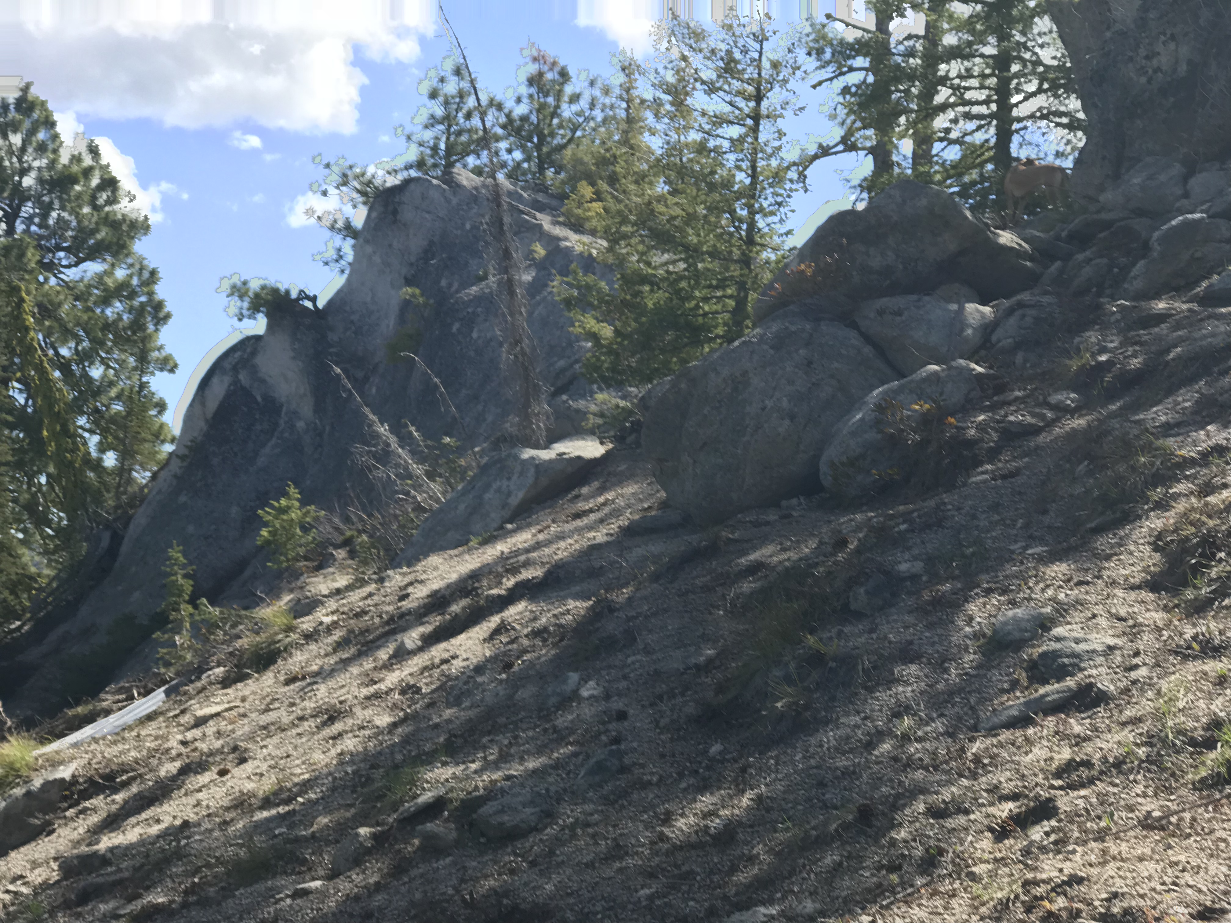
Follow FS-678B past the gate to the Silver Creek Lookout. Just north of the point where the road crosses the ridge is a large granite fin. On the West Side of the fin, look for a faint trail. Turn north on this trail and follow the ridge north. The trail is distinct in places, missing in spots and brushy at times. Even with the faint trail, following the ridge requires cross-country skills. From the parking spot to the granite outcrop that forms the summit, it is 2.5 miles with 962 feet of elevation gain.
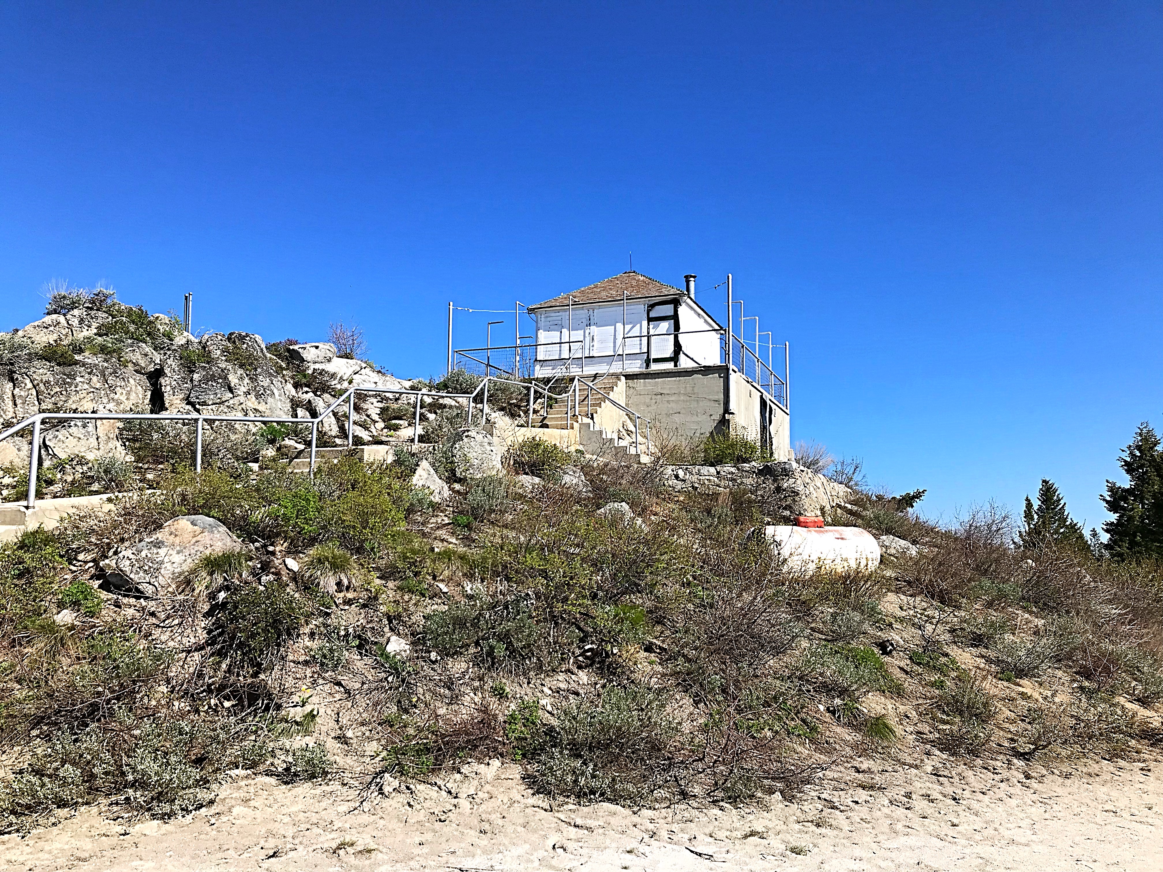
Silver Creek Lookout
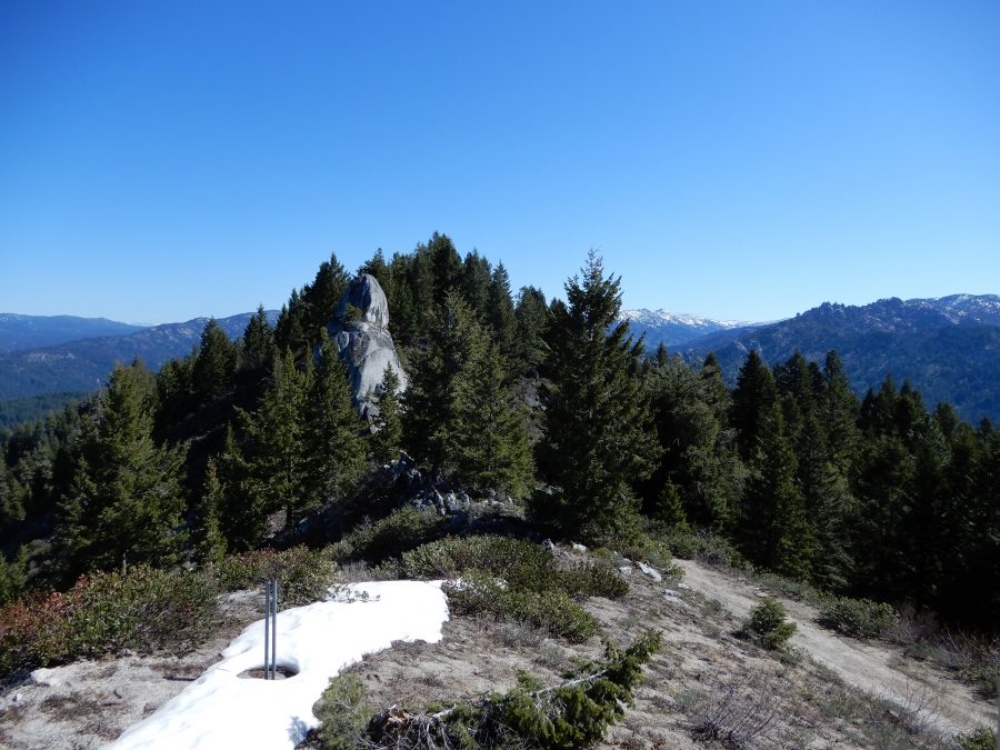
This is the rock fin at the beginning of the ridge scramble from the lookout to the peak. John Platt Photo
The summit of Peak 6812 is a granite outcrop surrounded by small trees.
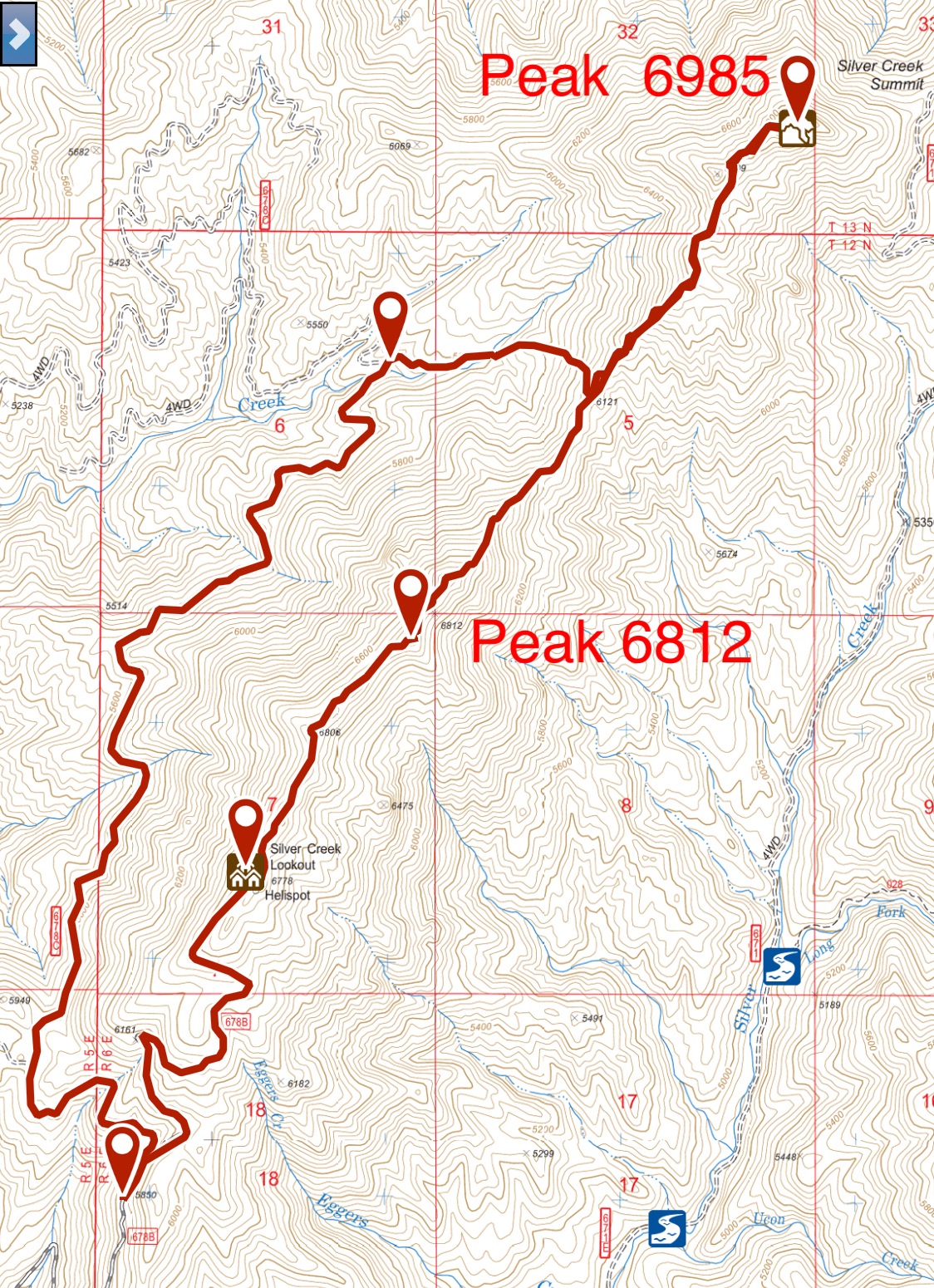
My GPS Track for Peak 6812 and Peak 6875.
Additional Resources
Regions: Log Mountain - Deadwood Divide Peaks->Salmon River Mountains->WESTERN IDAHO->Western Salmon River Mountains
Mountain Range: Western Salmon River Mountains
Year Climbed: 2018
Longitude: -115.78101 Latitude: 44.39409