Elevation: 6,813 ft
Prominence: 593
This peak is not in the book. Published May 2018
“Lone Tree Peak” (Peak 6813) is located along the Idaho/Oregon border northwest of South Mountain and is accessed from Mud Flat Road. USGS Cliffs
Access
To access Peak 6813, turn onto Yturri Blvd south of Jordan Valley which turns into Mud Flat Road. Follow Mud Flat Road until you reach the intersection of Lone Tree Creek Road which is just south of Lone Tree Creek. Depending on the time of the year, you can either park here or drive in about 1.5 miles to the base of the North Ridge. Mud Flat Road is part of the Owyhees Uplands Backcountry Byway.
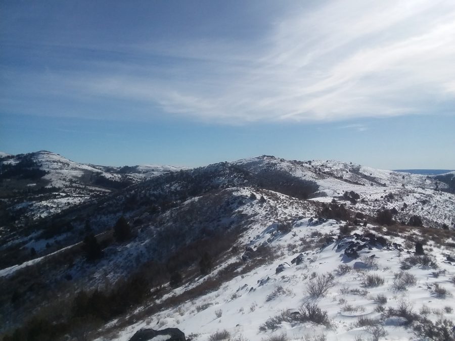
North East Ridge, Class 2
Head south and east to gain the ridge and follow the undulating ridge to the summit. The last bump on the ridge before the summit contains the Lone Tree USGS benchmark. My round trip distance was about 9.5 miles with 2,100 feet of elevation gain. If you park at the base of the ridge, the elevation gain is closer to 1,600 feet. There is private property just east of the summit that is owned by a mining company, so it is best to stick to the ridge.
Additional Resources
Regions: Owyhee Mountains->SOUTHERN IDAHO
Mountain Range: Owyhee Mountains
Longitude: -116.9718 Latitude: 42.7419