Elevation: 6,848 ft
Prominence: 578

This peak is not in the book. Published November 2024
Peak 6848 sits above Tenmile Pass at the southeast end of the Chesterfield Range. It separates Tenmile Creek from Mabey Canyon. Most of this climb is on BLM land. However, the summit is on private land that has been actively mined for phosphate. USGS Hatch

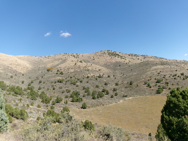
Peak 6848 (dead center) as viewed from the southwest. The southwest side was both my ascent route and my descent route. Livingston Douglas Photo
Access
From US-30 east of Lava Hot Springs (at virtual MM378.5), drive up the [paved] Lund Highway to Bancroft. Leave the highway at Bancroft and head north up [paved] Chesterfield Road for 1-2 miles to a signed junction with Tenmile Pass Road. Turn right/east onto Tenmile Pass Road and drive up to a phosphate mining operation on the left/northwest side of the road. Park in a large roadside pullout about 100 yards below the entrance to the mining facility (6,015 feet and 42⁰45’28”N, 111⁰46’34”W). This pullout is 0.4 miles southwest of the signed junction with Tenmile Pass Cutoff Road. Tenmile Pass Road is a well-maintained county road.
South Shoulder/Southwest Face, Class 2
The Climb
Consult the LOJ Land Management Map before undertaking this climb in order to stay on BLM land as much as possible. While the summit area is on private land, I encountered no fencing or signage to prohibit entry on the route that I took. The phosphate mining operation was dormant when I was there in 2024. Undertake this climb at your own risk. From the roadside pullout, bushwhack west through thick scrub to reach easier scrub near Point 6066. Scramble northwest up the easy grass/scrub ridge to the top of this point.
From Point 6066, descend north-northwest into a flat area with thick scrub. This flat area sits at the base of the south shoulder and is just left/west of the mining operation’s open storage/parking area. Bushwhack north up the shoulder of grass/scrub, junipers, and a few mountain mahogany. Stay near the ridge crest to find some grassy areas for easier going. At about 6,400 feet, angle diagonally right/northeast to cross a dry gully and climb a southwest shoulder that leads up to near the summit on mostly open grass with some scrub and rock near the summit ridge crest. The bushwhack down and across the dry gully is thick with scrub and is unpleasant, but it does not last for long.
Once on the summit ridge crest, follow the narrow, rocky ridge right/southeast to the 6,848-foot measured high point (42⁰46’05”N, 111⁰46’17”W). This bump has some mountain mahogany on it but the ridge traverse is mostly a rock scramble. Due to mining activity, this hump is now at about 6,755 feet (GPS), which was confirmed by my altimeter. That is almost 100 feet lower than its measured height. I was stunned. From the southeast summit, there is a ridge hump to the northwest that appears to be a bit higher (and it is).
From the southeast summit, follow the ridge northwest briefly then descend right/north onto a mining road. Follow this smooth road to the talus/scree heap that is the northwest summit. Leave the road near the northwest hump and scramble up a steep-ish pile of talus and scree to the small top. This hump now measures 15 vertical feet higher than the official/measured southeast summit, according to my altimeter. My GPS put it at 21 feet higher. The northwest summit has nothing north of it that is any higher. This hump is at 42⁰46’17”N, 111⁰46’33”W. The northwest summit sits at the head of the magnificent south ridge of the Peak 6848 massif. Stand atop both summits “just to be sure.”

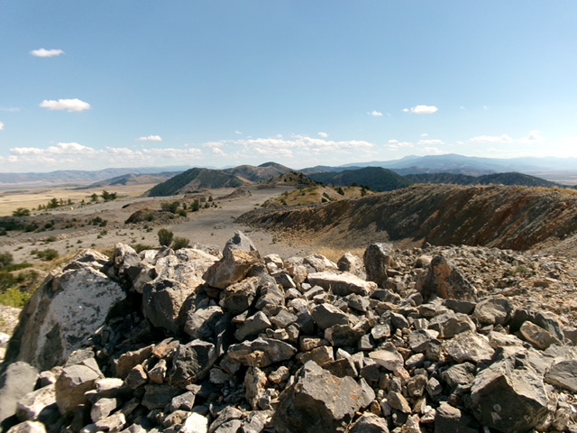
The rocky summit area of Peak 6848 as viewed from the [now-higher] northwest summit hump. This shot looks southeast at the official/measured summit hump in the distance in dead center. Livingston Douglas Photo
South Shoulder, Class 2
The Descent
From the northwest summit, descend west-southwest then southwest through rock and scrub to reach the top of the open shoulder at 6,700 feet. From here, it is a splendid cruise down short grass on the rounded shoulder all the way down to semi-forested terrain lower down. The ridge becomes a mix of grass, scrub, junipers, and a few mountain mahogany below 6,400 feet. Retrace the ascent route back to Point 6066 and then east to the large pullout along Tenmile Pass Road.
Additional Resources
Regions: Blackfoot Mountains->Chesterfield Range->SOUTHERN IDAHO
Mountain Range: Blackfoot Mountains
Longitude: -111.7710 Latitude: 42.7685