Elevation: 6,889 ft
Prominence: 349
This peak is not in the book. Brett chose his route to avoid the private land surrounding De Lamar. This private land is related to the historic mining operations. Published April 2014.
Peak 6889 is located west of Silver City and southeast of the De Lamar mining site. USGS Flint
Access
Approach the peak from the De Lamar/Silver City Road [[B)(1) on Page 347]. Drive past the abandoned De Lamar townsite along Jordan Creek until you reach roughly 5,600 feet. From this point, you are at the base of a north/south trending ridge that can be followed south to the peak without crossing private property.
Route
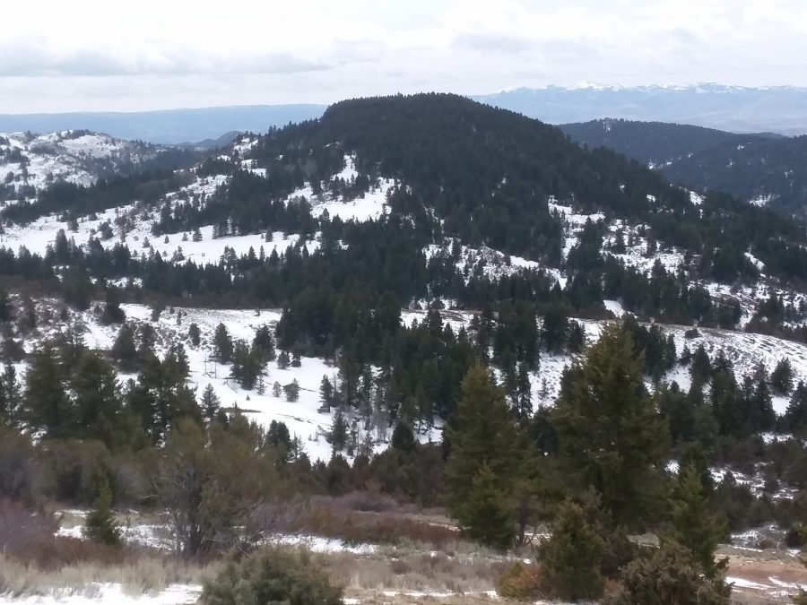
April 14, 2018. The first obstacle on this route is Jordan Creek. This creek will be close to hip deep during the Spring and dangerous to cross. After crossing the creek, follow the ridge south to Point 6957. Descend the south side of this point for roughly 500 feet to the base of Peak 6889. Climb 400 feet to the summit, which has excellent views despite looking like it is tree-covered.
Two other peaks are nearby just south of Louse Creek but would require a lengthy approach from De Lamar or Flint Creek Roads. It may be possible to get closer to this peak from Last Chance Gulch closer to Silver City, but the road crosses through private property and it is not clear if there is public access across this property.

Peak 6889. Brett Sergenian Photo
Additional Resources
Regions: Owyhee Mountains->SOUTHERN IDAHO
Mountain Range: Owyhee Mountains
Longitude: -116.8006 Latitude: 42.9849