Elevation: 6,900 ft
Prominence: 308
This peak is not in the book. Published November 2023
Peak 6900 is a gentle, forested hump that sits on the north side of Silver Creek and on the west side of Rooker Basin in the Eastern Salmon River Mountains. It is most easily climbed from Silver Creek Road/FSR-108 to its south. USGS Opal Lake
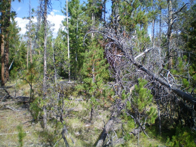
The thickly-forested, deadfall-ridden summit of Peak 6900. Pure misery. Livingston Douglas Photo
Access
From the signed junction of Panther Creek Road/FSR-055 and Silver Creek Road/FSR-108, drive 1.9 miles west on Silver Creek Road to a small pullout on the left/south side of the road. This pullout is at 6,335 feet and 44⁰55’58”N, 114⁰22’03”W. The signed junction is 5.3 miles south of Porphry Creek Road/FSR-112.
South Ridge, Class 2
The Climb
From the roadside pullout, scramble northeast up a steep, but easy, grassy slope on the right/east side of a dry gully to reach the crest of the south ridge. This grassy slope is just left/west of a steep talus slope and is a better option to reach the south ridge than a direct climb up the loose talus field. Once on the south ridge, bushwhack up through the easy pine forest (initially) to thicker and more unpleasant forest higher up. The deadfall intensifies and the summit plateau is littered with it.
There is no clear high point, so roam around in the tedious deadfall and thick forest to satisfy yourself that you have stood atop it. When descending back to the road, it is easy to get off course given how rounded the south ridge is lower down. It becomes more of a face and has some steep, rocky talus patches to descend to the road which can be rather unpleasant, as I found out.
Additional Resources
Mountain Range: Eastern Salmon River Mountains
Longitude: -114.3635 Latitude: 44.9407