Elevation: 6,901 ft
Prominence: 511
This peak is not in the book. Published January 2023
Peak 6901 is located due south of Camp Peak on the northeast side of Blackfoot Reservoir. It is most easily climbed via Collett Creek Road and its north ridge. USGS Henry
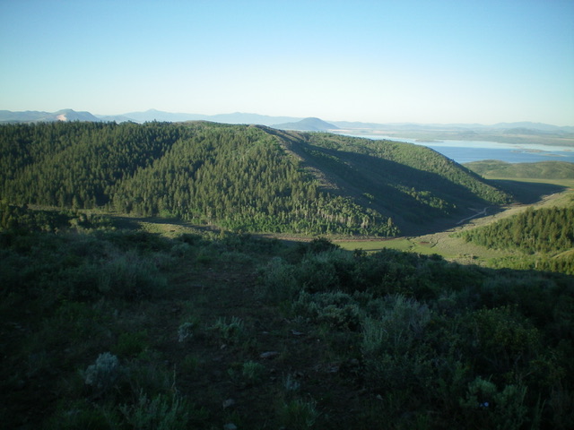
Peak 6901 (mid-ground) as viewed from the north. The north ridge follows a diagonal line (right of center to center) along the clear edge of the forest/scrub line. Livingston Douglas Photo
Access
From ID-34 just north of Henry, turn left/west onto Blackfoot North Access Road (shown as North Reservoir Road on the USGS topo map). Drive 3.9 miles west then northwest to an unsigned junction at a sharp left/west bend in the road. Turn right/northeast onto Collett Creek Road and drive 0.9 miles to an unsigned junction in a large meadow. Park here (6,283 feet).
North Ridge, Class 2
The Climb
From the road junction, walk west down Collett Creek Road a short distance (to just past the cattle cistern) to reach the toe the north ridge at the west/right edge of the thick aspen forest. Scramble up minor cattle trails on a steep sagebrush slope to reach the crest of the north ridge and the edge of the forest. Follow the forest/scrub line southeast then south up the ridge, using cattle trails to move quickly through the scrub, which is fairly dense and tall early on. After a few minor ups and downs, reach the west end of the summit ridge. Head left/east to reach the summit hump. The summit of Peak 6901 has a decent cairn and offers splendid views of nearby Blackfoot Reservoir and Camp Peak.
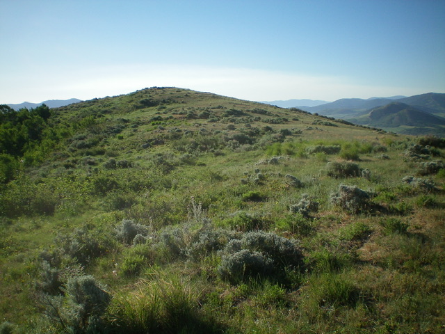
The gentle summit hump of Peak 6901 as viewed from its [lower] west summit. Livingston Douglas Photo
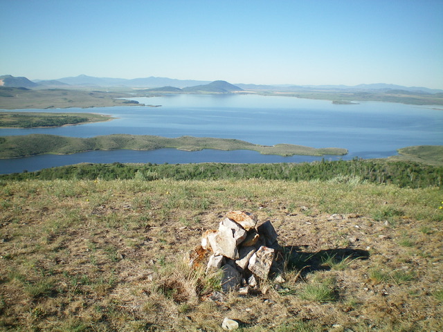
View of Blackfoot Reservoir from the summit of Peak 6901. Livingston Douglas Photo
Additional Resources
Regions: Blackfoot Mountains->SOUTHERN IDAHO
Mountain Range: Blackfoot Mountains
Longitude: -111.5582 Latitude: 42.9384