Elevation: 6,914 ft
Prominence: 464
This peak is not in the book. Published January 2023
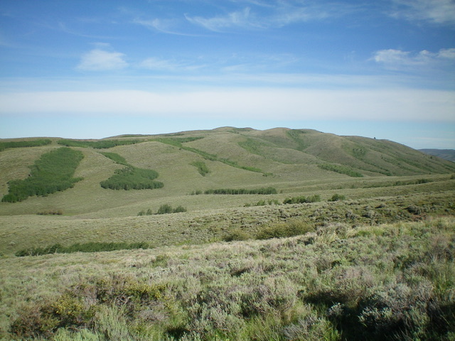
Peak 6914 is located on a hidden ridgeline west of Reservoir Mountain. The ridgeline separates Bear Creek to the east from Corral Creek to the west. The easiest access to Peak 6914 is via Skinny Dip Road to its west. USGS Reservoir Mountain
Peak 6914 as viewed from the southeast. Livingston Douglas Photo
Access from the North (Blackfoot Reservoir Road)
From Exit 116 (Sunnyside Road) on I-15 in Idaho Falls, drive east on Sunnyside Road to its end at a signed “T” junction with Bond Road. This junction is 9.1 miles east of Ammon Road. Turn right/south onto Bone Road and drive 8.5 miles south to a signed junction with Blackfoot Reservoir Road, just south of Bone. Turn right/west onto Blackfoot Reservoir Road. The road quickly bends left/south and begins its journey to Blackfoot Reservoir. Drive 20.5 miles on Blackfoot Reservoir Road to a signed junction at the northwest corner of Blackfoot Reservoir.
Continue straight/south on Government Dam Road for 12.8miles to a signed junction with Skinny Dip Road. Drive west then north on Skinny Dip Road (a well-graded dirt/gravel road) for 5.2 miles to a signed junction. Turn right/north to continue on Skinny Dip Road and drive another 0.5 miles on the red lava gravel road and park along the road at the crossing of a ridge (6,230 feet). GPS coordinates: 42⁰55’07”N, 111⁰42’58”W.
Access from the East (ID-34)
From ID-34 at the southeast corner of Blackfoot Reservoir, drive west on [signed] China Cap Road for 3.8 miles to a “T” junction with Government Dam Road. Turn right/north and drive 4.3 miles on Government Dam Road to a signed junction with Skinny Dip Road. Follow the directions in the previous paragraph for Skinny Dip Road.
West Ridge, Class 2
The Climb
From Skinny Dip Road, bash east up the tall, thick sagebrush and other prickly brush on the ridge. This ridge follows the right/south side of a prominent drainage. Higher up, the ridge bends right-ish/southeast to head directly to the cairned summit. The summit cairn it outdone by a second, TALL cairn located to the west and down the ridge a short distance. The west ridge is a punishing bushwhack through thick sagebrush and brush with some game trails to help, but not enough.
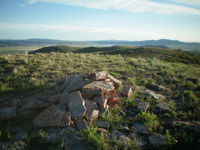
The summit cairn atop Peak 6914, looking north. Livingston Douglas Photo
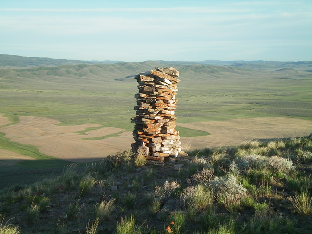
The tall cairn just below, and west of, the true summit of Peak 6914. Livingston Douglas Photo
Additional Resources
Regions: Blackfoot Mountains->Chesterfield Range->SOUTHERN IDAHO
Mountain Range: Blackfoot Mountains
Longitude: -111.7031 Latitude: 42.9175