Elevation: 6,931 ft
Prominence: 441
This peak is not in the book. Published November 2020
Moonshine Mountain is a thickly forested mound with a narrow east-west summit ridge. It is located south of Thurmon Ridge, east of Bishop Mountain, and southeast of Green Canyon Pass. This climb is the second peak in a three-peak adventure that includes Thurmon Ridge (7,338 feet), Moonshine Mountain (6,931 feet), and Bishop Mountain (7,810 feet). USGS Bishop Mountain
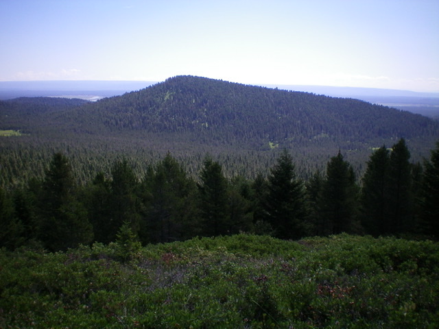
Moonshine Mountain as viewed from Thurmon Ridge to the north. Livingston Douglas Photo
Access
Same as for Thurmon Ridge. This is the second leg of a three-peak journey.
Map Errors:
The Caribou-Targhee National Forest Map (2010 edition) shows FSR-861 coming up from Green Canyon Road to the Thurmon Ridge/Moonshine Mountain saddle but no such road exists. Not even remnants of it. The USGS topo map shows roads and trails in the basin that separates Thurmon Ridge from Moonshine Mountain. No such roads or trails exist. None.
North Face, Class 2
The Climb
From the 6,490-foot connecting saddle with Thurmon Ridge, follow an old 2-track road briefly south along the saddle then bushwhack south up through an open pine forest that is clogged with blowdown and thick veg. Upon reaching the summit ridge, go right/west to reach the high point of Moonshine Mountain at the west end of the summit ridge. There is a small cairn alongside the highest pine tree (though there is another pine tree about 20-30 feet to the west with a base of equal base height).
West Face, Class 2
The Descent
From the summit, descend west through thick pine forest (not as bad as the north face) to a meadow and dry drainage. Follow the open, grassy meadow south then finally southwest to reach Green Canyon Road in a wooded area. Hike right/northwest up Green Canyon Road for about a mile to reach a [signed] junction with FSR-170 (6,530 feet). This is the conclusion of the second leg of today’s three-peak journey. Bishop Mountain is up next.
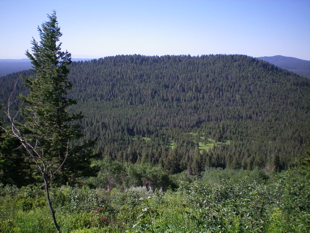
Moonshine Mountain as viewed from the west. Livingston Douglas Photo
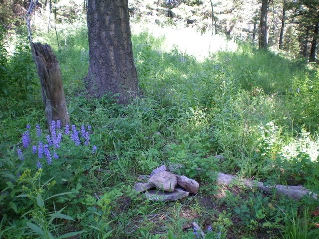
The small summit cairn atop Moonshine Mountain amidst the thick pine forest. Livingston Douglas Photo
Additional Resources
Regions: Centennial Range->EASTERN IDAHO
Mountain Range: Centennial Range
Longitude: -111.55339 Latitude: 44.33389