Elevation: 6,962 ft
Prominence: 422

This peak is not in the book. This was the first Idaho peak I climbed. My great aunt Ethel and her husband Paul had a cabin on the west side of Booth Canyon. It was a nice hike to climb from the cabin up the ridgeline to the summit. Thanks to Livingston Douglas, the peak is now on the website with a route that avoids crossing private property. Published January 2023
Peak 6962 is a forested hump in the Snake River Range. It is located between Big Elk Creek and Booth Canyon. It is most easily climbed via an old 2-track road and Quaker Flat Trail with a short ridge scramble to the top. USGS Mount Baird

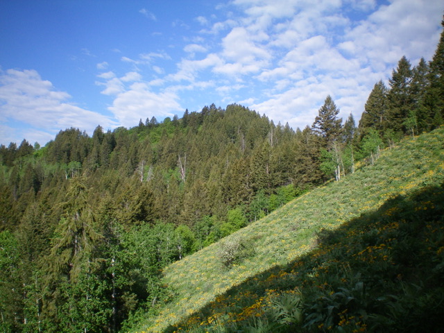
The forested summit hump of Peak 6962 (dead center) as viewed from the east ridge, my ascent route. Livingston Douglas Photo
Access
From US-26 near Palisades Reservoir, drive east up [signed] FSR-262/Big Elk Creek Road for 1.9 miles to its end at a large trailhead parking area. Park here (5,680 feet).
North Spur/East Ridge, Class 2
The Climb
From the trailhead parking area, hike east on a side road that leads to a YMCA Camp. This road crosses Big Elk Creek on a bridge then passes a 2-track road heading left/north. Continue another 50 yards or so to the road’s end at a “T” junction at the east end of the YMCA Camp. Head left/northeast on a 2-track road that goes past the main buildings of the YMCA Camp and then turns sharply right/southeast after it leaves the camp area. This 2-track road is not shown on maps and heads up a dry gully.
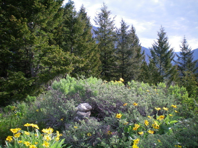
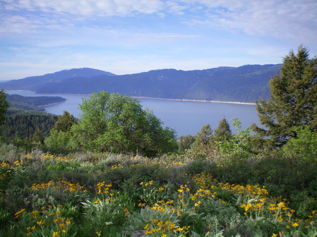
Follow the 2-track road a short distance to the [signed, on a tree] Quaker Flat Trail/FST-110 which is on the right/south side of the road and heads south up a forested ridge (the north spur). FST-110 is NOT shown on the USGS topo map. Hike south up the steep, narrow trail to reach the point where it crosses the east ridge of Peak 6962. Bushwhack west then southwest up the east ridge through a merciless, thick forest that has a weak game/use trail in spots. The climb requires a 40-foot drop to a forested saddle as you near the summit hump. The summit has a modest cairn that is overgrown by brush. The view of nearby Palisades Reservoir is magnificent.

The veg-covered summit of Peak 6962. Even the summit cairn is overtaken by the veg. Livingston Douglas Photo
Additional Resources
Mountain Range: Big Hole and Snake River Mountains
Longitude: -111.1184 Latitude: 43.3124
