Elevation: 6,969 ft
Prominence: 349
This peak is not in the book. Published January 2023
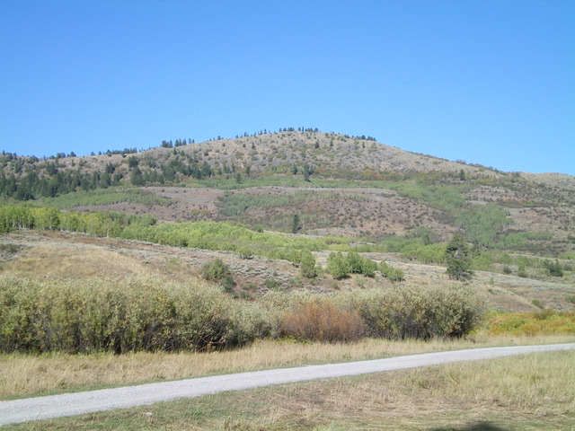
Peak 6969 sits above Jackknife Creek in the Caribou Range. It separates Squaw Creek from Deep Creek. Peak 6969 is a semi-forested ridgeline hump that is most easily climbed from Jackknife Creek Road to its south. Avoid forested terrain in this area as it is thick with brush. Stay in open terrain whenever possible. USGS Etna
Peak 6969 as viewed from Jackknife Creek Road to its southwest. Livingston Douglas Photo
Access
From the junction of US-89 and US-26 at the north end of Alpine, WY, drive 9.4 miles south on US-89 to a signed junction with Creamery Road. Turn right/west onto Creamery Road (which becomes Jackknife Creek Road/FSR-136) and drive 3.3 miles to an unsigned junction with FSR-070. Turn right/north onto FSR-070 and drive 1.3 miles to a minor pullout and park. Just after this point, the road has some serious mudholes and is difficult to navigate. The pullout is at 6,120 feet. GPS coordinates: 43⁰03’41”N, 111⁰05’15”W.
North Face/Northeast Ridge, Class 2+
The Climb
From the parking pullout, hike about 0.7 miles up FSR-070 to a flattish road area at 6,350 feet with beaver ponds and Deep Creek nearby on the left/south side of the road. The northeast ridge is visible from here and it is at the top of a thickly forested face. Leave the road and find a spot to jump the small creek and avoid the beaver ponds. Once across the creek, bushwhack south up through the steep, dense forest with copious underbrush and blowdown.
Reach the ridge crest and bushwhack right/southwest up through steep-ish, chest-high brush to reach easier brush then, soon, some open scrub terrain. Find more open terrain higher up, to the left/south side of the ridge crest. Bash through a final thick patch of forest and brush to reach the open summit. The summit of Peak 6969 is on a ridgeline. The summit has a decent cairn and offers nice views down to the Jackknife Creek Valley to the southwest.
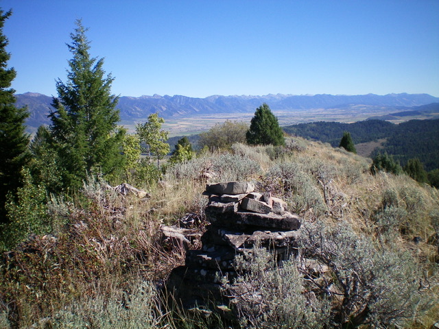
The view from the summit of Peak 6969. Livingston Douglas Photo
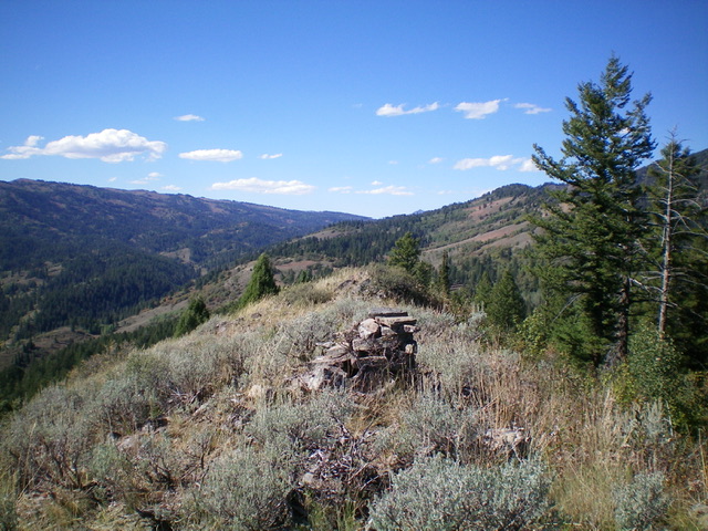
The summit cairn atop Peak 6969. Livingston Douglas Photo
South Face/South Ridge, Class 2
The Climb
The open scrub of the south face and south ridge is a much better route to climb Peak 6969. It is easily reached from Jackknife Creek Road/FSR-136 at its junction with [signed] FSR-389. This junction is 4.9 miles up Creamery Road/Jackknife Creek Road from US-89. While I did not climb this route, I certainly got a good look at it.
Additional Resources
Regions: Caribou Range->SOUTHERN IDAHO
Mountain Range: Caribou Range
Longitude: -111.10769 Latitude: 43.05901