Elevation: 7,003 ft
Prominence: 473
This peak is not in the book. Published November 2023
Peak 7003 is a mostly-open scrub hump that sits at the mouth of Trail Canyon northeast of Soda Springs. It is an easy scramble up its southwest ridge from Trail Canyon Road, entirely on BLM land. USGS Soda Springs
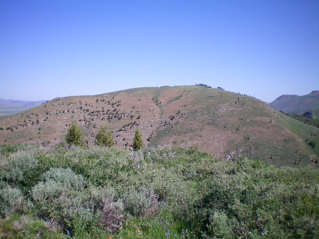
Peak 7003 as viewed from the south. The southwest ridge (my ascent route) is the skyline left of center. Livingston Douglas Photo
Access
From the junction of US-30 and ID-34 in Soda Springs, drive north on ID-34 for 3.0 miles to the signed junction with [paved] Trail Canyon Road/FSR-124. Go right/east onto Trail Canyon Road and drive 2.4 miles to a large pullout on the left/north side of the road. The roadside pullout is at 6,220 feet and sits at the base of the southwest ridge of Peak 7003. It is at 42⁰41’42”N, 111⁰32’05”W.
This area is a mix of private land and BLM land, so be careful. This climb is entirely on BLM land. This is the first leg of a 2-peak adventure that includes Peak 7003 and Peak 7128. It covers 4.0 miles with 2,100 feet of elevation gain round trip.
Southwest Ridge, Class 2
The Climb
From the roadside pullout, walk about 0.1 miles east along Trail Canyon Road then climb northwest up a shoulder of short scrub to reach the crest of the southwest ridge. This route avoids the thick brush/scrub that is directly above the pullout. Once on the southwest ridge, scramble up the easy scrub to reach the mostly-open summit of Peak 7003. I built a cairn around the two protruding pieces of rebar.
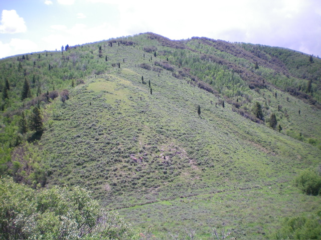
Peak 7003 as viewed from the northwest. Livingston Douglas Photo
Northwest Shoulder, Class 2
The Descent
From the summit, descend north along the ridge on an old 2-track road (which cuts through the thick scrub and aspens/mountain mahogany. This old road ends at Point 6702. From there, bushwhack north then northwest through a miserably thick patch of aspens to reach open scrub terrain and the northwest shoulder. Cruise down this shoulder to a meadow near an old road junction (visible from high up) and a muddy, stinky cattle pond to the right/northeast. The meadow (6,430 feet) is the low point in the traverse between Peak 7003 and Peak 7128 and concludes the first leg of today’s 2-peak journey. Peak 7128 is up next. Please note that the meadow is on unposted, unfenced private land.
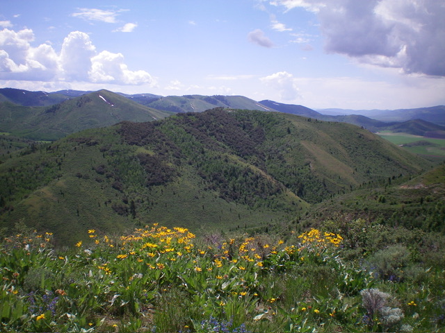
Peak 7003 and its northwest shoulder (just left of center), my descent route. Livingston Douglas Photo
West Face, Class 2
The Climb
After returning to the 6,430-foot meadow from Peak 7128, follow the grassy 2-track road south-southwest to the private property line (signed and blocked with a “No Trespassing” sign). Scramble left/southeast up steep but reasonable scrub to intercept the southwest ridge of Peak 7003 just below the summit area. Descend the southwest ridge back to Trail Canyon Road and your parked vehicle.
Please note that you must only ascend to 6,600 feet to avoid the private land but contouring on the steep, angled sagebrush is tiresome. I climbed a bit more uphill but got to the ridge quicker and avoided much of the potential unpleasant side-hilling in the sagebrush. I reached the southwest ridge crest at about 6,970 feet.
Additional Resources
Regions: Aspen Range->Peale Mountains->SOUTHERN IDAHO
Mountain Range: Peale Mountains
Longitude: -111.5295 Latitude: 42.7012