Elevation: 7,037 ft
Prominence: 377
This peak is not in the book. Published November 2020
Peak 7037 is located on the east side of the Champagne Creek drainage. It is overshadowed by its neighbor to the north, Timbered Dome (8,356 feet). This area is a mix of private and public land so be very careful with the route that you choose in order to stay out of trouble. The route described here is entirely on BLM land and is an enjoyable scramble in open terrain. USGS Champagne Creek
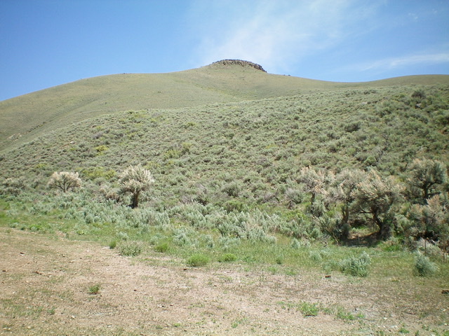
The first leg of the ascent route of Peak 7037, as viewed from the parking pullout along Champagne Creek Road. A sea of sagebrush. You must skirt under, and to the right of, the cliff band in the center of the photo. Livingston Douglas Photo
Access
From the junction of US-93 and US-20 in downtown Arco, ID, drive west on US-20 for 5.1 miles. Turn diagonally right/west onto [unsigned] Blizzard Mountain Road. Drive 8.7 miles on Blizzard Mountain Road to a signed junction with Champagne Creek Road (signed with a simple street sign as “Champagne”). Turn right/west onto Champagne Creek Road and drive 3.7 miles to a large parking pullout/camping area on the right/east side of the road (5,925 feet) at the mouth of a gully. This is the old Era townsite and is on BLM land.
West Shoulder/West Ridge, Class 2
The Climb
From the large parking pullout, bushwhack southeast up through a sagebrush hillside onto a sagebrush shoulder that is heading east. Thankfully, the sagebrush shortens and thins pretty quickly on this shoulder. Follow the shoulder east to the south side of a prominent cliff band/block on the lateral ridge crest above you. This cliff band shows up clearly on the USGS topo map. Move eastward and skirt below the rocky cliff band to reach a notch between it and the next rocky outcrop/hill to its east.
Skirt the left/north side of the 2nd rocky outcrop on a mix of taller/thicker sagebrush and boulders (a bit tedious) to reach easier, open scrub. Descend east 70 vertical feet to a wide saddle then scramble east up easy short scrub to reach a minor saddle just north of the summit. Turn right/south and hike up a final easy ridge section to reach the summit of Peak 7037. There was a torn-down cairn on the summit so I rebuilt it.
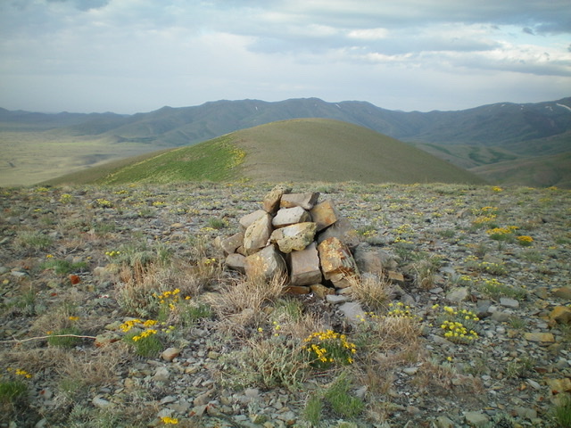
The summit cairn atop Peak 7037 with its [lower] south summit in the background. Livingston Douglas Photo
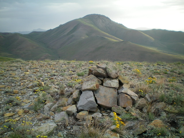
The summit of Peak 7037 with Timbered Dome is in the distance. Livingston Douglas Photo
Additional Resources
Regions: EASTERN IDAHO->Pioneer Mountains
Mountain Range: Pioneer Mountains
Longitude: -113.54919 Latitude: 43.57539