Elevation: 7,049 ft
Prominence: 309
This peak is not in the book. Published January 2023
Peak 7049 is a hidden summit that is tucked behind the west side of the main ridge crest of the Jim Sage Mountains. It is seldom climbed. This area is a mix of private and public land, so be careful. This climb is entirely on BLM land. Peak 7049 is most easily climbed from the west, but private land blocks access there. USGS Elba
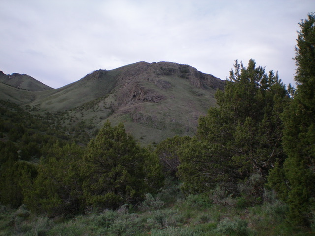
The imposing north face of Peak 7049 (my ascent/descent route). Will this even be climbable? YES. Livingston Douglas Photo
Access
From the sharp turn in ID-77 at Connor, go southwest on the Elba-Almo Highway (some consider this an offshoot of ID-77) for 1.9 miles to an unsigned junction with [unsigned] Jones Hollow Road. Drive 0.2 miles up Jones Hollow Road to a cattle fence and park in a pullout area. The road is badly rutted and overgrown past this point. You will encounter more cattle here than humans.
North Ridge/Face, Class 3
The Climb
From the parking area, cross the cattle fence and hike southeast up Jones Hollow Road. The road ends somewhat unceremoniously at about 5,800 feet (which is farther up Jones Hollow than the USGS topo map indicates). From the road’s end, follow a cattle trail that follows Jones Hollow south then southeast to a prominent side gully (to the left/east) at 6,300 feet. This side gully is about 0.3 miles below the top of Jones Hollow, which is visible from the base of the side gully.
Leave Jones Hollow and bushwhack east up this side gully in a mix of loose scree and grass/sagebrush. Stay in the center (or just right of center) of the dry gully for the best footing. Higher up, angle diagonally right/southeast to reach a ridge crest just south of Point 6829 just above a sagebrush-clogged saddle at the head of the gully. Once on the ridge crest, follow its easy, open scrub right/south to quickly reach a saddle at 6,820 feet in short field grass. From this critical saddle, Peak 7049 is now visible and is due south.
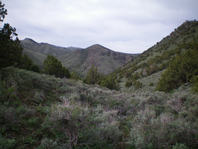
Elusive Peak 7049 is finally in view (dead center). Livingston Douglas Photo
That’s the good news. The bad news is that you must descend over 500 vertical feet down a gully and then climb the rugged north ridge (which looks ominous) from here, and then re-climb the 500 vertical feet to get back to this saddle. From the saddle, bushwhack south in a gully of sagebrush and scattered junipers. There is a cattle trail near the center of the gully (on-and-off) to help. The sagebrush gets quite thick in sections. Upon reaching the bottom of the gully, cross another dry gully to reach the base of the north ridge/face of Peak 7049.
Scramble up the steep, easy short grass/scrub of the north ridge/face to reach the rocky, midsection of the ridge/face. Angle left/southeast to avoid an ominous cliff band that covers much of the north face. Reach a diagonal ridge that heads right/southwest. This is the northeast spur of the north ridge. This spur is a mix of rock, veg, and short junipers. The beauty of it is that it leads you directly up to the north ridge. A final Class 3 climb up some face rock puts you on the north ridge. The north ridge is easy Class 2 (loose shale) from here to the summit, except for a cliff band that must be skirted on its left/east side.
The summit of Peak 7049 is gentle and easy: ground boulders, short scrub with some scattered talus/scree. There were no signs of previous ascent so I built a summit cairn with the abundant loose talus nearby. There are two potential high points. The north summit appears to be slightly higher so I built the cairn there. The south summit is a rocky, ridgeline outcrop and is about 50 yards south of the north summit It measures of equal height according to my altimeter but visually appears to be slightly lower. When descending from the summit, it is critical to remember where the junction of the northeast spur is or you will be stuck atop the peak’s extensive cliff bands. The northeast spur is the only weakness on the north face of Peak 7049.
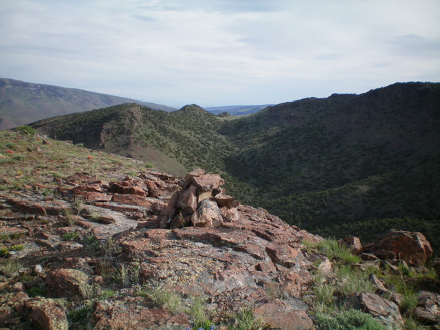
The newly-built summit cairn atop Peak 7049 with the critical approach gully directly behind it in dead-center. Livingston Douglas Photo
Additional Resources
Regions: Albion Range->Jim Sage Mountains->SOUTHERN IDAHO
Mountain Range: Albion Range
First Ascent Information:
- Other First Ascent: North Ridge/Face
- Year: 2023
- Season: Summer
- Party: Livingston Douglas
Longitude: -113.5091 Latitude: 42.2212