Elevation: 7,063 ft
Prominence: 363
This peak is not in the book. Published January 2023
Peak 7063 sits northwest of the Twin Sisters in the City of Rocks. This is the first leg of a 2-peak adventure that includes Peak 7063 and Peak 7038. USGS Almo
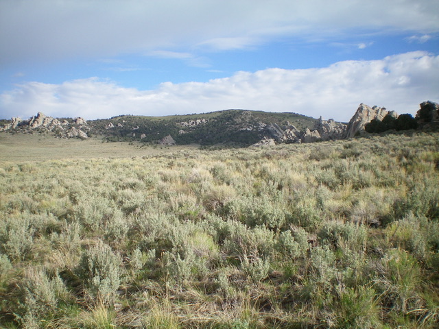
Peak 7063 (center) as viewed from the sagebrush basin to its south. Livingston Douglas Photo
Access
From the City of Rocks Visitor Center at the south end of Almo, drive south on ID-77 for 0.4 miles to a signed junction with the City of Rocks Road. Turn right/west onto the City of Rocks Road. Drive 4.0 miles to a signed junction with Twin Sisters Road. Turn left/south onto Twin Sisters Road and drive 2.3 miles to the Twin Sisters Campground on the right side of the road. Park at the campground (6,280 feet) or at a climber’s parking lot nearby to the west.
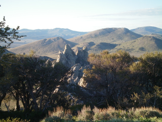
Twin Sisters (dead center) as viewed from the summit of Peak 7063. Livingston Douglas Photo
South Face/Southwest Ridge, Class 2
The Climb
From the climber’s parking area (at a gated road closure), follow a 2-track road west then northwest along the south side then west side of [the magnificent] Twin Sisters spires. Leave the road after it passes the Twin Sisters, crosses a wide gully, and bends left/west. Bushwhack north through sagebrush (with some gaps thanks to the cattle that graze here), aiming for a rock tower-free area that has junipers and a slope to reach the southwest ridge. Scramble just left/west of a major collection of rock towers that are just left/west of a prominent gully that cuts the south face Peak 7063.
Bushwhack directly northwest at the crest of the southwest ridge. You will soon get there. The terrain is somewhat-thick forest [junipers and pines] with some embedded rock. Once on the crest of the southwest ridge, scramble right/northeast up the open ridge on easy scrub and ground talus. The summit is at the northeast end of a long, tilted summit plateau of easy scrub but sometimes-cumbersome ground talus. The summit high point has a small cairn on the summit boulders and has a triangulation post and wiring nearby.
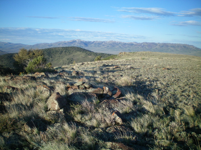
The elongated, flat summit ridge area of Peak 7063, looking southwest. Livingston Douglas Photo
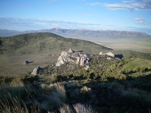
The summit cairn atop Peak 7063 with Peak 7038 in mid-ground (left of center). The brushy area between the summit and the rocky outcrop (center) is the ascent route. Livingston Douglas Photo
Southwest Ridge, Class 2+
The Descent
From the summit, descend the ridge southwest then south to reach the 6,540-foot connecting saddle with Peak 7038. The ridge terrain is initially easy, open scrub with embedded talus but changes its character significantly lower down. The ridge becomes a mess of rocky towers with boulders and forest mixed in. Navigating successfully through the lower half of the ridge is much more problematic than the USGS topo map implies.
To complicate matters, ample junipers and pines are on the ridge as you descend and they block your visuals of what’s directly ahead. You simply cannot see the bottom of the ridge (and the saddle) until you’re on top of it. As you descend the ridge, stay near (or slightly right/west of) the ridge crest and skirt the rocky towers and massive ground boulders that are hidden in the forest. The base of the ridge is a narrow, flat area of open sagebrush. This concludes the first leg of today’s journey. Peak 7038 is up next.
Additional Resources
Regions: Albion Range->SOUTHERN IDAHO
Mountain Range: Albion Range
Longitude: -113.7317 Latitude: 42.0584