Elevation: 7,081 ft
Prominence: 471
This peak is not in the book. Published May 2019
Peak 7081 is located roughly 4 miles west of Warm Lake and 2 miles north of Warm Lake Highway. John Platt’s trip report is linked below and has more photos and text. USGS Gold Fork Rock
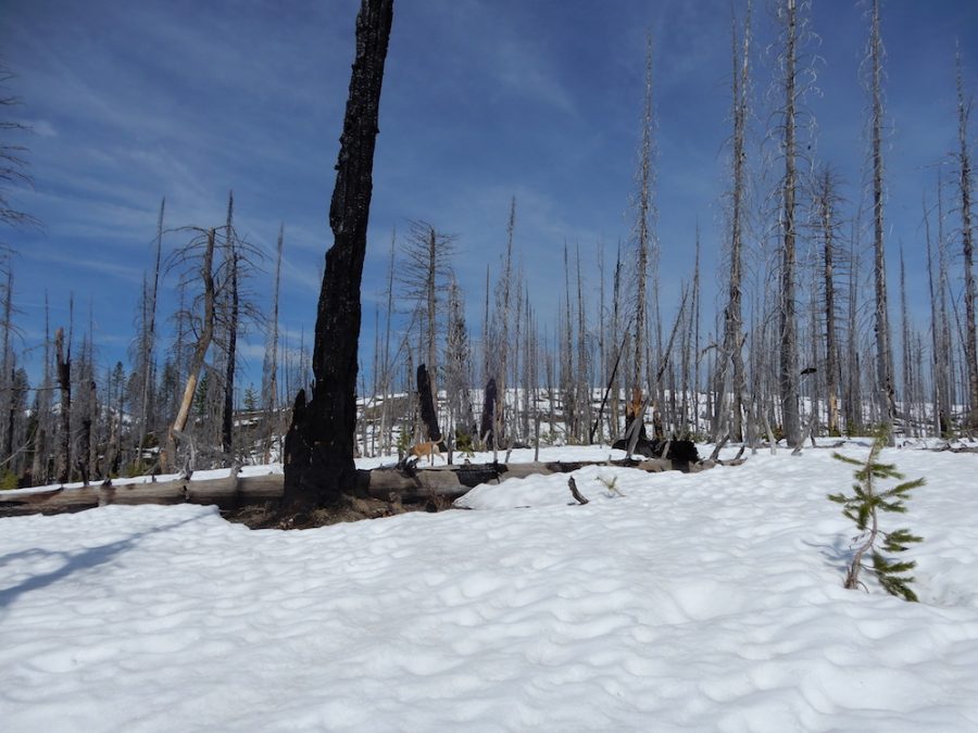
Looking up the Peak 7081’s East Ridge to the true summit. John Platt Photo
Access
Follow Warm Lake Highway [(C)(1) on Page 138] to the point shown on the map below. There is an obvious pullout next to a creek onto an uphill dead-end, because the road has been reclaimed. It’s the second or third pullout on the left about 1/2 or 2/3 miles after passing the road to Clear Creek on the right. Note: the coordinates show on the map.
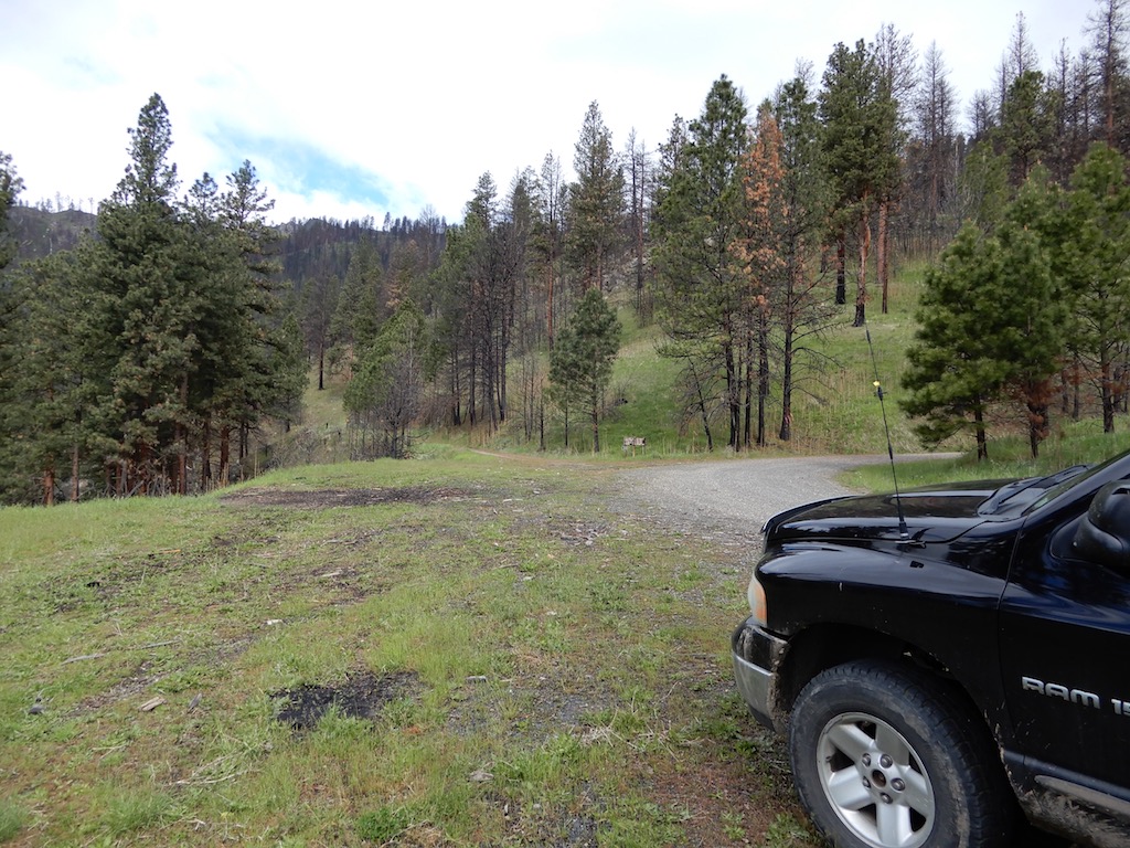
The starting point along Warm Lake Highway. John Platt Photo
East Ridge, Class 2
Follow one of 2 rehabilitated 4WD roads (as shown below) north from the highway to the peak’s East Ridge. Follow the ridge to the summit. John’s round-trip stats: 6.4 miles with 1,700 feet of elevation gain.
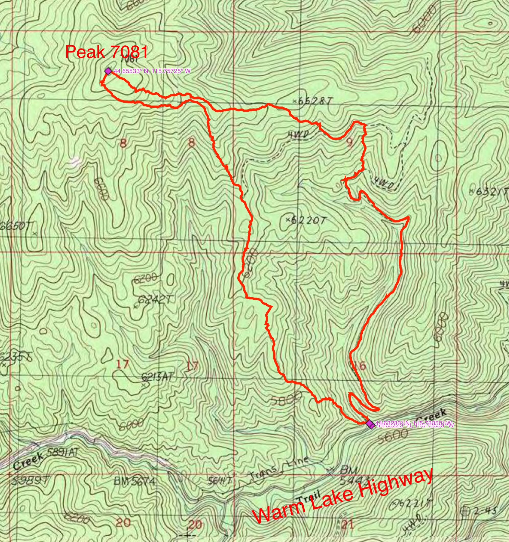
John Platt’s GPS track.
Additional Resources
Mountain Range: Western Salmon River Mountains
Longitude: -115.75719 Latitude: 44.65549