Elevation: 7,082 ft
Prominence: 352
This peak is not in the book. Published November 2023
Peak 7082 is the high point of a north-south ridge that sits west of Trail Creek in the Aspen Range. Stay in open scrub in this area or risk getting mired in brutal bushwhacking amidst dense aspens and tall, thick brush. USGS Johnson Creek
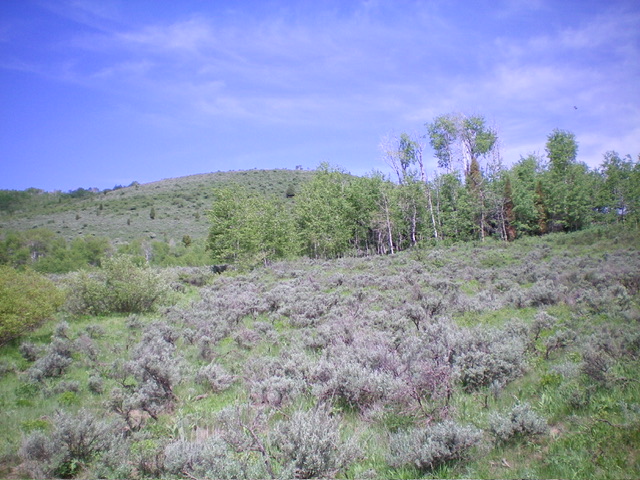
Peak 7082 as viewed from the base of the east ridge (start of climb). Livingston Douglas Photo
Access
From the junction of US-30 and ID-34 in Soda Springs, drive north on ID-34 for 3.0 miles to the signed junction with [paved] Trail Canyon Road/FSR-124. Go right/east onto Trail Canyon Road and drive 5.7 miles to a signed junction. Go left/north onto North Trail Road and drive 0.7 miles to a signed junction. Go straight/east on North Trail Road for another 0.6 miles and park along the road. This minor pullout is at 6,415 feet and 42⁰43’14”N, 111⁰27’24”W.
This area is a mix of private and public land. Given the thickness of the brush and aspens, it is difficult to complete this climb entirely on public land. However, the east ridge is mostly on public (State of Idaho) land and the short sections that are private are not posted, though the summit area has some cattle fencing. The least-painful route to the top is the west face, which requires a short and steep, but reasonable, bushwhack up through sagebrush and other brush from a public road that leads north to a private ranch. The land on the west face of the peak is not fenced posted except if you reach the ranch entrance on the northbound road.
East Ridge, Class 2
The Climb
From the minor pullout on North Trail Road, bushwhack north through easy sagebrush to reach the rounded east ridge. Head northwest then west up the ridge. The ridge remains rounded and often feels like a face climb much of the way to the summit. As you advance up the east ridge, the terrain quickly becomes thick sagebrush and other brush and becomes tedious. The ridge is steep between 6,600 feet and 6,880 feet. Worse yet, aspens join the mix. Reach a flat ridge section at 6,900 that is simply brutal.
This is one of the thickest patches of aspens that I’ve ever seen in the State of Idaho. You just thrash around and have no visibility. You feel like you’re getting nowhere. Bash your way west then southwest through the aspens and gain elevation once again. Emerge in an open area just below the summit to finish off the east ridge. The high point is obvious and has no summit cairn but has a tall piece of rebar protruding from the ground about 50 feet away from (and five feet lower than) the high point. The summit is on private land but is not posted.
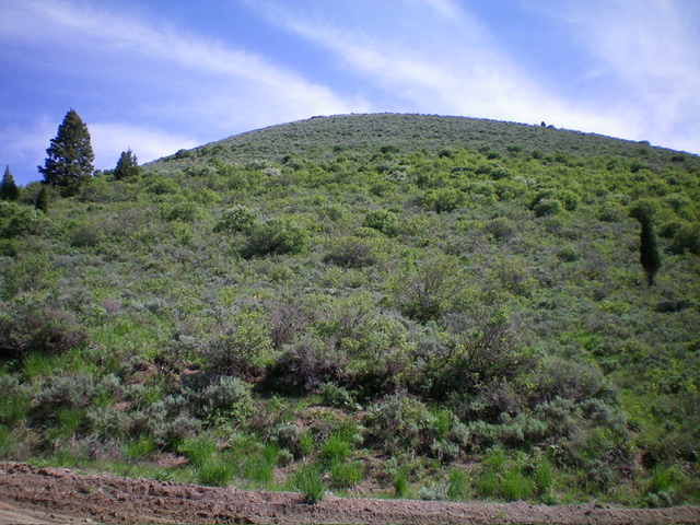
The sagebrush-covered southwest face of Peak 7082 as viewed from its base. Livingston Douglas Photo
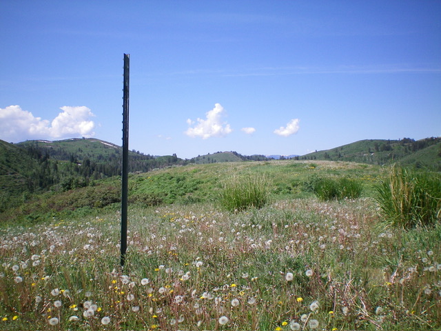
The summit rebar post near the high point of Peak 7082. Livingston Douglas Photo
West Face, Class 2
The Descent
From the summit, bushwhack down the west face through tall and somewhat-thick sagebrush and other brush. While somewhat tedious, it is short and gets you to the road quickly. I descended it in seven minutes. Once on the road, walk south down the road to a junction with North Trail Road then follow the road east down to the parking pullout in 0.6 miles. The west face is entirely on private land but is not posted or fenced in any way.
Additional Resources
Regions: Aspen Range->Peale Mountains->SOUTHERN IDAHO
Mountain Range: Peale Mountains
Longitude: -111.4682 Latitude: 42.7213