Elevation: 7,161 ft
Prominence: 341
This peak is not in the book. Published December 2024
Peak 7161 sits on a ridgeline that separates Spring Gulch from Sage Creek in the Eastern Salmon River Mountains. It is most easily climbed on its east side from a 4WD road up Spring Gulch. Peak 7161 is a gentle hump compared to its rocky neighbor to the southwest, Peak 7020. USGS Gooseberry Creek
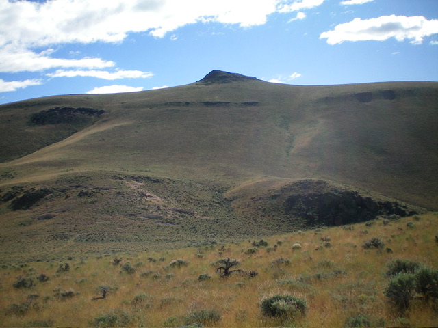
Peak 7161 (dead center) as viewed from just above its connecting saddle with Peak 7020. The west face (just left of center) was my descent route. Livingston Douglas Photo
Access
Same as for Peak 6460. This is the second leg of a 3-peak adventure that includes Peak 6460, Peak 7161, and Peak 7020. It covers 7.5 miles with 3,100 feet of elevation gain round trip.
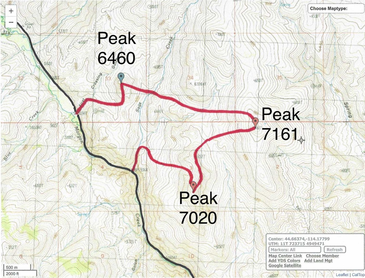
Livingston Douglas GPS Track for Peak 6460, Peak 7161, and Peak 7020. The black line is Morgan Creek Road.
West Shoulder, Class 2
The Climb
From the crossing of Sage Creek at about 5,940 feet, climb east up a grassy slope to a saddle between two ridge humps. From this saddle, head east and drop about 30 feet to cross the head of a dry gully. Bushwhack east-southeast up another dry gully and skirt the right/south side of a ridge hump by crossing a saddle. From this saddle, continue east-southeast and descend about 30 feet to cross another dry gully to reach the base of the west face of Peak 7161.
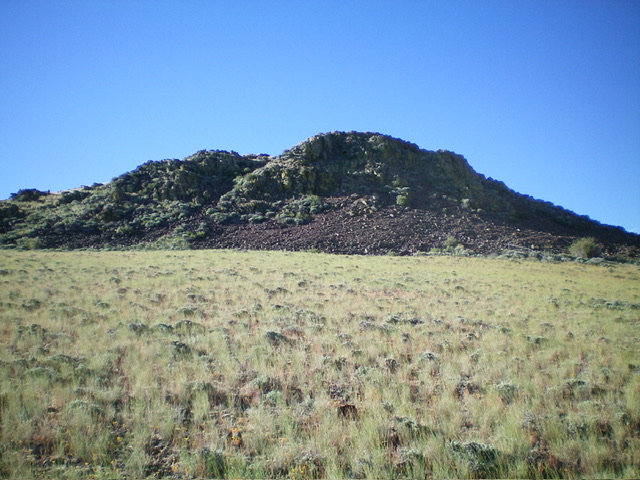
Scramble up a steep-ish shoulder on the west face (just left of a prominent gully on the west face) in reasonable scrub to reach the north ridge of Peak 7161 just left/north of the summit cap. Head right/southeast on the easy, grassy ridge crest to the rocky summit cap. Move left/east to climb a grassy ramp to the top of the rocky summit cap then scramble right/west to reach the two potential high points (very close to each other). The west hump is probably the high point so I rebuilt the summit cairn atop it.
The rocky summit hump of Peak 7161 as viewed from the top of the west shoulder. This was my ascent route. Livingston Douglas Photo
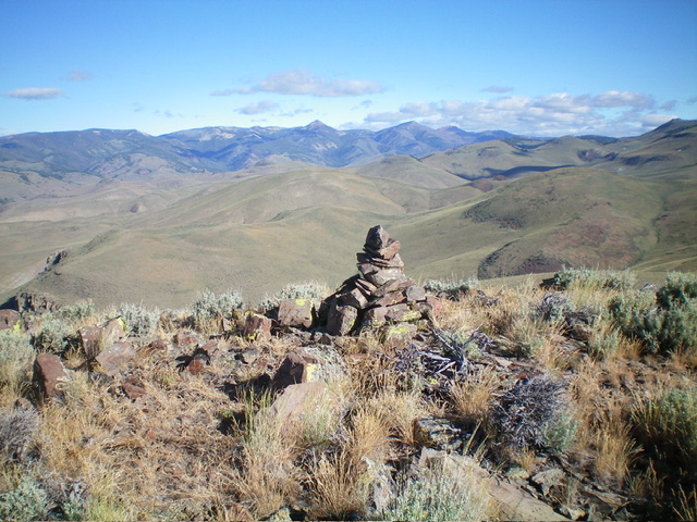
The summit cairn atop Peak 7161. Livingston Douglas Photo
West Face, Class 2
The Descent
From the summit, descend southwest briefly in rock/boulders/scrub and some talus patches to reach easy grassy slopes below. Once in the grass, cruise west-southwest down to the wide saddle that connects Peak 7161 to nearby Peak 7020. This connecting saddle is at 6,380 feet and concludes the second leg of today’s 3-peak journey. Peak 7020 is up next.
Additional Resources
Regions: Eastern Salmon River Mountains->Salmon River Mountains->Southeast Corner Peaks->WESTERN IDAHO
Mountain Range: Eastern Salmon River Mountains
Longitude: -114.1885 Latitude: 44.6656