Elevation: 7,180 ft
Prominence: 640
This peak is not in the book. Published October 2025
Peak 7180 is located east of Arimo. It sits above the Deer Creek drainage in the thickly-forested Portneuf Range. This area is a mix of private and public land, so be careful. USGS Lava Hot Springs
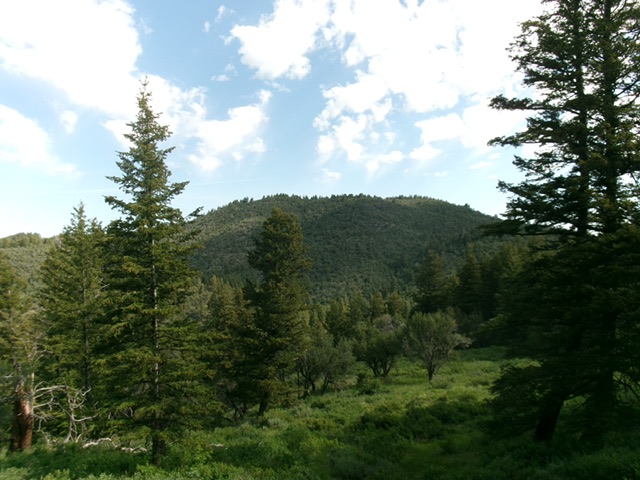
Peak 7180 as viewed from the south. Livingston Douglas Photo
Access
From Exit 36/Downey on I-15, head briefly southeast on US-91 to a signed junction with Old Highway 91. Go left/north onto Old Highway 91 and drive 1.3 miles to a signed junction with Smith Canyon Road. Reset your odometer here. Drive east then northeast up Smith Canyon Road. At 3.1 miles, reach a signed “T” junction. Go left/north here to stay on Smith Canyon Road.
At 6.2 miles, reach a road crest at the base of the east face of Peak 7135. At 6.5 miles, reach a signed junction with Wolverine Pass Road. Park on Wolverine Pass Road at this junction [6,365feet; 42°32’54.3”N, 112°03’37.4”W]. This is the first leg of a 2-peak adventure that includes Peak 7180 and Peak 7135. It covers 3.7 miles with 1,500 feet of elevation gain round trip.
Map Errors
Maps fail to show the extensive private roads and homes in this area.
Southeast Ridge, Class 2
The Climb
From road junction, walk about 100 yards southwest up Smith Canyon Road. Leave the road and bushwhack west up into a forest of pines and mountain mahogany and quickly find a ridge. Follow this ridge west then northwest to a minor hump. This ridge is better defined than the USGS topo map suggests. The forest is mostly mountain mahogany (tedious and somewhat thick) with some junipers and scattered pines.
Drop about 25 vertical feet west-northwest to a minor saddle. From there, continue northwest up the densely forested ridge to another hump. Drop 60 vertical feet to a final, semi-open saddle. From that saddle, scramble north-northwest then west up much steeper terrain to reach the obvious, cairned high point of Peak 7180. I rebuilt the modest cairn and enlarged it. This ascent route crosses a short section of unposted private land.

Looking up the thickly-forested southeast ridge of Peak 7180. This was my ascent route. Livingston Douglas Photo
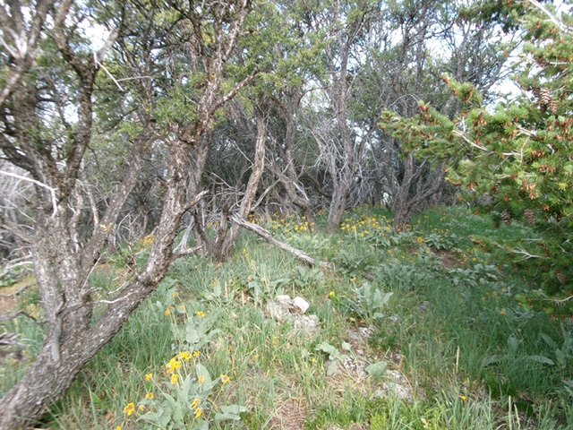
The mountain mahogany-covered summit of Peak 7180. Livingston Douglas Photo
South Ridge, Class 2
The Descent
From the summit, descend back down the southeast ridge to Point 6840+. From there, head right-ish/south down a thickly-forested, rounded ridge to find the connecting saddle with Peak 7135. This bushwhack has lots of mountain mahogany to work around but also has some open areas and lanes. Find the hidden saddle (I came out a bit right/west of the saddle and scrambled left/east and up about 35 vertical feet to reach it). There is much more sagebrush in the saddle than elsewhere. The mountain mahogany is replaced with pine trees. The saddle itself is mostly field grass and is mostly open. This concludes the first leg of today’s 2-peak journey. Peak 7135 is up next.
Additional Resources
Regions: Portneuf Range->SOUTHERN IDAHO
Mountain Range: Portneuf Range
Longitude: -112.0734 Latitude: 42.5571