Elevation: 7,183 ft
Prominence: 643
This peak is not in the book. Published November 2022
Peak 7183 is the high point on a forested ridgeline that sits above Valley Creek and ID-21 to its southwest. It has a steep, rocky southwest face. Peak 7183 is most easily climbed from FSR-633 to its northeast. This route avoids a fording of Valley Creek and a climb of the rugged southwest face. If you can easily cross Valley Creek, the open south ridge looks like a short, magnificent ridge climb. USGS Stanley
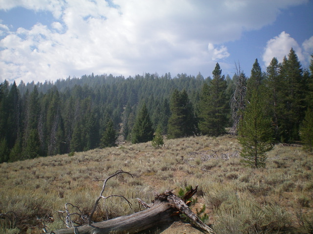
Peak 7183 (forested ridge/summit in dead center) as viewed from the northeast shoulder. Livingston Douglas Photo
Access
From ID-21 west of Stanley, turn right/east onto [signed] Stanley Creek Road/FSR-653. At 1.3 miles, reach an unsigned road junction. Go straight onto [unsigned] FSR-633/Stanley Basin Trail. Drive 0.9 miles on FSR-633 to an unsigned junction with a 2-track road on the right/south. Park at this junction (6,445 feet). GPS coordinates: 44⁰15’00”N, 114⁰58’24”W.
Northeast Spur/Northeast Shoulder, Class 2
The Climb
The northeast side of Peak 7183 is a confusing mess of gullies and shoulders. The terrain is not overly difficult but the forest often blocks your view of the terrain in front of you. Getting off course here is not unexpected. Thankfully, if you keep heading uphill in a southwesterly direction, you will reach the rocky summit. From the road junction, hike south then southwest up an old 2-track (closed to motor vehicles) to reach the northeast shoulder. The old road climbs the northeast spur which leads to the northeast shoulder. The road ends just before reaching the crest of the shoulder.
Bushwhack briefly left/south up into open terrain to reach the crest of the northeast shoulder. After hiking southwest across a long, flat section of open scrub and scattered deadfall, head southwest then south-southwest up into a splendid forest of scattered pines, not much deadfall, and easy grass underfoot. Head directly to the rocky, narrow summit of Peak 7183. The summit is a rocky affair and the high point is a tall boulder. There is a modest cairn on a lower, nearby boulder and I built it up significantly. There is also a cross (made of triangulation posts) in a cairn down about 50 feet (horizontal) from the high point.
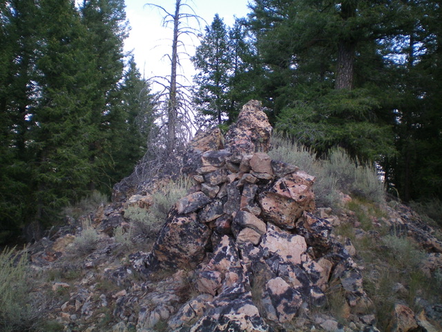
The rock-and-forest summit of Peak 7183. Livingston Douglas Photo
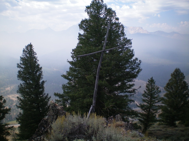
The triangulation post “cross” just below the high point of Peak 7183. Livingston Douglas Photo
Additional Resources
Regions: Eastern Salmon River Mountains->Salmon River Mountains->Southeast Corner Peaks->WESTERN IDAHO
Mountain Range: Eastern Salmon River Mountains
Longitude: -114.98949 Latitude: 44.24029