Elevation: 7,202 ft
Prominence: 302
This peak is not in the book. Published January 2023
Peak 7202 is a ridgeline summit that sits on the east side of Bear Lake. It separates Indian Creek from Bee Hunt Hollow. Its ranked neighbor to the south (Peak 7091) is only slightly lower. Peak 7202 is most easily climbed via its north ridge from Indian Creek Road. This area is a mix of private and public land, so be careful. This climb is entirely on BLM land. USGS Pegram Creek
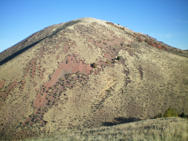
Peak 7202 (dead center) as viewed from the east. It is the high point on a long north-south ridgeline. Livingston Douglas Photo
Access
From the stoplight at the south end of Montpelier (Maverick and Broulim’s nearby), drive south on US-30 for 3.3 miles to reach a junction with [signed] Dingle Road. Turn right/west onto Dingle Road and reset your odometer. Dingle Road becomes East Shore Road when it reaches the east side of Bear Lake. At 11.5 miles, reach a signed junction with North Beach Road (right). Continue straight/south on East Shore Road. At 12.6 miles, reach an unsigned junction with Indian Creek Road (left). Turn left/east onto Indian Creek Road and drive 1.2 miles east to reach the mouth of a dry gully on the right/south side of the road. Park in a pullout here near a fence row (6,405 feet). GPS coordinates: 42⁰05’42”N, 111⁰14’04”W.
North Ridge, Class 2
The Climb
From Indian Creek Road at the pullout, follow the right/west side of a cattle fence briefly. The cattle trail reaches an old powerline service road. From this junction (of sorts), you have two choices. Hike up a cattle trail in the center of the dry sagebrush gully (descent route) or follow the old powerline service road briefly to then climb the sagebrush shoulder on the right/west side of the dry gully (ascent route). Either way, your goal is to reach the head of the dry gully and the nearby crest of the north ridge just south of Point 6942.
The sagebrush is somewhat thick in the dry gully (a bit less so on the adjacent shoulder). However, the sagebrush on the north ridge is much shorter and less tedious. Skirt the left/south side of Point 6942 and scramble up easy scrub to reach a minor ridge hump at the north end of the summit ridge. This hump has a large cairn with a flag post and a dark red flag. It offers an amazing view of Bear Lake to the west. Follow the ridge crest south on easy, short scrub/grass to reach the summit of Peak 7202, which has a 2-track road leading up to it from a large gully to the northeast. The high point is just east of the 2-track road on the ridgeline. There is no summit cairn.
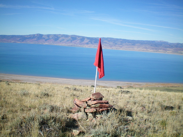
The large cairn and red flag at the north end of the high ridgeline of Peak 7202, with Bear Lake in the background. You pass this flagged cairn as you ascend the north ridge. Livingston Douglas Photo
South Ridge, Class 2
The Descent
From the summit, hike south along the 2-track road down to a saddle then up over Point 7197. The 2-track ends soon after crossing this point. Continue south on the easy, open ridge until it steepens and gets rocky and ugly at about 6,975 feet. Leave the ridge crest and descend left-ish/south-southeast on steep grass and sections of talus to reach grassy terrain below. Once on the open field grass, head south to a saddle-like area in Bee Hunt Hollow with an old corral and a patch of trees (6,420 feet). This is the low point between Peak 7202 and Peak 7091. It concludes the first leg of today’s 2-peak adventure. Peak 7091 is up next.
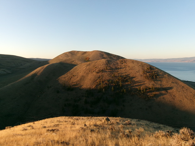
The steep lower section of the south ridge of Peak 7202 (my descent route). The summit hump is not in view. Livingston Douglas Photo
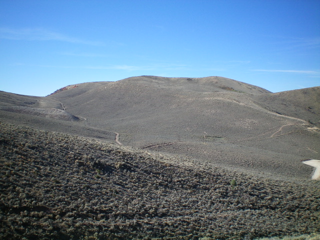
Peak 7202 as viewed from Pine Spring Ridge to its north. Livingston Douglas Photo
Additional Resources
Regions: Bear Lake Plateau->SOUTHERN IDAHO
Mountain Range: Bear Lake Plateau
Longitude: -111.2369 Latitude: 42.0793