Elevation: 7,248 ft
Prominence: 348
This peak is not in the book. Published November 2023
Peak 7248 is the high point of the southeast section of Porphry Ridge in the Yellowjacket Mountains. This ridgeline separates Porphry Creek from Musgrove Creek. The easiest access to Peak 7248 is from FSR-112/Porphry Creek Road to its southwest. USGS Blackbird Mountain
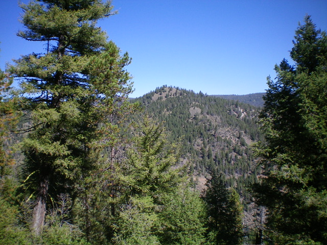
Peak 7248 as viewed from the south. Livingston Douglas Photo
Access
From the signed junction of Panther Creek Road/FSR-055 and Porphry Creek Road/FSR-112, drive 2.3 miles west then northwest up Porphry Creek Road to an unsigned junction with a side road. Park here (6,150 feet;45⁰01’29”N, 114⁰22’11”W). This is the first leg of a 3-peak adventure that includes Peak 7248, Peak 7112, and Peak 7220. It covers 5.0 miles with 2,225 feet of elevation gain round trip.
Map Errors
The USGS topo map shows a 4WD road that crosses PorphryRidge between Peak 7112 and Peak 7220. That road no longer exists, though some of the old road bed remains in a few spots near the saddle.
South Ridge, Class 2
The Climb
From the unsigned road junction, hike briefly north up the old jeep road to a sharp right/east bend. Leave the road here and scramble up a steep grass/scrub slope left-ish/north to quickly reach the crest of the south ridge. Contrary to the USGS topo map, this ridge is mostly forested and is not very open. Scramble north up the steep-ish ridge in a mix of field grass and scattered pines with some deadfall (not too much) to reach the summit hump. There were no signs of previous ascent so I built a summit cairn.
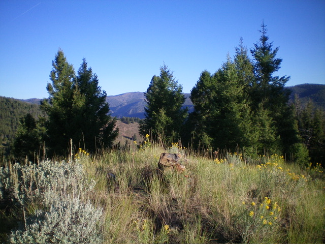
The summit of Peak 7248 with its newly-built summit cairn. Livingston Douglas Photo
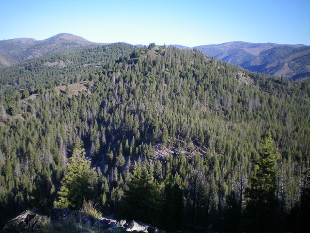
Peak 7248 (in dead center) as viewed from Peak 7112 to its southeast. Livingston Douglas Photo
Southeast Ridge, Class 2
The Descent
From the summit, descend southeast in a mix of pine forest and ridge rock to find a better-defined, forested ridge with limited visibility. Work through this thick-ish pine forest and scramble southeast up over a minor ridge hump. From the hump, descend to a 6,780-foot saddle with much more deadfall to navigate through. This is the connecting saddle with Peak 7112 and concludes the first leg of today’s 3-peak adventure. Peak 7112 is up next.
Additional Resources
Regions: Eastern Salmon River Mountains->Salmon River Mountains->WESTERN IDAHO->Yellowjacket Mountains
Mountain Range: Eastern Salmon River Mountains
Longitude: -114.3684 Latitude: 45.0344