Elevation: 7,253 ft
Prominence: 393
This peak is not in the book. Published November 2021
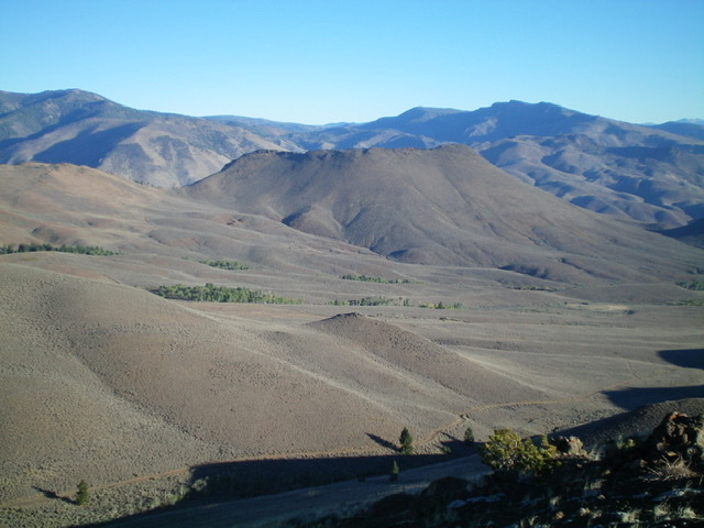
Peak 7253 towers over Challis Creek to the north and Jeffs Flats to the south. It is most easily climbed from FSR-253 to its south via its southwest ridge. USGS Pats Creek
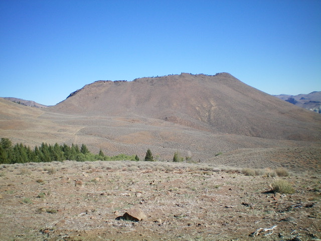
Peak 7253 (mid-ground) as viewed from summit of Peak 7300 to its south. Livingston Douglas Photo
Access
From US-93 at the north end of Challis, turn left/west onto [signed] Clinic Avenue. Follow Clinic Avenue as it goes west briefly, then jogs north briefly, then heads west to a “T” junction with [unsigned] Challis Creek Road. This junction is 0.4 miles from US-93. Turn right/north onto Challis Creek Road and drive 5.2 miles to a poorly-signed junction with Mill Creek Road/FSR-079. Turn left/south onto well-graded Mill Creek Road and drive 1.2 miles to a signed junction with Jeffs Flats Road/FSR-079.
Yes, Mill Creek Road becomes Jeffs Flats Road here. The road that continues up Mill Creek is a private road to a ranch and is gated/posted. Reset your odometer at the road junction. Turn right/west onto Jeffs Flats Road/FSR-079. At 1.9 miles, reach an unsigned junction. Go straight to stay on FSR-079. At 2.6 miles, reach a signed junction with FSR-253. Park in a pullout at this junction (6,368 feet). GPS coordinates: 44⁰32’29”N, 114⁰20’19”W.
The Approach, Class 1
From the junction of Jeffs Flats Road/FSR-079 and FSR-253, hike (or ride) west then north up FSR-253 to reach a 6,860-foot saddle just southwest of Peak 7253. FSR-253 is best suited for ATVs and MCs. It has a significant pine tree blocking the road about halfway to the saddle. It is a good road for hikers, though it has its ups and downs. The road descends 165 vertical feet through a pine forest about midway through the approach hike.
Southwest Ridge, Class 2
The Climb
From the 6,860-foot saddle, follow a fence row briefly up the southwest ridge, using a cattle trail on its right/southeast side. When you reach a fence corner, leave the fence row and scramble up the crest of the ridge on short scrub and loose scree/gravel, staying right of a patch of mountain mahogany trees. Higher up, bend right-ish/east to reach the small, rocky summit via a short scramble up some ridge boulders/talus and scrub. The west/official summit has a modest cairn and appears to be the high point of several possible high points on the elongated, curving summit ridge crest.
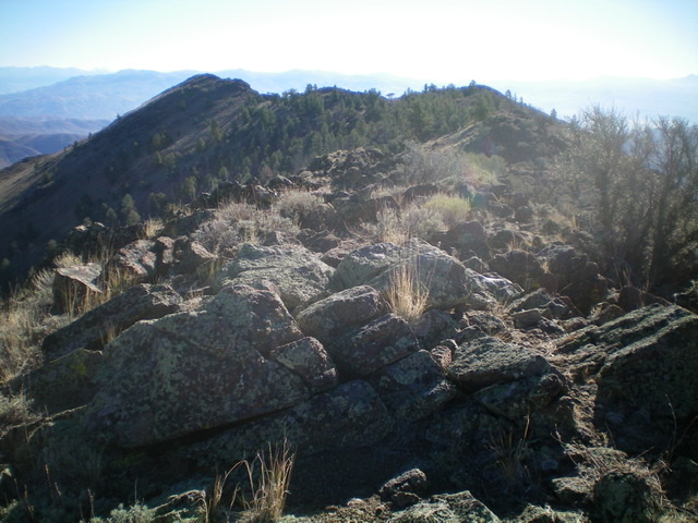
Looking along the long summit ridge from the official high point. Livingston Douglas Photo
Peak 7253 and its long summit ridge (skyline). The official high point is at the left/west end. The right/east end looks noticeably higher but it is an optical illusion. Livingston Douglas Photo
Additional Resources
Regions: Eastern Salmon River Mountains->Salmon River Mountains->Southeast Corner Peaks->WESTERN IDAHO
Mountain Range: Eastern Salmon River Mountains
Longitude: -114.35039 Latitude: 44.55949