Elevation: 7,283 ft
Prominence: 663
This peak is not in the book. Updated December 2024
Peak 7283 and its neighbor Peak 7042 are two ranked summits that sit atop a ridge that separates Tex Creek from Indian Fork Creek. They can be climbed either from the northeast (a shorter climb) or from the southwest (a longer climb from Kepps Crossing Road). This area is a patchwork of private and public land but the routes described for these two peaks are entirely on BLM land. USGS Point Lookout
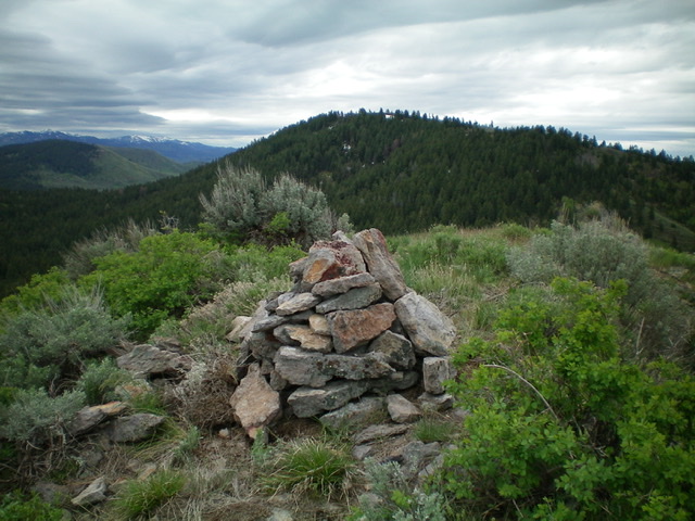
The newly-rebuilt summit cairn atop Peak 7042 with Peak 7283 in the background. Livingston Douglas Photo
Southwest Access
Park along Kepps Crossing Road in a pullout just past a gully that sits southwest of Peak 7283. To minimize the ups and downs on this journey, you must find this specific gully. It is located exactly 12.7 miles east on Eagle Pass Road (which merges into Kepps Crossing Road) from its junction with Bone Road just south of the Sunnyside Road/Bone Road junction southeast of Idaho Falls. This pullout is about a mile south of a hairpin right/south turn in Kepps Crossing Road where the road crosses a small creek. The elevation at this pullout is 6,100 feet and the GPS coordinates are: 43.3827⁰N, 111.6429⁰W. There are no roads or trails to help you on this journey. It is a 100% bushwhack. Tex Creek is bigger and more problematic than the USGS map suggests.
Southwest Ridge, Class 2
The Climb
From the parking pullout near the base of the side gully, bushwhack east up the east side of the dry gully to reach a shoulder (of sorts) and cross the intervening ridge that sits between Kepps Crossing Road and the Tex Creek drainage just north of Point 6462. The terrain up to this point is open scrub and sagebrush. From the flat high point area, descend east-northeast through thicker brush and some aspens to reach Tex Creek. Find a place to jump the creek amongst the willows then bash your way through a short patch of willows to reach the easy, open scrub slope on the north side of Tex Creek.
Scramble steeply north up a slope of field grass, scrub, and scattered brush to reach the southwest ridge of Peak 7283. Skirt some patches of loose scree in so doing. Follow an old cattle fence shown on the USGS map (only the metal posts remain) up the open ridge through a combination of easy short scrub and sagebrush requiring some weaving to navigate. The ridge meanders a bit, heading northeast initially then east then northeast again as it gains elevation. Finally, the ridge turns left/northwest to reach the open summit of Peak 7283. The summit has a very tall cairn.
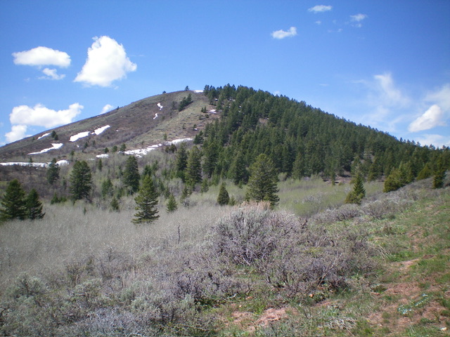
The first section of the southwest ridge of Peak 7283 as viewed from the knoll on the west side of the Tex Creek drainage. Livingston Douglas Photo
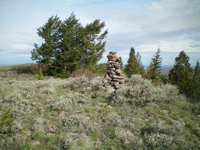
The summit of Peak 7283. Livingston Douglas Photo
Northwest Ridge/Face, Class 2
The Descent
From the summit, follow the open ridge northwest until the ridge becomes a face and the nice, open terrain becomes a thick pine forest. Maintain a northwest trajectory and descend through the thick forest to a saddle that connects Peak 7283 to Peak 7042. The forest ends and the terrain opens up as you approach the saddle. You will be happy to regain your visuals here.
Alternative Route From the Northeast
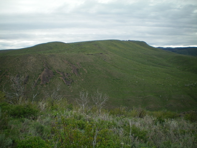
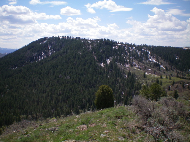
Peak 7283 and its forested northeast face. Livingston Douglas Photo
Northeast Access
Same as for Peak 7042. This is the second leg of a 2-peak journey that includes Peak 7042 and Peak 7283. It covers 5.5 miles with 1,600 feet of elevation gain round trip.
Northwest Ridge, Class 2
The Climb
From the connecting saddle with Peak 7042, follow a cattle trail along an old fence row (shown on the USGS topo map) up the dead center of the northwest ridge. Higher up, the fence and cattle trail disappear. Continue scrambling up the steep scrub, trees, and talus patches to reach the high ridgeline. Head left/southeast in open terrain through thick-ish scrub to reach shorter, easier scrub higher up.
After a lengthy approach, reach the high point (a ground boulder with minimal protrusion) then continue southeast to a large summit cairn on a slightly lower ridge point. From the summit, descend the northwest ridge back to the connecting saddle with Peak 7042. From the saddle, descend northeast down a forested gully to return to Indian Fork Road. Walk northwest down the road to your parked vehicle.
The southeast face of Peak 7283. Livingston Douglas Photo
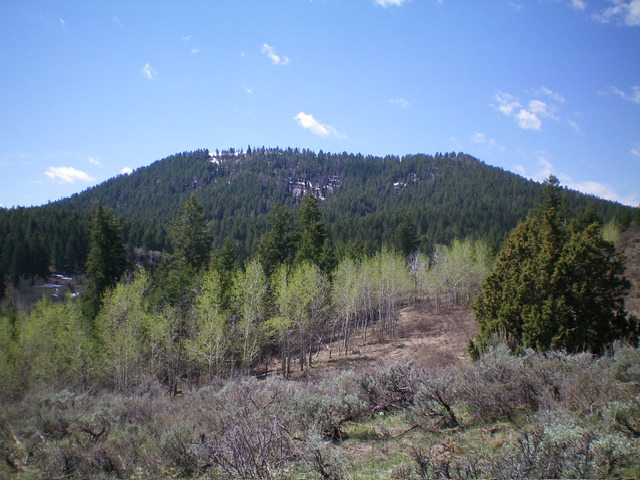
The north and northwest aspects of Peak 7283. I ascended the northwest ridge, which is right of center. Livingston Douglas Photo
Additional Resources
Regions: Caribou Range->SOUTHERN IDAHO
Mountain Range: Caribou Range
Longitude: -111.59179 Latitude: 43.40579