Elevation: 7,288 ft
Prominence: 378
This peak is not in the book. Published November 2023
Peak 7288 sits above the convergence of the two forks of Trail Creek in the Aspen Range. It is entirely on private land that is gated and posted. There are private residences on both its north and south slopes. Consider this peak off-limits. USGS Johnson Creek
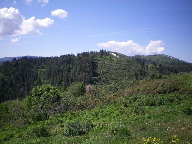
Peak 7288 (dead center) as viewed from Peak 7082 to its north. Livingston Douglas Photo
Map Errors
The USGS topo map shows the south side of Peak 7288 as open terrain. However, it is a mix of pine forest and very thick brush. A lodge sits at its base at the signed junction of North Trail Road and South Trail Road. The USGS topo map also incorrectly shows the north side of the peak as heavily forested when, in fact, it is an open scrub slope with an old mining road that switchbacks its way up the north face (see photo). If you can gain permission from the landowner(s), the north face is your best option to climb Peak 7288.
Additional Resources
Regions: Aspen Range->Peale Mountains->SOUTHERN IDAHO
Mountain Range: Peale Mountains
Longitude: -111.4680 Latitude: 42.7127