Elevation: 7,307 ft
Prominence: 727
This peak is not in the book. Livingston Douglas added new routes approaching the peak from the north as well as some new photos. Updated November 2023
Although one of the shorter peaks in the Northern Boulder Mountains, Malm Peak is an attractive destination. It not only offers an expansive view of the surrounding mountains but its views extend down into the Salmon River Canyon. The peak’s steep sides are adorned with cliffs and multi-colored talus. USGS Lone Pine Peak
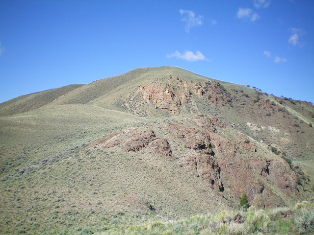
Malm Peak as viewed from the top of the first rise on the connecting ridge
Access
Spar Canyon Road is the primary access for the Northern Boulder Mountain peaks [(D)(1) on Page 243]. Spar Canyon Road can be accessed from US-93 in the east or from East Fork Salmon River Road in the west. The road is maintained except during the Winter. It is subject to occasional flash floods and can be difficult to drive when wet. All of the side roads departing from the Spar Canyon Road require high-clearance vehicles and 4WDs are recommended.
To reach the 4WD road that leads to Peak 7794 from US-93, follow Spar Canyon Road west for 7.0 miles to the junction for Bradshaw Basin Road. To reach this junction from the west, follow East Fork Salmon River Road south from ID-75 for 4.1 miles, turn left/east, and follow Spar Canyon Road east for 7.7 miles. Follow Bradshaw Basin Road north for 4.6 miles. Park here at a junction just before the road drops precipitously into Malm Gulch.
Southeast Rib, Class 2
From the parking spot, follow the rolling ridgeline northwest toward Malm Peak. There is a game trail for much of the distance to the base of the peak’s southeast rib but you must cross a fence at the top of the first rise. Climb toward the obvious break in the cliff band. A game trail is visible on the left/west side of the gully that splits the cliff band. Follow this steep game trail to the saddle above the cliff band. From the saddle, climb up to the summit ridge. Follow the summit ridge north to the high point. There is a nice collection of quartz and petrified wood gracing the summit cairn.
The route climbs a game trail on the right side of westernmost cliff band
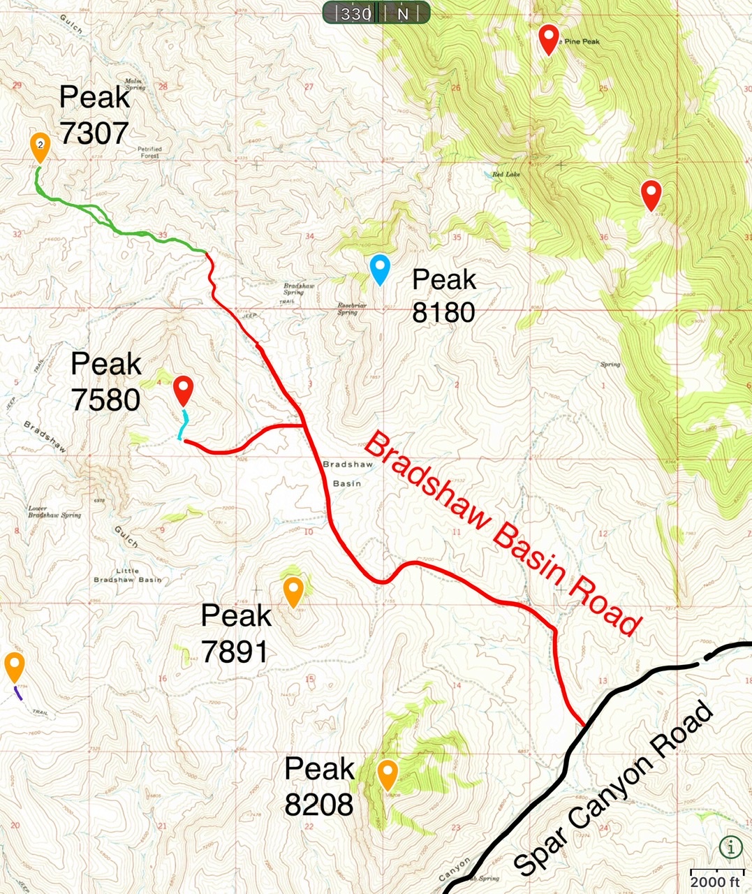
Access for Malm Peak and Peak 7580
North Spur/Northeast Ridge and Southeast Spur by Livingston Douglas
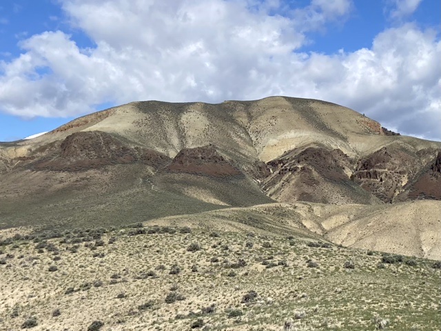
The summit hump of Peak 7307 as viewed from high on the northeast ridge. Livingston Douglas Photo
Access
From the junction of US-93 and ID-75 about two miles south of Challis, drive south on ID-75 for 9.7 miles to a signed junction with Malm Gulch Road. Turn left/east and drive 0.7 miles up Malm Gulch Road to a major washout where the road is impassable. There is a parking area here (5,510 feet; 44⁰21’04”N, 114⁰14’55”W). This is the first leg of a 2-peak adventure that includes Peak 7307 and Peak 7580. It covers 9.0 miles with 3,300 feet of elevation gain round trip.
Map Errors
The USGS topo map shows a jeep trail heading left/northeast from Malm Gulch Road that no longer exists. The USGS topo map fails to show the critical road junction (and side road) near the base of the north spur of Peak 7307. The Malm Gulch Road (shown on the USGS topo map) does not even exist for a chunk of it and is either an unmaintained foot trail or no trail at all. The USGS topo map shows two jeep trails heading east from Malm Gulch Road near the base of the northeast shoulder of Peak 7580. Neither of those roads exist anymore.
North Spur/Northeast Ridge, Class 2
The Climb
From the parking area, hike about a mile southeast up washed-out, rutted Malm Gulch Road to an unsigned junction that is just past the toe of the [obvious] north spur of Peak 7307. Leave the road at the unsigned junction and scramble southwest up through easy sagebrush to reach the crest of the north spur. Follow the short scrub on the spur southward to a rocky bend right/southwest in the ridge. Drop 30 feet off a rocky outcrop on easy sagebrush to a minor saddle. Continue southwest then west up a final, steep face of sagebrush to reach the cairned summit of Peak 7307.
Southeast Spur, Class 2
The Descent
This route is also discussed by Tom Lopez. I include it because of the specific detail and the low point in the traverse to Peak 7580, which is the next peak to climb in today’s 2-peak adventure. From the summit of Peak 7307, follow the ridge crest south to a minor ridge hump where the ridge falls off sharply. Leave the ridge here and descend southeast then east down a shoulder of short scrub and loose shale.
Drop off the shoulder and descend east down a gully (of sorts) to reach flatter sagebrush below. Head east then southeast across a field of sagebrush then cross a few minor dry gullies to reach a final ridge in the rather confusing, wide gulch between Peak 7307 and Peak 7580. Cross this ridge then drop to cross the large gulch at the base of the northwest face of Peak 7580. This gulch crossing is at about 6,450 feet and concludes the first leg of today’s 2-peak journey. Peak 7580 is up next.
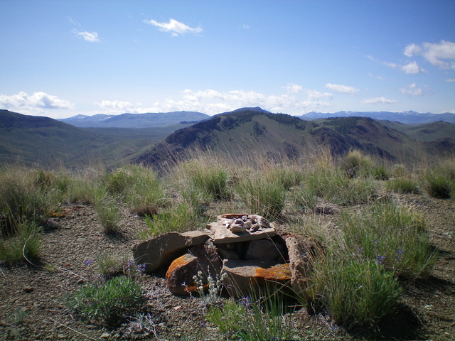
The summit cairn/table atop Peak 7307 with Peak 7580 in the distance (dead center). Livingston Douglas Photo
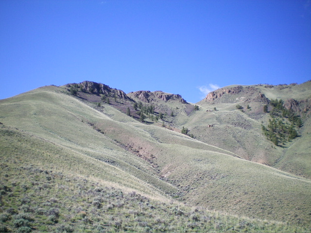
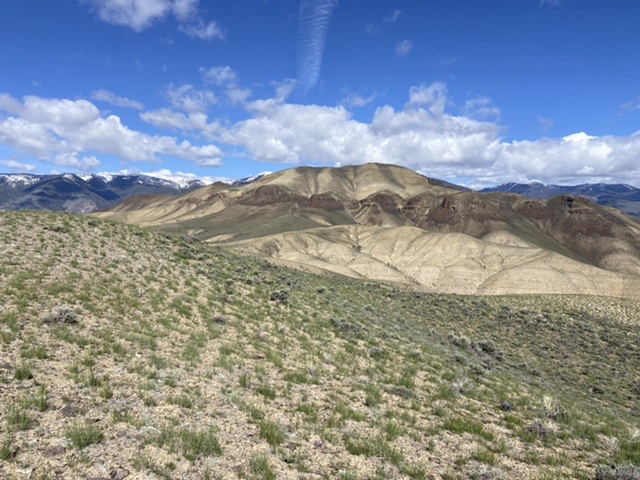
Looking up the northeast ridge (left of center) of Peak 7307. The summit hump is right of center. Livingston Douglas Photo
Additional Resources
Regions: Boulder Mountains->EASTERN IDAHO
Mountain Range: Boulder Mountains
Year Climbed: 2022
Longitude: -114.23879 Latitude: 44.33309