Elevation: 7,333 ft
Prominence: 553
This peak is not in the book. Margo Mandella prepared the first version of this page including the introductory section. Livingston Douglas provided the updated access information and a new route description. Updated November 2024
Peak 7333 by Margo Mandella
Peak 7333 is an attractive peak that lies slightly southeast of Arco Peak and northeast of the town of Arco, Idaho. Climbing the peak from the north will take you through a mining claim from 1996 that is marked with white PVC poles. This area is actively grazed, though no cows were present during our stay/climb in early May. However, cows were brought into Sutton Canyon and Jack Waite Canyon farther to the northeast while we were there. With recent warm temperatures, the ticks were actively waiting for the cows throughout the area. We encountered 10 ticks during our 2-day stay, including one that blew into the FJ, while we were driving with the windows down, and attached itself to the ceiling. USGS Arco Hills
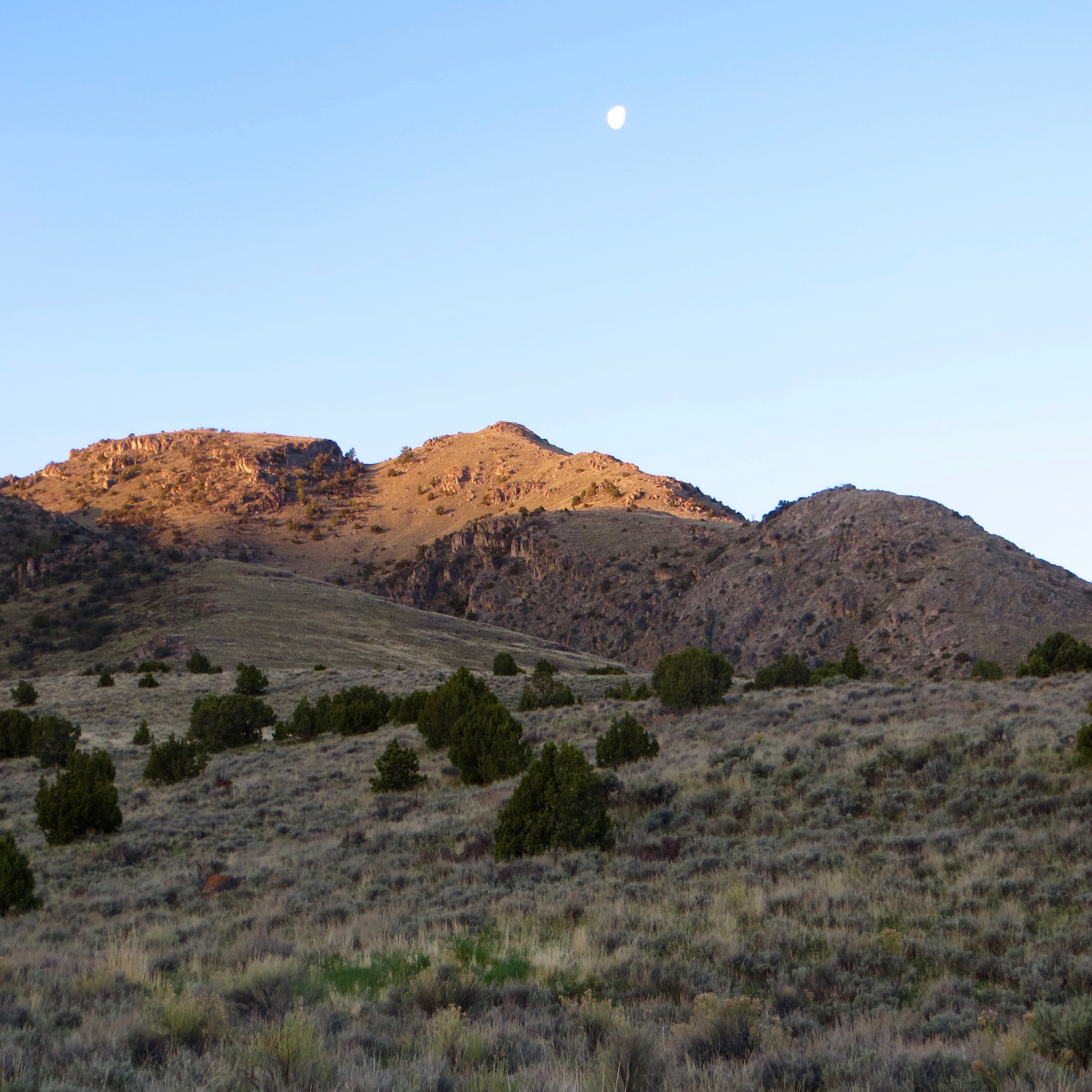
Peak 7333 as viewed from camp. Steve Mandella Photo
Access by Livingston Douglas
At the south end of Arco (ID) along US-20/26, there is a frontage road (Highway Drive) on the east side of the highway. Just north of the Conoco gas station, look for the Lost River Motel on the right/east side of the highway. Find an access road here that goes east to intersect Highway Drive. There is a public park of sorts here with a picnic table. When you reach the “T” junction with [signed] Highway Drive, turn right/south and drive 0.3 miles to a [signed] junction. Go left/east here onto 2450N. This junction is directly east of the Conoco gas station.
Drive 1.0 mile on 2450N to a signed road junction. Go left/north here. This is the start of Arco Pass Road. Reset your odometer here. At 3.6 miles, the road turns right/east at a corral. At 4.8 miles, you reach a signed road junction. Go left/north here for Arco Pass. Continue straight/east for a climb of Peak 7333. At 6.8 miles, the road bends left/northeast here and crosses a cattle guard. Park in a pullout alongside the road here (5,722 feet).
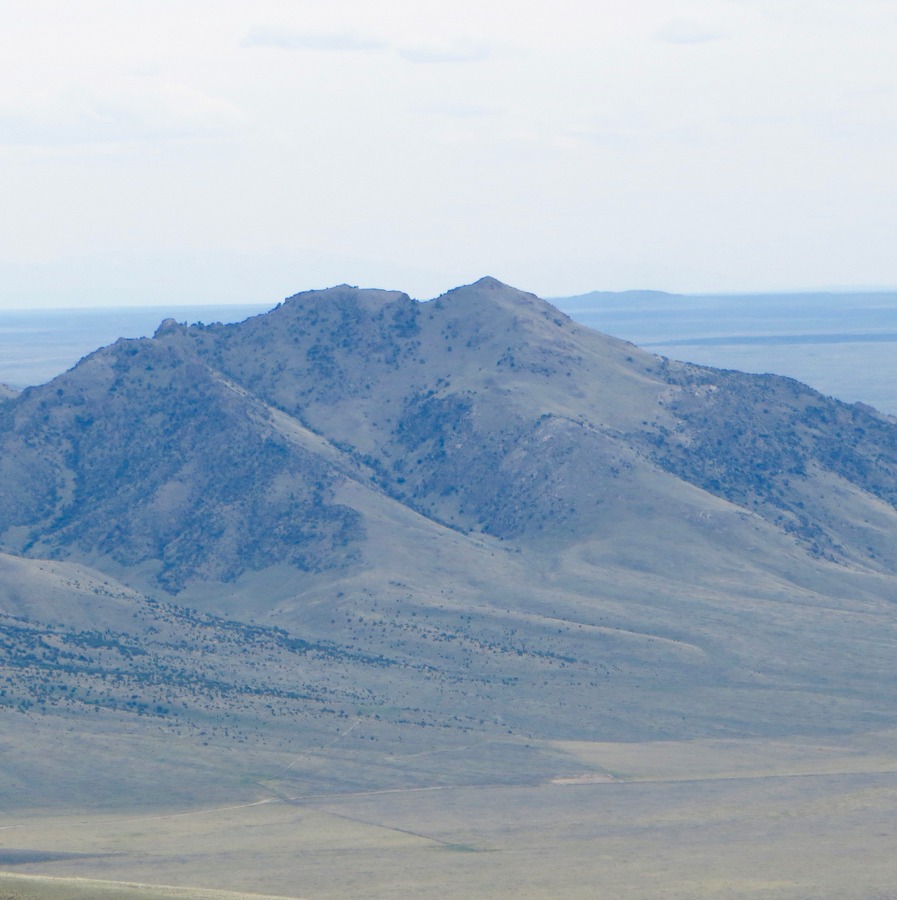
Peak 7333 as viewed from the northeast. Livingston Douglas Photo
North Gully, Class 2 by Margo Mandella
From Arco Pass Road, you have a clear view of the northern approaches to scout from your vehicle. While both north ridges appear doable, we found the gully between the two ridges having fewer obstacles. As you scout Peak 7333 from this level, you will see two possible summit high points, one on each side of the gully. However, it is the rounded west summit that is the true summit, not the blocky east summit.
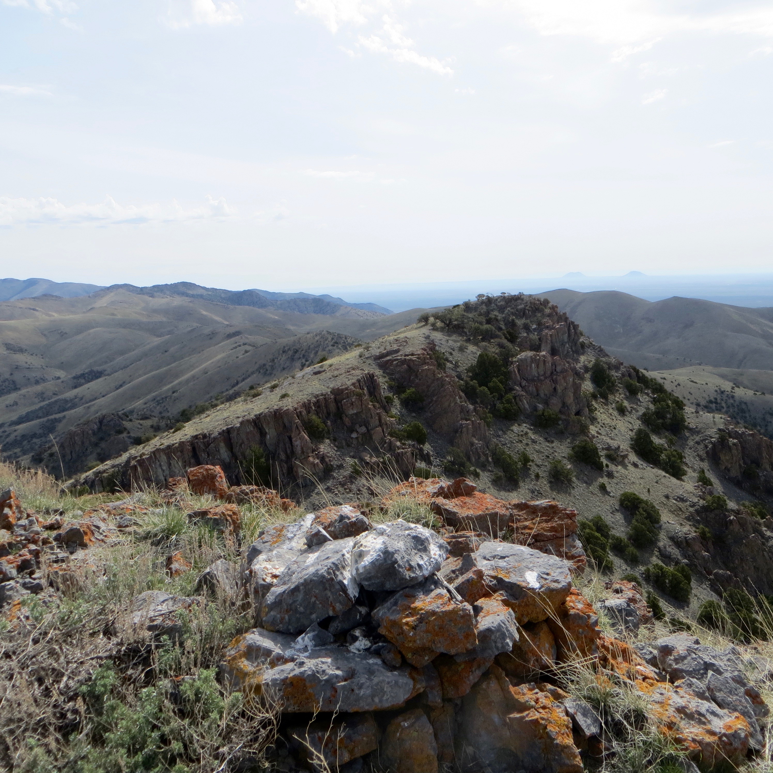
The summit cairn atop Peak 7333. Steve Mandella Photo
From the point on the road where you can park, head south toward the obvious gully, possibly crossing a lower section of the eastern of the two north ridges to enter the gully. Continue up the gut, looking for the easiest travel through sagebrush and juniper. Our GPS track shows our decision to climb up and through a rock garden (path on the viewer’s left). However, this was an unnecessary, and slower, side trip. Stay in the gully, crossing to the left side (viewer’s right on the map below) of the gully when it narrows heading toward what know looks like a grassy ramp between the two summit high points.
Continue up the steep ramp heading for the saddle between the high points. At the saddle, turn west and climb up a short section of easy rock to reach the true summit. From the top, enjoy views of the Arco Hills, King Mountain, Arco Peak, Big Southern Butte, the Lost River Mountains, the Snake River Plain, and the East End of the Boulder Mountains.
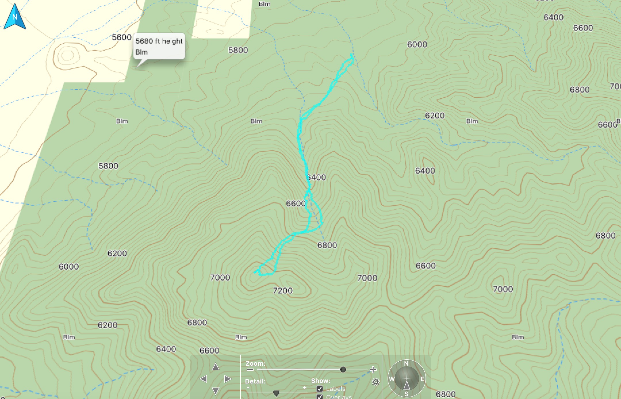
GPS track for our climb of Peak 7333. Steve Mandella Track
North Ridge, Class 2+ by Livingston Douglas
Access
Same as set forth above
The Climb
From the cattle guard, find a weak 2-track road heading south. Hike up this road. It soon reaches a cattle gate/fence with a long rectangular cistern nearby. There are now two roads to choose from. One heads right/west on the outside of the cattle fence. The other [weaker] 2-track road goes through the gate and bends southwest soon after. The correct road is the weak one that goes THROUGH the cattle gate. Follow that road. It soon gets much better and easier to follow.
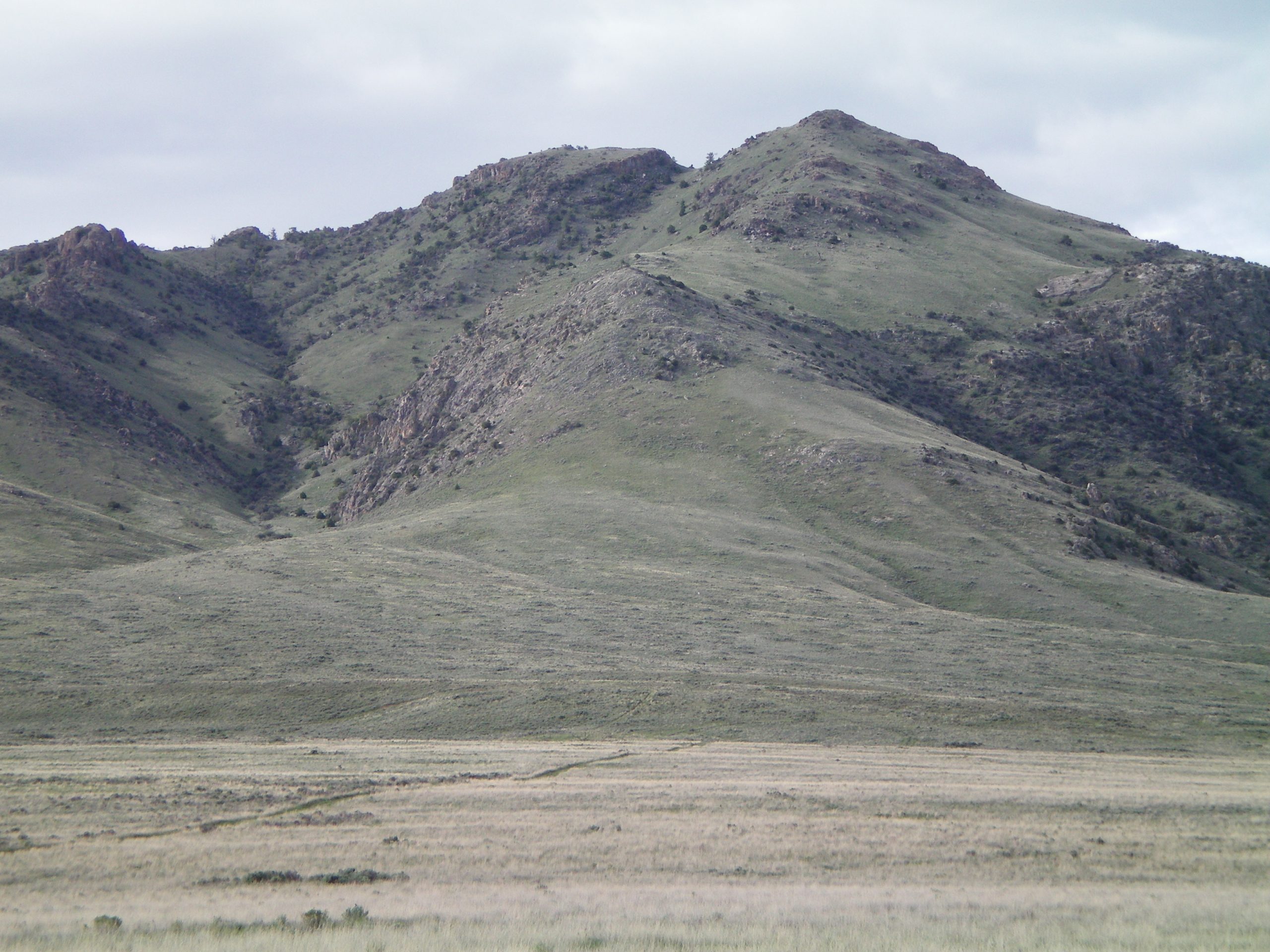
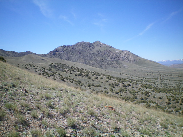
A look directly up the north ridge of Peak 7333. The ridge bends to the right higher up. The true summit is the gentler hump on the right. Livingston Douglas Photo
The old road soon bends southwest and is now heading directly at the base of the north ridge of Peak 7333. You will pass two cattle cisterns on this adventuresome road hike. Cistern #1 is round, small, and metal. Cistern #2 is round, large, metal, and full of water. Just after passing Cistern #2, the road drops a little to cross a gully and starts heading northwest, away from Peak 7333. Leave the road here. Do a cross-country scramble through relatively easy sagebrush, aiming for the wide, gentle toe of the north ridge. The north ridge is more of a face/slope here than a well-defined ridge.
You will see an obvious white post/pole (which is a land survey marker) in the dead center of the north ridge—aim for it. Upon reaching the white post, you are just under 6,000 feet in elevation. Scramble south up easy open terrain (grass/sage mix) to reach the base of the rocky outcrops of the north ridge at about 6,400 feet. Continue up the better-defined ridge with a few Class 2+ moves up face rock, rocky outcrops, and rock buttresses.
When you look at this ridge from its base, you will swear that it is at least a Class 3 climb, if it’s even do-able. But it really does go at Class 2+. You soon reach the small summit area and see the gentle saddle and false east summit. You saw both of these potential summits as you climbed up the ridge, quite certain that the “blocky” east summit is higher, BUT IT ISN’T. The gentler west summit is the true summit. It has a modest summit cairn.
Additional Resources
Regions: EASTERN IDAHO->Lost River Range
Mountain Range: Lost River Range
Longitude: -113.22459 Latitude: 43.655529