Elevation: 7,340 ft
Prominence: 600
This peak is not in the book. Published November 2020
Peak 7340 sits above Dairy Creek and overlooks I-15 north of Spencer, ID. The peak is the home of Three Benchmark (7,310 feet) which is located a short distance southwest of the true summit. The northwest ridge is a fun scramble and is typically snow-free by May. There is some private land down near I-15 and Beaver Creek so don’t mistakenly descend west off the northeast ridge. USGS Spencer North
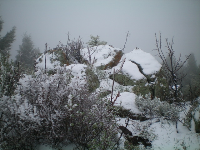
The snow-covered summit boulders atop Peak 7340 on a snowy May morning in Eastern Idaho. Livingston Douglas Photo
Access
From Exit 184/Old Beaver on I-15, drive 0.4 miles south on a frontage road (FSR-006) that turns left/east then northeast to skirt the base of the northwest ridge of Peak 7340. Park here in a pullout on the left-hand side of the road (6,030 feet) at the base of the northwest ridge. At 0.6 miles, this road reaches a [signed] junction with Dairy Creek Road/FSR-017.
Northwest Ridge, Class 2
The Climb
From the base of the northwest ridge, scramble southeast up the obvious ridge in open scrub and sagebrush. Some weaving is required but there are gaps in the sagebrush to make it easier. In addition, there is a cattle trail on portions of the ridge crest. Higher up on the ridge, a pine forest emerges on the left/east side of the ridge crest. Stay in the open terrain to the right/west of the thick forest. There are four ridge points to go up and over on the way to the summit.
At just below 7,000 feet, you reach a flat, open area akin to a saddle. The ridge bends left/east here and becomes better defined above this juncture. Just keep the forest on your left/north as you climb east to reach Three Benchmark (7,310 feet). Three Benchmark has a triangulation tripod laying on the ground. Fresh snow covered everything so I’m not sure if there is still a USGS benchmark there. But Three Benchmark is not the summit high point of Peak 7340.
Continue north to the true summit of Peak 7340. There is no summit cairn but there is a collection of large boulders on the high point. The drop-off to the north is noticeable, particularly given how docile the sides of the ridge have been all the way to this point. It was a cold, foggy, snowy May morning in Eastern Idaho and I had to follow my boot prints in the fresh snow to find my way back down the ridge as visibility was nil. Even so, I reached a ridge juncture at about 6,700 feet and mistakenly descended the north spur instead of the northwest ridge from that point. I was concerned that the ridge (heading almost west at that point) was going to dump me onto private land below and I wanted to avoid that.
Northwest Ridge/North Spur, Class 2
The Descent
From the summit, descend the northwest ridge to the aforementioned ridge juncture at 6,700 feet. From that juncture, follow the north spur down to 6,400 feet then continue northwest down to Dairy Creek and Dairy Creek Road. Hike about 0.5 miles west down Dairy Creek Road to FSR-006 and the parking pullout at the base of the northwest ridge where you are parked. The north spur is more tedious than the northwest ridge. It is rockier, narrower, and is clogged with brush, but the pain is short-lived. Once you reach the flat land alongside Dairy Creek, you can use cattle trails to expedite your return to Dairy Creek Road. Look for a cattle-friendly spot to cross Dairy Creek through the surrounding willows to reach the nearby road.
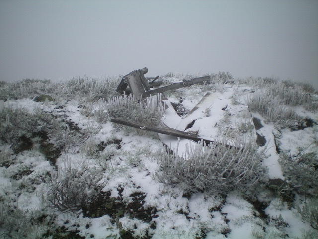
The snow-covered triangulation tripod wreckage atop Three Benchmark, the [lower] southwest summit of Peak 7340.
Additional Resources
Regions: Centennial Range->EASTERN IDAHO
Mountain Range: Centennial Range
Longitude: -112.15819 Latitude: 44.40019