Elevation: 7,345 ft
Prominence: 285
This peak is not in the book. Published December 2020
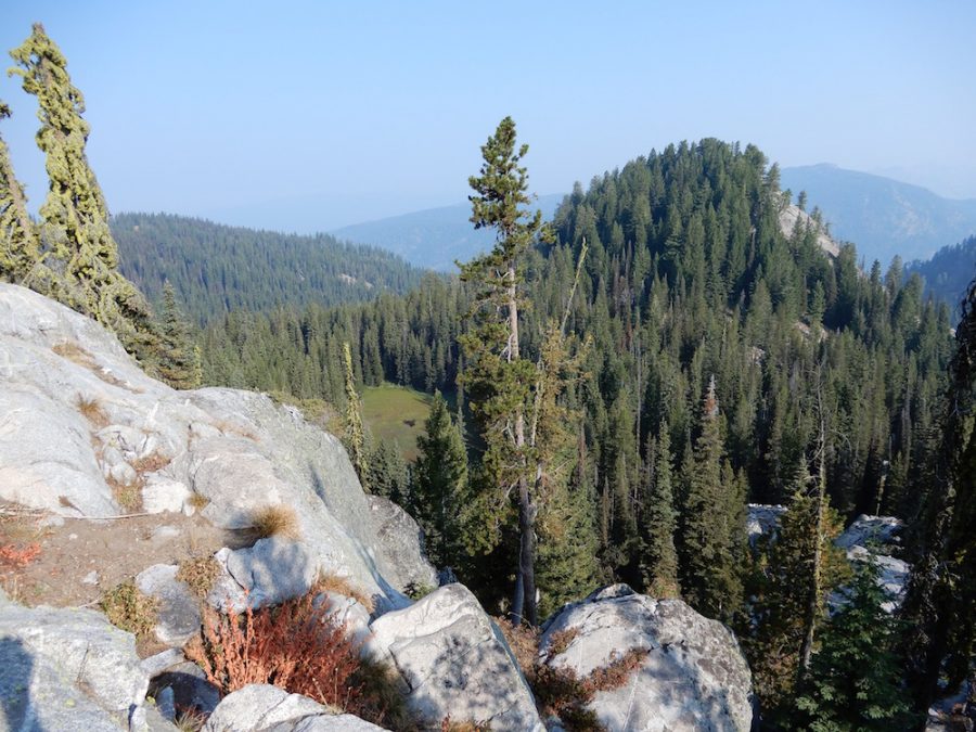
Peak 7345 is located west of McCall, Idaho, north-northeast of Boulder Lake, and just north of Shaw Twin Lakes. USGS Fitsum Summit
Shaw Twin Point. John Platt Photo
Access
Primary access is via FS-403/Boulder Creek Road [(B)(4) on Pages 137-138]. Shortly after crossing onto State of Idaho lands, a convoluted system of logging roads is found on the north side of the road. After the second cattle guard on Boulder Road, look for a left turn that immediately starts uphill. Stay on the main road until it reaches the top of the ridge in about 5 miles. The road eventually leaves the ridge and traverses south. Look for a hard, steep left turn. UP until this point, a sedan can make it. Turn left and park in 50 yards, then walk the last bit to the unmarked trailhead- you can drive that, but you risk removing your mirrors on very tight trees (not just brush).You will need a map to navigate these roads to the unofficial Shaw Twin Lakes Trailhead. Follow the trail to the lakes.
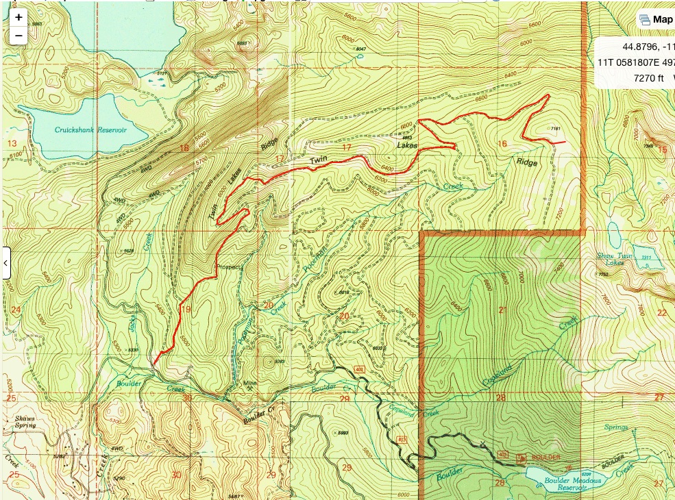
Access map, courtesy of John Platt.
Southeast Ridge, Class 2+
According to John Platt, the ridge is straightforward with minor route-finding issues around granite outcrops. For additional details, use the link below to read John’s tribute report.
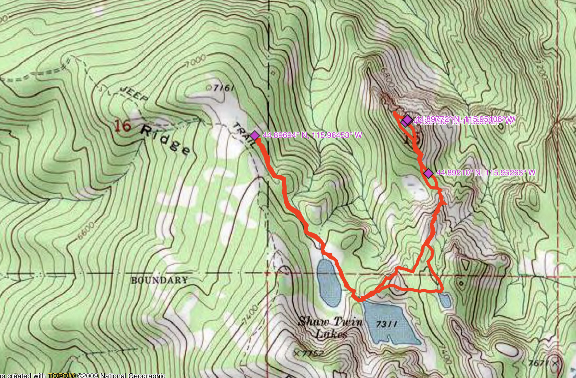
John Platt’s GPS track. John’s route covers 3.7 miles with 1,156 feet of elevation gain round trip.
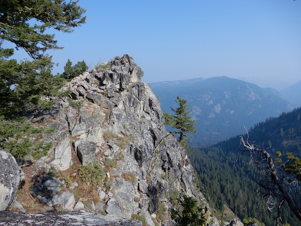
The summit. John Platt Photo
Additional Resources
Mountain Range: Western Salmon River Mountains
Longitude: -115.95401 Latitude: 44.89769