Elevation: 7,362 ft
Prominence: 302
This peak is not in the book. Updated January 2023
Skyline Peak sits on the main Albion Range crest midway between Mount Harrison and Mount Independence. The peak has two summits of nearly equal height. The Skyline Trail crosses its summit. USGS Mount Harrison
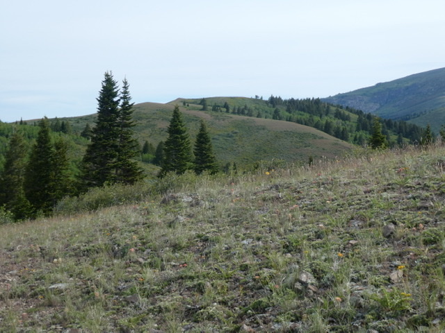
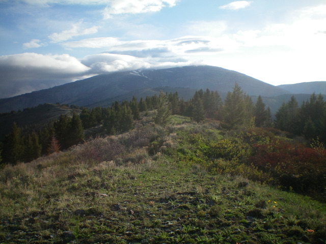
Skyline Peak as viewed from the south
Map Errors
First, the point elevation for Peak 7362 is too high for the final contour line (7320+). Second, the summit cairn is on the [forested] north summit hump but the south summit measures at equal or greater height (by altimeter) and is open and bare. LOJ assigns the true summit as the north summit but the south summit has more area above the identical contour line (7320+).
Access
This peak is accessed via FS-548, the Elba to Oakley Road [(A)(2) on Page 351]. From either Elba or Oakley, Idaho follow this road to Basin/Elba Pass. Park on the pass. From ID-77 in Elba, turn right/west onto Elba Road/1950S Road (which becomes FSR-548) and drive 9.5 miles to Basin/Elba Pass (7,106 feet). Park in a large pullout area on the pass. Caution: do not do this climb on a windy day. Additionally, I note that Google Maps will provide good directions to the pass.
Skyline Trail, Class 1
The Skyline Trail starts on the pass and runs north to Twin Lakes. The trail is an old road until it reaches Skyline Peak. The trail is open to motorcycles. From Basin/Elba Pass, hike north up [signed] Skyline Trail #0513 (an old 2-track road). Leave this trail high up (at a cairn) to continue near the ridge crest on the old road. This old 2-track road is only a foot path in some sections. It has a ridiculous number of ups and downs (850 feet of extra uphill round trip). The 2-track leads to the two summits. The summit is a most unimpressive ridgeline hump.
The north summit has a modest cairn amongst the junipers, but is it really the high point? The [open] south summit is just as (or more) likely to be the actual high point. Peak 7362 is merely a bump (barely ranked) on the southwest ridge of Mount Harrison. However, it does offer a nice view of Mount Harrison. This an up-and-down route that covers 5.0 miles and 479 feet of elevation gain round trip. 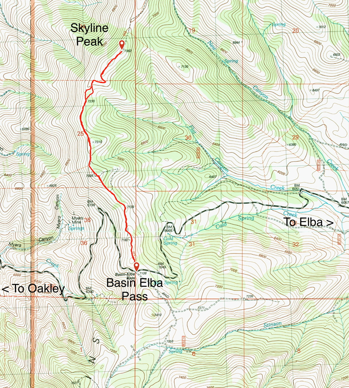
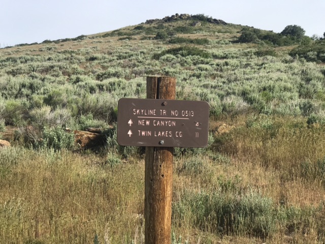
The Skyline trailhead
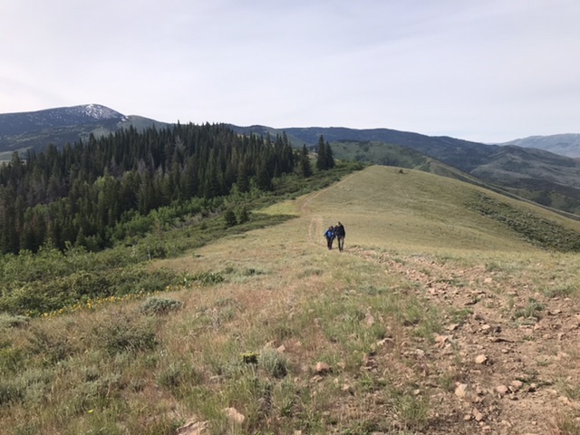
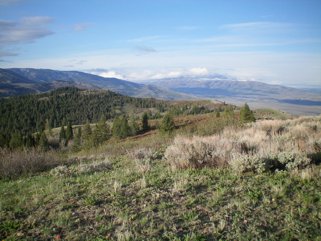
The route to the summit is mostly open
View of the official/north summit of Peak 7362 from the [open] south summit. But is the [forested] north summit actually higher? Livingston Douglas Photo
View of the Albion Mountains from the south summit of Peak 7362. Livingston Douglas Photo
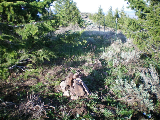
The forested north summit of Peak 7362 has a modest cairn. The south summit is in the background. Livingston Douglas Photo
Additional Resources
Regions: Albion Range->SOUTHERN IDAHO
Mountain Range: Albion Range
Year Climbed: 2020
Longitude: -113.70939 Latitude: 42.27449