Elevation: 7,386 ft
Prominence: 376
This peak is not in the book. Published November 2023
Peak 7835 is located on the north side of Wood Canyon in the Aspen Range northeast of Soda Springs. The summit is most easily reach via its south side from Wood Canyon Road/FSR-125. It is a short, steep bushwhack in reasonable scrub. USGS Soda Springs
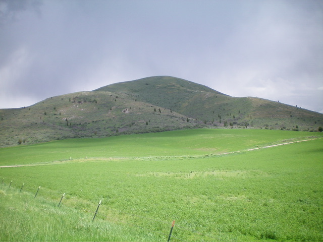
Peak 7386 as viewed from the valley floor to its southwest. Livingston Douglas Photo
Access
Park along Wood Canyon Road/FSR-125 exactly 1.5 miles west of the FSR-175/FSR-125 junction and 5.8 miles east of the base of Wood Canyon Road at ID-34 in Soda Springs. My improvised pullout is at 6,325 feet and 42⁰41’00”N, 111⁰30’21”W. This area is a mix of private and public land. The summit and much of the south side of Peak 7386 is on unposted, private land. This route avoids much of that land and remains on State of Idaho land for most of the climb.
Southeast Shoulder, Class 2
The Climb
From Wood Canyon Road, cross a cattle fence early on. This fence follows, and is just below, an unmapped mining road that crosses the south face of Peak 7386. From the mining road, scramble up a steep slope (then shoulder) of scrub that is thick initially then thins out higher up. The shoulder is better defined as you gain elevation. Cross two lateral mining roads on the way up: one good one down low and the weak remnants of another road midway up. Just below the weaker mining road, there is a patch of talus/scree to scramble up. The scrub on this climb requires weaving and the underlying scree/gravel is loose and steep in some areas. The summit has three memorials on the small summit area.
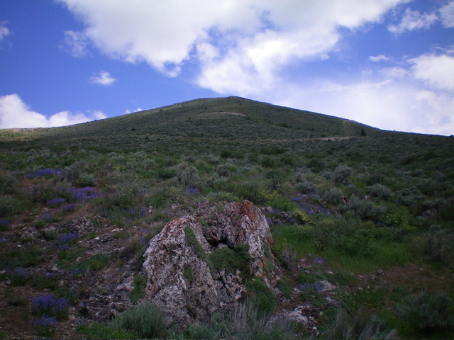
Peak 7386 as viewed from the base of the steep south shoulder (start of climb). Livingston Douglas Photo

The three summit memorials atop Peak 7386. Livingston Douglas Photo
Additional Resources
Regions: Aspen Range->Peale Mountains->SOUTHERN IDAHO
Mountain Range: Peale Mountains
Longitude: -111.4718 Latitude: 42.6807