Elevation: 7,391 ft
Prominence: 371
This peak is not in the book. Published December 2020
Peak 7391 is a small, ridgeline summit that is located just north of the north end of Deadhorse Ridge and southeast of Currant Hollow. It separates the Horse Creek drainage from the Squaw Creek drainage. It is most easily reached via FST-267 (an ATV trail). USGS Conant Valley
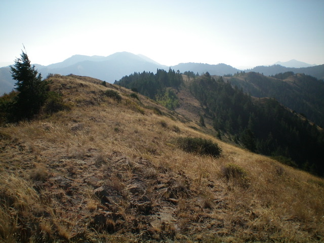
Peak 7391 is the hump in dead center as viewed from the summit of Deadhorse Ridge North. Livingston Douglas Photo
Access
From US-26 north of Swan Valley, ID, turn right/south at a signed junction just before a bridge crossing of the Snake River a few miles west of the junction of US-26 and ID-31 in Swan Valley. This junction is signed for the Snake River Road and “Fall Creek Road 1 mile.” Drive 1.2 miles south on Snake River Road as it follows the west side of the Snake River and reaches a signed junction with Fall Creek Road/FSR-077. Turn right/west on Fall Creek Road and drive 4.5 miles west to the [signed] trailhead for Horse Creek Trail/FST-140 on the left/southeast side of the road. The trail has an immediate ATV/foot bridge crossing of Fall Creek that is visible from the road. Park in the open grassy area at the trailhead (5,500 feet).
South Ridge, Class 2
The Climb
From Fall Creek Road, hike southeast up FST-140 (an ATV trail) to a signed “T” junction with FST-267 at 7,005 feet. FST-267 is an ATV trail heading north from here but it is a MC trail heading south from here. Both are good for hiking. Please note that the USGS topo map does not show FST-140 at all, though it does show FST-267. The aforementioned trail junction is at a saddle just south of Peak 7391.
From the saddle/junction, follow FST-267 north then northwest to near the summit of Peak 7391. Leave FST-267 at a minor shoulder crossing that is located southwest of the summit. Cross a cattle fence to the right/northeast and scramble up short scrub and broken rock to the open, ridgeline summit. The summit had no cairn so I built a small one.
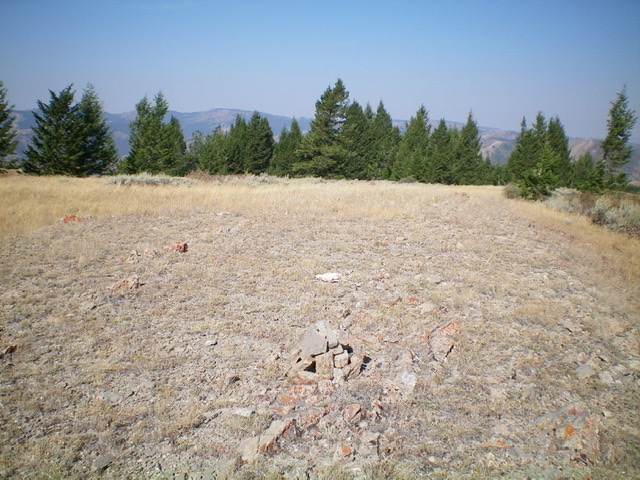
The flat, gentle summit of Peak 7391. Livingston Douglas Photo
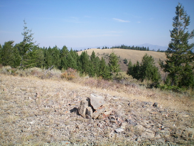
The newly-built summit cairn atop Peak 7391, looking north at a lower ridgeline hump. Livingston Douglas Photo
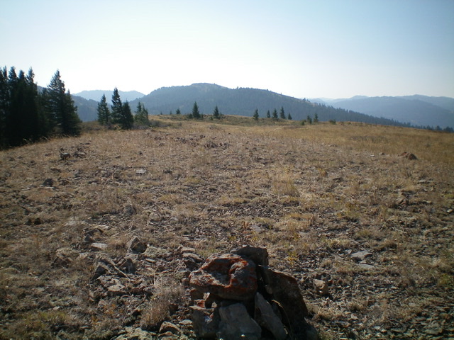
Deadhorse Ridge North is in the distance (just left of center) as viewed from the summit of Peak 7391. Livingston Douglas Photo
West Face, Class 2
The Descent
From the summit, descend southwest back to the minor shoulder. Cross the cattle fence and continue descending west then southwest on an open shoulder through somewhat tedious brush and sagebrush. The shoulder morphs into a face then back into a shoulder lower down. Scattered pines join the mix as you descend toward [visible] FST-140 (an ATV trail) where it crosses a minor shoulder/saddle. Once you reach FST-140, follow it right/northwest back to the trailhead and Fall Creek Road.
Additional Resources
Regions: Caribou Range->SOUTHERN IDAHO
Mountain Range: Caribou Range
Longitude: -111.39589 Latitude: 43.38829