Elevation: 7,392 ft
Prominence: 692

This peak is not in the book. Published December 2019
Peak 7392 is a hill located between Big Dry Canyon and Muldoon Canyon. Its southwest ridge makes for a great early-season scramble on open terrain. USGS Seamans Creek
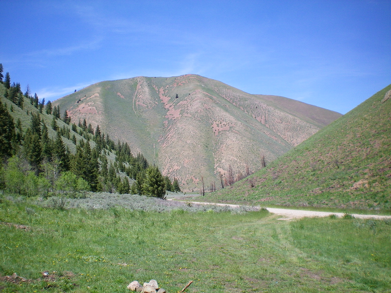
The south face of Peak 7392 as viewed from the floor of Sharps Canyon. The south shoulder descent route is dead-center, just right of a massive gully. It is a treacherously steep, loose descent. Livingston Douglas Photo
Southwest Ridge, Class 2
Access
From ID-75 in Bellevue, drive east on Pine Street (which becomes Muldoon Canyon Road) for 4.6 miles to the mouth of Big Dry Canyon. A short spur road leads a short distance off Muldoon Canyon Road to a small parking area. Park here (5,640 feet).
The Climb
From the parking area, bushwhack northeast a short distance to reach the toe of the southwest ridge. The ridge is ill-defined initially and has thick sagebrush with gaps to weave through. The sagebrush soon thins out and the ridge becomes an enjoyable mix of short scrub and a stable scree base. The ridge becomes a better-defined, rounded ridge. Grind your way northeast then east then northeast to the elongated summit area. There are two minor humps (false summits) you must go over prior to reaching the true summit. The summit area is relatively bare with broken scree and very short scrub. There was no summit cairn, so I built a small one with the few loose pieces of talus that I could find.
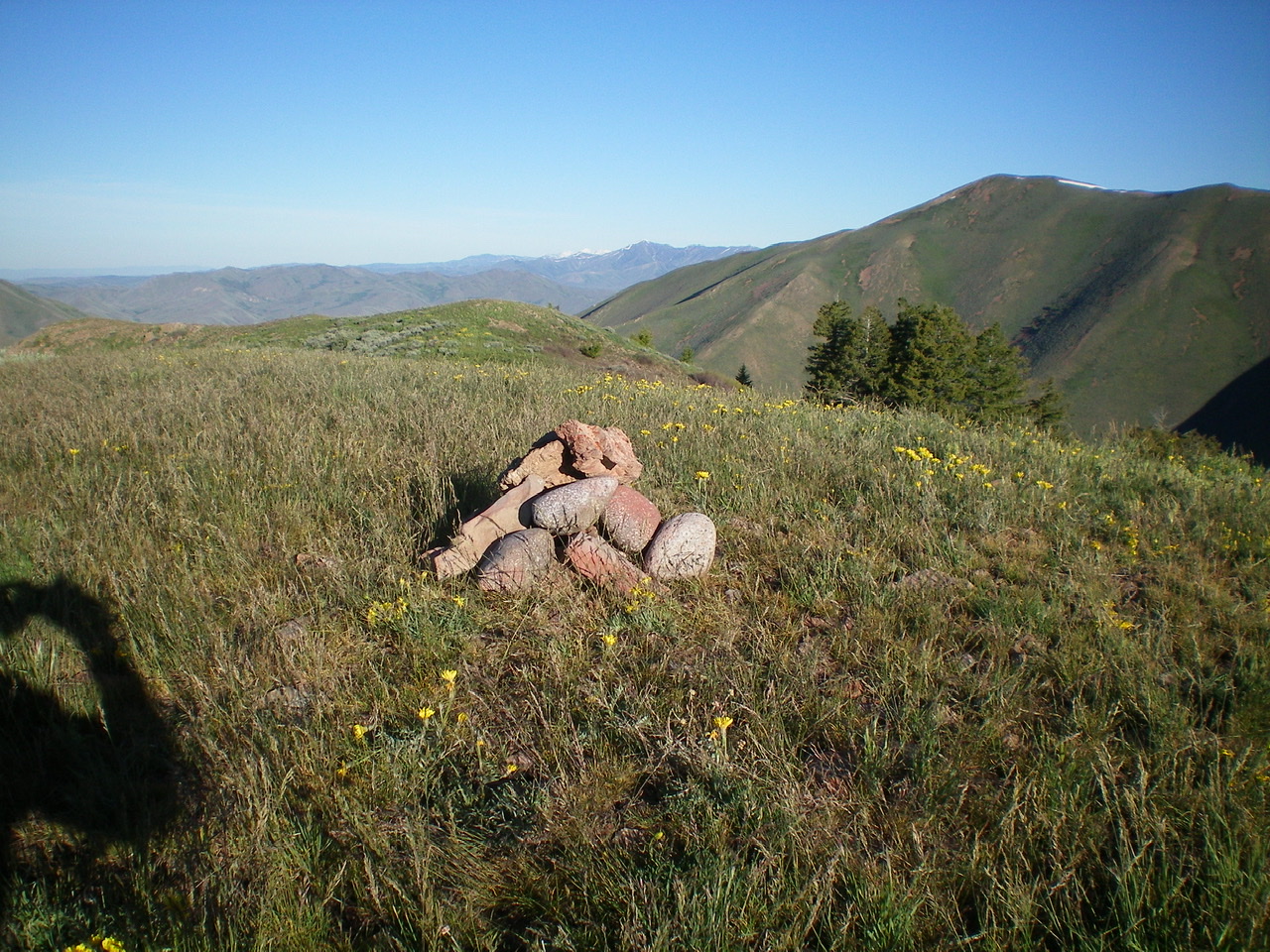
The newly-built summit cairn atop Peak 7392. Livingston Douglas Photo
South Shoulder, Class 2+
Access
From ID-75 in Bellevue, drive east on Pine Street (which becomes Muldoon Canyon Road) for 5.9 miles to a road junction at the mouth of Sharps Canyon. Park in a pullout near this junction along Sharps Canyon Road. The elevation here is 5,800 feet.
The Descent
There are multiple shoulders and gullies on the southeast aspect of Peak 7392. Many of them become very steep lower down and might be impassable. I selected the most prominent and easiest shoulder which I call the south shoulder. It descends directly to a point just east of the road junction at the mouth of Sharps Canyon. It is worth taking the time to recon this shoulder from Sharps Canyon Road (or from a dispersed campsite a short distance up the road) to be able to find it when you begin this descent. Don’t be sloppy with your planning for this descent route. Do your homework.
From the summit, descend the somewhat-obvious south shoulder. Aim to finish the descent just left/east of the road junction a whopping 1,600 feet below. This is a tedious descent on loose scree and short/medium scrub. It is somewhat of a nightmare, to be honest. Wear your heavy boots for this one so that you can ski down some sections of the loose scree and to protect your ankles from injury. You will be grabbing brush/sage to control your descent. Most of the scree sections are too firm to be boot-skied, unfortunately. Consequently, you will find yourself slowly down-climbing what you thought would be a fast, smooth, boot-ski descent. When you reach the road, you’ll be grateful to be on flat ground again.
Additional Resources
Regions: EASTERN IDAHO->Pioneer Mountains
Mountain Range: Pioneer Mountains
Longitude: -114.14919 Latitude: 43.47549