Elevation: 7,402 ft
Prominence: 582
This peak is not in the book. Published January 2023
Peak 7402 is one of several scrub humps that are located near Geneva Summit along US-89 east of Montpelier. It is a ridgeline summit that towers over Wood Canyon to its west. This area is a patchwork of private and public land, so be careful. The summit is on private land but it is not fenced or posted. The only public access is from US-89 to its northwest. USGS Geneva
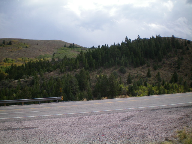
Peak 7402 (left of center) and the initial hump to climb (right of center) as viewed from US-89. Livingston Douglas Photo
Access
Park along US-89 east of Geneva Summit on the north side of the highway at a junction with a side road (not shown on maps) that leads to a gated fence and private property (6,645 feet). GPS coordinates: 42⁰20’13”N, 111⁰07’42”W.
North Spur/Northwest Shoulder, Class 2
The Climb
From the road junction, cross to the south side of US-89 and descend 60 vertical feet through easy scrub to cross a dry gully. From the gully, bushwhack steeply southeast up through a patch of thick aspens/pines to reach the crest of the narrow, forested north spur. Scramble up the left/east side of the ridge crest in open scrub to reach a saddle to the left/southeast. Angle diagonally into it, dropping 20 vertical feet, in easy sagebrush.
From the saddle, hike southeast up the rounded northwest shoulder through the sagebrush on a cattle trail. The cattle trail soon flames out. Scramble southeast up to the summit ridge. Head right/south on a 2-track road on the ridge crest to quickly reach the ridgeline summit of Peak 7402. There was no summit cairn so I built one on the high point. The open summit offers nice views of the surrounding area and nearby peaks. There is no signage or fencing on this route and it is almost entirely on BLM land.
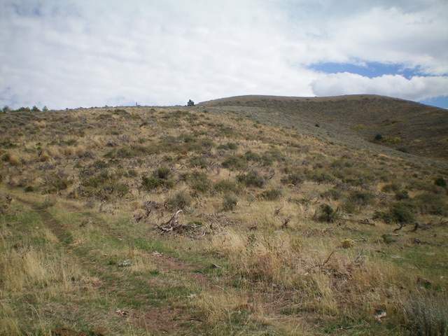
Looking up the west shoulder (ascent route) from its base. The summit is right of center. Livingston Douglas Photo
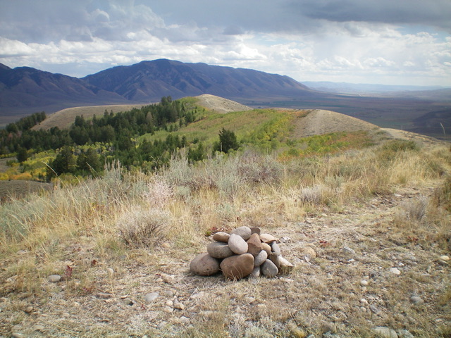
Looking southeast from the summit of Peak 7402 along the high ridgeline. Livingston Douglas Photo
Additional Resources
Regions: Peale Mountains->Pruess Range->SOUTHERN IDAHO
Mountain Range: Peale Mountains
Longitude: -111.1196 Latitude: 42.3278