Elevation: 7,420 ft
Prominence: 560
This peak is not in the book. Published November 2021
Peak 7420 is a gentle scrub hump that sits above Cartwright Gulch, west of Challis. Due to private land issues, it is most easily accessible from the Custer Motorway near the Challis National Forest boundary. This hike is entirely on BLM land and is mostly a road hike. USGS Pats Creek
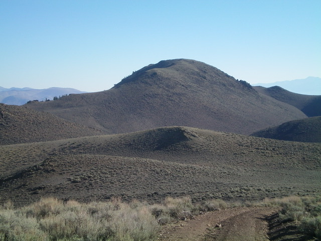
Peak 7420 as viewed from the southwest, near the base of the BLM 2-track road. Livingston Douglas Photo
Access
From the junction of US-93 and Main Street in Challis, drive west on Main Street (which becomes Garden Creek Road) for 4.9 miles to a signed junction with the Custer Motorway/FSR-070. Turn right onto the Custer Motorway and reset your odometer. At 1.6 miles, reach an unsigned road junction. This junction is just below, and 0.1 miles east of, the cattle guard/fence (7,005 feet on the USGS topo map) that marks the Challis National Forest boundary. Park at this junction (6,970 feet).
South Face/Southwest Ridge
The Approach, Class 1
From the road junction, hike north up a rugged 2-track road(only suitable for ATVs and MCs) which climbs a dry gully to reach a saddle. This road is labeled “NFD 257” on the USGS topo map. From the saddle, you get a nice view of Peak 7420 to the northeast. Continue hiking along the 2-track road as it heads northeast then north to reach Cartwright Gulch and an unsigned “T” junction (6,780 feet). Congratulations, you have lost net elevation in getting here. This is the base of the [obvious] south face of Peak 7420. There is a nearby cattle cistern.
The Climb, Class 2
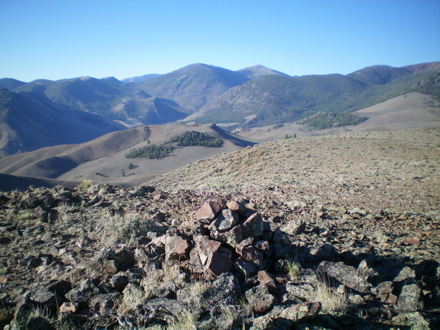
Looking down at the ascent route from the cairned summit of Peak 7420. Livingston Douglas Photo
From the “T” junction in Cartwright Gulch, leave the road and scramble north up through thick sagebrush (with loose underlying scree/gravel) to intercept the southwest ridge. Head right/northeast up the rounded ridge on scree and sagebrush to reach the tilted summit plateau. Continue north-northeast through sagebrush to reach the cairned summit. Surprisingly, there is a lot of loose rock on this climb. You will notice this particularly on the descent back to the 2-track road.
Additional Resources
Regions: Eastern Salmon River Mountains->Salmon River Mountains->Southeast Corner Peaks->WESTERN IDAHO
Mountain Range: Eastern Salmon River Mountains
Longitude: -114.32109 Latitude: 44.51219