Elevation: 7,420 ft
Prominence: 738
This peak is not in the book. Published January 2023
Peak 7420 is located west of Hartley Peak and at the head of Last Chance Gulch. It is a mostly-forested ridgeline hump in a sea of such humps in this section of the Sublett Range. Peak 7420 is most easily climbed from Hartley Canyon Road to its east. USGS Hartley Peak
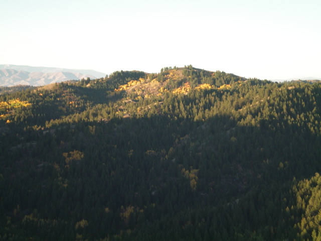
Peak 7420 as viewed from the northeast. Livingston Douglas Photo
Access
Hartley Canyon Road/FSR-578 is located along ID-37 about 22 miles south of the I-86 junction and 22.6 miles north of the west end of Holbrook. It is also 2.0 miles south of Big Canyon Road. Turn right/west onto [signed] Hartley Canyon Road and reset your odometer. At 3.4 miles, go straight (not left) at an unsigned junction. At 4.3 miles, the road changes from smooth gravel to rutted dirt. At 4.8 miles, go straight (not left) at a junction. At 5.0 miles, go through a wire cattle gate. At about 6.0 miles, reach the Sawtooth National Forest boundary. At 7.8 miles, reach an unsigned junction at a fork in the canyon. Harley Canyon Road turns sharply left/south at this junction. At 8.7 miles, reach “Hartley Pass” where there is a triple [signed] road junction. Park on the pass (6,682 feet).
East Gully/Northeast Face, Class 2
The Climb
From Hartley Pass, follow FSR-579 for about 0.4 miles to sharp right/north turn at a dry gully crossing (6,665 feet). An old jeep road heads west-southwest up the gully. This road is still shown on the USGS topo map. Follow the old road/road bed up the right/north side of the dry gully to reach a sharp left/south bend at 6,950 feet. This is the first of two switchbacks that lead up to just below the ridge at the head of this gully. Continue left/south up the 2-track. It crosses to the south side of the dry gully here. The 2-track is now getting very overgrown and hard to follow.
The 2-track soon makes a sharp right/north turn to begin another switchback. A short distance up from this turn, there is a patch of willows that completely cover any remnants of the old road (which is only a foot trail here). The road actually continues on the other side of this short patch and goes up to just below the head of the gully. Not knowing this, leave the old road here and bushwhack left/west up through the steep face through dense aspens and brush to reach the summit ridge just east of the high point. Scramble west up the ridge and bash through a final short patch of thick brush to reach the open summit of Peak 7420.There is a repeater on the high point. There was no summit cairn on top so I built a decent one next to the repeater.
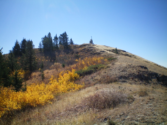
The antenna-clad summit hump of Peak 7420. Livingston Douglas Photo
North Ridge/East Gully, Class 2
The Descent
Given the wicked bushwhacking on the northeast face, I sure as heck was not going to descend the ascent route. I had to find an alternate route to get into the east gully. From the summit, descend the rock-and-scrub of the open north ridge to reach a short patch of forest just above the head of the east gully. There is an off-and-on use trail on the ridge crest to help. Once at the head of the gully, descend it in open scrub for a short distance to find the remnants of the old 2-track road. Follow the two switchbacks of the road/foot trail south then north to reach the better-defined road below at the crossing of the dry gully. Retrace the ascent route down the roads to return to Hartley Pass
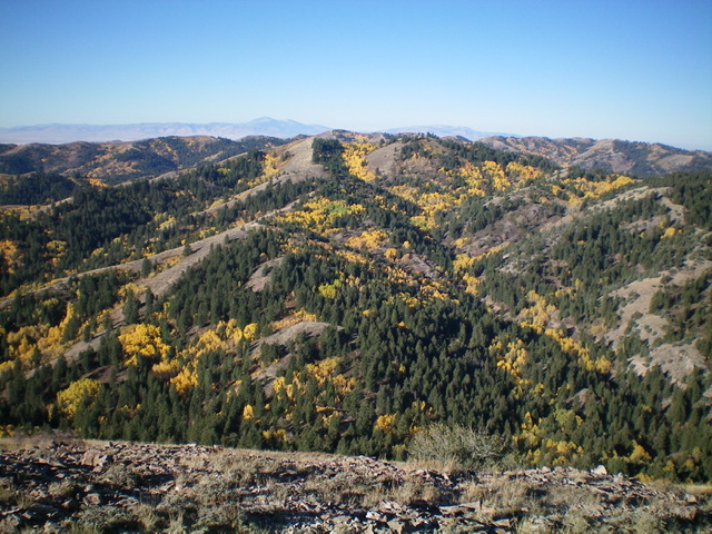
Peak 7420 (dead center) as viewed from Hartley Peak to its east. Livingston Douglas Photo
Additional Resources
Regions: SOUTHERN IDAHO->Sublett Range
Mountain Range: Sublett Range
Longitude: -112.9754 Latitude: 42.4039