Elevation: 7,425 ft
Prominence: 435
This peak is not in the book. Published January 2023
Peak 7425 is a minor hump located on the west side of the Slug Creek drainage, west of the south end of Schmid Ridge. It sits above beautiful Green Basin to its west and Wilde Canyon to its south. Staying in open terrain is critical in this area since bushwhacking through the thick aspens is punishing and should be avoided at all costs. Peak 7425 is best approached from FSR-187/Wilde Canyon Road to its south. USGS Dry Valley
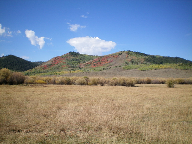
Peak 7425 as viewed from Slug Creek Road to the east. The right hump is the summit. Livingston Douglas Photo
Access
From ID-34 at the south end of Blackfoot Reservoir (11.8 miles north of US-30 in Soda Springs), turn right/east onto [signed] Blackfoot River Road and drive 10.1 miles to a signed junction with Slug Creek Road. Turn right/south onto Slug Creek Road and reset your odometer. At 6.0 miles, reach a signed “T” junction with South Trail Road. Go left/east here. At 12.6 miles, reach the Caribou National Forest Boundary. At 13.8 miles, reach a signed junction with FSR-187/Wilde Canyon Road. Turn right/west here onto Wilde Canyon Road. Drive 1.3 miles up Wilde Canyon Road and park in a pullout at a minor saddle/notch just before a cattle guard crossing (6,820 feet).
South Ridge, Class 2
The Climb
From the parking pullout, cross to the north side of Wilde Canyon Road and scramble north up a steep scrub-and-scree slope (avoiding any gullies) to reach Point 7385 in open terrain. Descend north to an aspen-clogged saddle area. The bushwhack through this aspen patch is short but BRUTAL and offers no visibility. Once past the aspens, cruise from the saddle north to the true summit on easy, short scrub. The summit of Peak 7425has a modest cairn and a triangulation post and wiring laying on the ground nearby. I rebuilt the cairn and stuck a cattle fence post in it. The summit offers a splendid view of beautiful Green Basin to its southwest.
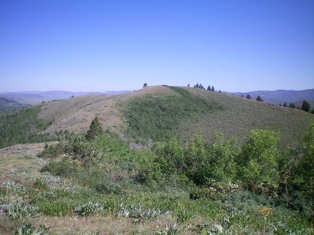
The gentle summit hump of Peak 7425 as viewed from Point 7385 to its south. Livingston Douglas Photo
Southeast Ridge, Class 2
The Descent
From the summit, descend on a ridgeline east (briefly) then southeast through scrub that thickens as you descend. The ridge ends in a brushy, aspen-clogged gully. Bushwhack east-southeast across the dry gully to reach a clearing. Once in the clearing, head south on open scrub/grass all the way to intercept Wilde Canyon Road. Hike right/west up Wilde Canyon Road to the parking pullout at the base of the south ridge and your parked vehicle.
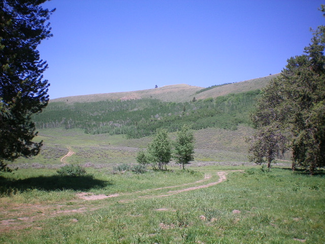
Peak 7425 as viewed from Green Basin on its west side. Livingston Douglas Photo
Additional Resources
Regions: Aspen Range->Peale Mountains->SOUTHERN IDAHO
Mountain Range: Peale Mountains
Longitude: -111.3253 Latitude: 42.62579