Elevation: 7,444 ft
Prominence: 384
This peak is not in the book. Published November 2020
Peak 7444 is one of three peaks that surround a basin north of Timbered Dome. It is best accessed via the elusive Latham Hollow Road which begins at Antelope Creek Road. Finding Latham Hollow Road is the trick. The map errors (both USGS and Forest Service) are appalling and made this a navigational nightmare at the start. But I will clear it all up in this posting. USGS Grouse
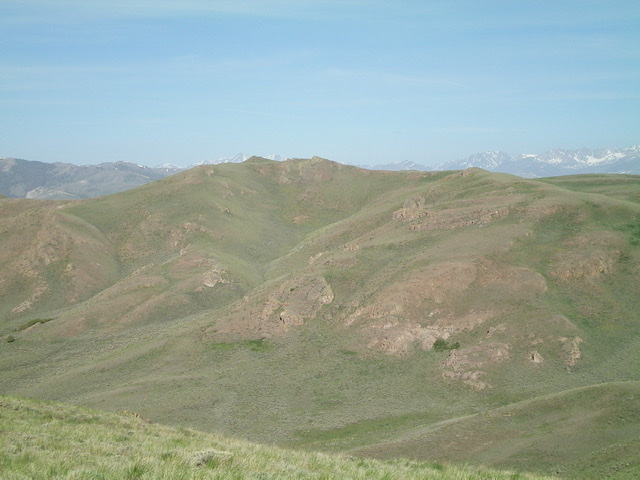
Peak 7444 as viewed from the east. The summit is left of center. Livingston Douglas Photo
Access
Antelope Creek Road/FSR-137 is located 11.5 miles north of the Conoco gas station at the south end of Arco, ID on US-93. The junction is poorly signed, so look for the road itself. Drive 10.9 miles southwest on FSR-137 to a signed junction at a bridge crossing of Antelope Creek. Go left and cross Antelope Creek on a good bridge to continue on Antelope Creek Road. From the signed junction at the bridge crossing, drive 1.8 miles farther up Antelope Creek Road to an unsigned road junction.
The jeep road heading left/east goes up a gully, crosses a saddle, then heads down to Trail Creek. At only 0.1 mile farther up Antelope Creek Road, there is an abandoned 2-track road heading left/east. This is the old Latham Hollow Road (as shown on maps). It is an abandoned 2-track road with severe ruts. It is probably impassable even to ATVs, though you can hike it.
Here’s the trick. The jeep road to Trail Creek has an unsigned junction a short distance up it. A spur road on the right/south heads south to Latham Hollow Road, joining Latham Hollow Road where it is quite drivable for a 4WD vehicle. This “connecting” road is rougher than both the road to Trail Creek and Latham Hollow Road from the juncture with the spur road. But if you can drive it, you can shorten this hike significantly. This is the way that people currently access and drive up Latham Hollow Road.
I hiked Latham Hollow Road from its rough start and but descended the spur road to see if it connected to the road to Trail Creek (which it does). Now you know the real story. No maps show the “connecting” road but they do show Latham Hollow Road as just fine directly from Antelope Creek Road, which it most certainly is NOT.
West Ridge, Class 2
The Climb
Hike south on Latham Hollow Road for about 3 miles to reach the base of the west ridge at a cattle fence (GPS coordinates: 43.6433⁰N, 113.5676⁰W). Follow this cattle fence east up the ridge until it ends at a rocky buttress. Skirt the right/south side of the buttress and continue east to another ridge hump. Drop 105 vertical feet to a minor saddle then continue east up the ridge to the summit. There is some taller, thicker sagebrush early on but it soon gives way to short, easy scrub for the rest of the climb. There is a small cairn on the summit and a splendid view of Timbered Dome to the south.
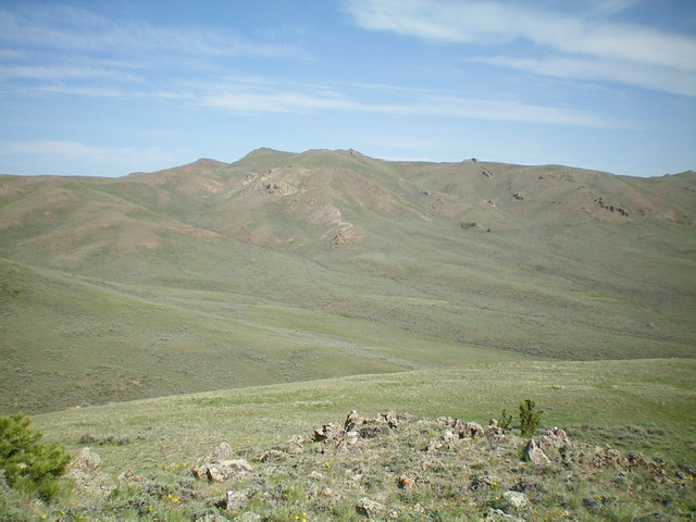
Peak 7444 (summit is left of center) as viewed from the southeast. Livingston Douglas Photo
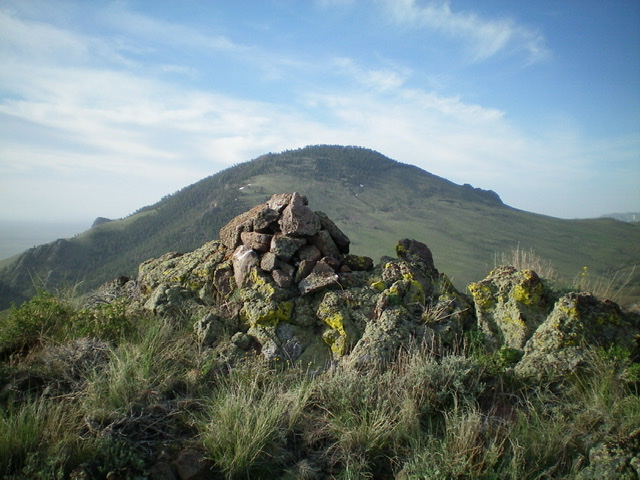
The summit cairn atop Peak 7444 with Timbered Dome in the distance. Livingston Douglas Photo
Northeast Ridge, Class 2
The Descent
From the summit, follow the open, easy scrub of the weaving, undulating ridge northeast then east up over Point 6995. From Point 6995, descend a short distance southeast to the connecting saddle with Peak 7248, the next objective on this three-peak adventure.
Additional Resources
Regions: EASTERN IDAHO->Pioneer Mountains
Mountain Range: Pioneer Mountains
Longitude: -113.55139 Latitude: 43.64339