Elevation: 7,455 ft
Prominence: 355
This peak is not in the book. Published November 2023
Peak 7455 towers over the confluence of the Right Fork Knox Canyon and the Left Fork Knox Canyon in the Deep Creek Mountains. It is most easily climbed via its south ridge from the Right Fork Knox Canyon Road. This area is a mix of private and public land, so be careful. This climb is entirely on BLM land. USGS Bannock Peak
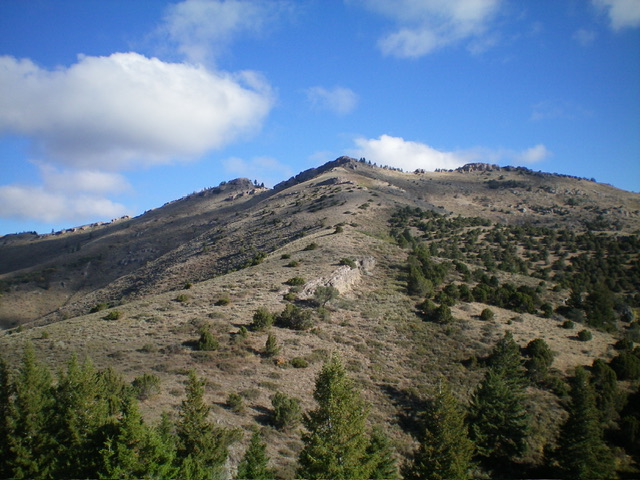
Peak 7455 as viewed from midway up the south ridge (my ascent route). The summit hump is left of center. Livingston Douglas Photo
Access
From Exit 52/Arbon Valley on I-86, drive south on [paved] Arbon Valley Road. At 23.5 miles, reach a signed junction with South Mink Creek Road. At 26.8 miles, reach a signed junction with Knox Canyon Road. Turn right/west onto Knox Canyon Road West. Drive 6.0 miles west then southwest on Knox Canyon Road West to reach an unsigned road junction in a meadow at a major fork in Knox Canyon. The main road turns left-ish/south here to follow the Left Fork Knox Canyon. Park in a pullout just south of the junction (5,700 feet; 42⁰30’18”N, 112⁰40’03”W).
South Ridge, Class 3
The Climb
From the road junction, walk about 1/8 mile up the Right Fork Knox Canyon Road to a gated road closure. This road closure gate is far sooner than the private/public property boundaries suggest it should be. I believe that it is still on BLM land. The gate was open and was not posted. This gated road closure is just past the steep cliffs at the base of the south ridge of Peak 7455. Leave the road here and scramble steeply north then northeast up a scrub slope, angling right/east to reach the crest of the south ridge.
Climb up through a mix of junipers and limestone cliff bands (Class 3) to reach flatter, easier terrain that is a mix of scrub and scattered junipers. The ridge is much better defined now. Follow the enjoyable ridge crest as the junipers soon end and the terrain is completely open. The terrain quickly becomes a mix of broken rock and short scrub. The ridge wiggles a bit and heads up over Point 6692. From there, continue northward with a few ups and downs to reach ominous, rocky Point 7320+ (the southeast summit).
Skirt the left/west side of this point on a decent elk trail(s) across a sagebrush slope to reach a final ridge saddle. From this saddle, scramble up across (or skirt the left/west side of) a few limestone cliff bands to reach the summit of Peak 7455. The summit has a USGS benchmark and a nice summit cairn. When descending back down to the Right Fork Knox Canyon Road, be careful to not go too far left/east or you will get into ridge cliffs that are impossible to downclimb. The ridge becomes rounded and poorly defined down low so err to the right/west if you must.
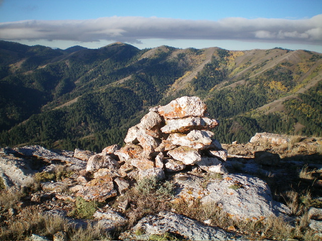
The large summit cairn atop Peak 7455. Livingston Douglas Photo
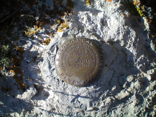
The USGS benchmark atop Peak 7455. Livingston Douglas Photo
Additional Resources
Regions: Deep Creek Mountains->SOUTHERN IDAHO
Mountain Range: Deep Creek Mountains
Longitude: -112.6711 Latitude: 42.5241