Elevation: 7,460 ft
Prominence: 400
This peak is not in the book. Published November 2021
Peak 7460 is the high point on a long ridge line that runs up the east side of Pats Creek. The easiest ascent route comes up from Pats Creek Road/FSR-173 to the west. The south rib makes for a magnificent alternative to the mostly-road hike from the west and returns you to the base of Pats Creek Road. USGS Pats Creek
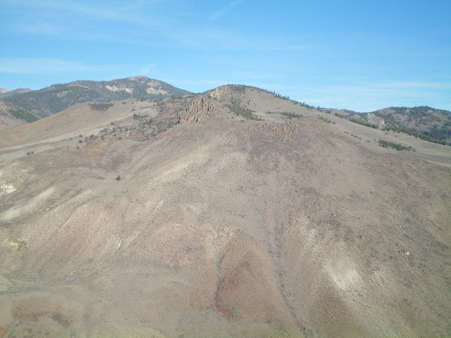
Peak 7460 (dead center, forested, in mid-ground) as viewed from the southeast. The summit is hidden by the [lower] east summit that is the visible hump. Livingston Douglas Photo
Access
From US-93 at the north end of Challis, turn left/west onto [signed] Clinic Avenue. Follow Clinic Avenue as it goes west briefly, then jogs north briefly, then heads west to a “T” junction with [unsigned] Challis Creek Road. This junction is 0.4 miles from US-93. Turn right/north onto Challis Creek Road and drive 9.2 miles to a signed junction with Pats Creek Road/FSR-173. Park at this junction (5,705 feet).
West Face/West Ridge, Class 2
The Climb
From the road junction, hike about 1.8 miles up Pats Creek Road (a narrow, seldom-used 2-track) past a junction and right/east across two small streams to reach an open area at the base of the steep west face. The west ridge is above with a line of mountain mahogany trees on it. You can also continue north up Pats Creek Road for another 0.2 miles to reach the toe of the northwest spur of the west ridge, which may provide an easier route to access the west ridge. Leave the road and scramble east up the steep face of scrub and scree/gravel to reach the crest of the west ridge. This is a 550-foot grind up consistently steep, loose terrain. Not fun.
Once on the west ridge, follow it south-southeast up to 6,850 feet. Skirt the left/north side of a ridge hump and head left/east up the obvious ridge. The ridge terrain is easy scrub all the way to a minor hump that is located just south of the forested summit. From the hump, descend 30 vertical feet northeast to a minor saddle then head northeast then left-ish/north up into the mountain mahogany (and ground boulders) to reach the small, semi-open summit of Peak 7460. On the final approach, do not be tempted to go right/east to the [lower], open east summit hump. There is a modest summit cairn on the west/true summit.
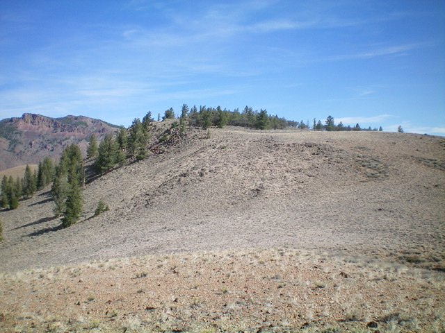
The forested summit hump of Peak 7460 as viewed from just below the summit plateau to its south. Livingston Douglas Photo
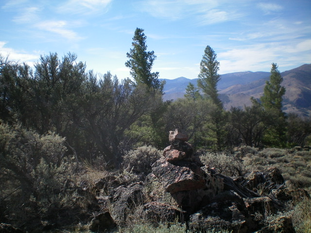
The summit of Peak 7460. It has that wonderful combination of rock and mountain mahogany. Livingston Douglas Photo
South Rib, Class 2
The Descent
From the true/west summit, descend back to the minor hump mentioned in the ascent route. From that hump, descend west (briefly) to reach a rocky outcrop at the head of the south rib. The south rib is completely open, obvious, and beautiful. It follows the Pats Creek drainage all the way down to Challis Creek Road near the junction with Pats Creek Road. From the rocky outcrop, descend southwest then south on the magnificent rib/ridge all the way back to Challis Creek Road.
The meandering rib has a few ups and downs, but the terrain is easy scrub and gravel until lower down. The lower 1/3 of the rib has rocky outcrops to skirt and more talus/scree in the mix. As you approach the final descent to Challis Creek Road, leave the ridge crest in a flat area at 5,800 feet and bushwhack left-ish/southeast down through sagebrush to reach the road. The direct descent to the road is almost cliffed and is rather dangerous, trust me. Once on Challis Creek Road, walk a short distance west up the road to reach the Pats Creek Road junction and your parked vehicle.
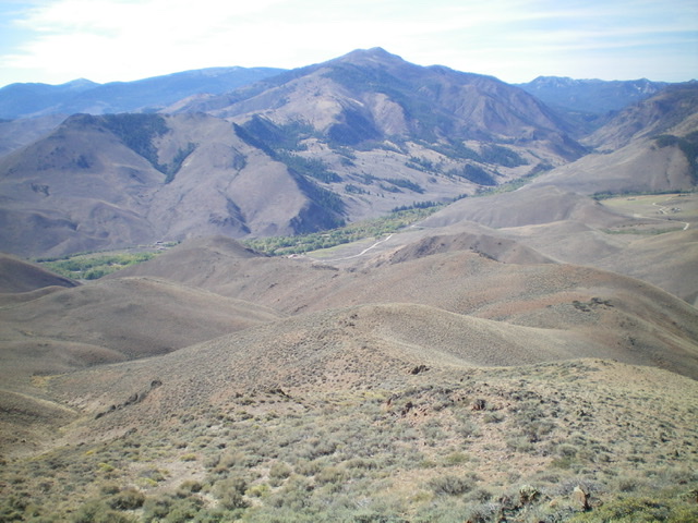
Looking down the south rib from its apex. The rib heads straight then right then diagonally left to reach Challis Creek Road (which is visible in the photo). Livingston Douglas Photo
Additional Resources
Regions: Eastern Salmon River Mountains->Salmon River Mountains->Southeast Corner Peaks->WESTERN IDAHO
Mountain Range: Eastern Salmon River Mountains
Longitude: -114.33511 Latitude: 44.60079