Elevation: 7,462 ft
Prominence: 602
This peak is not in the book. Published November 2022
Peak 7462 is located on the north side of the East Fork Wood River. This area is a mix of private and public land, so be careful. Triumph Gulch is on BLM land. However, most of Peak 7462 is on private land, so please obtain permission from the landowner before conducting this climb. USGS Sun Valley
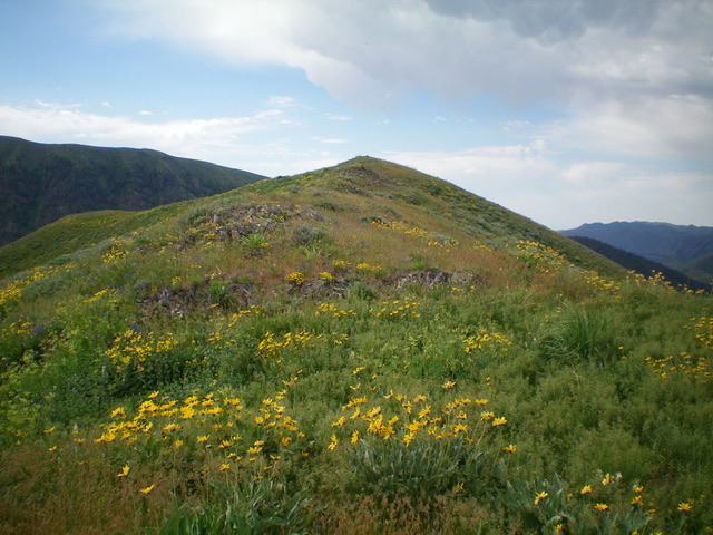
Peak 7462 (summit is well left of center) and Point 7013 (hump right of center) as viewed from a side ridge to its northeast. Livingston Douglas Photo
Access
From ID-75, drive 4.9 miles northeast up East Fork Road to a signed junction with Triumph Gulch Road (a BLM Road). Drive northwest up Triumph Gulch for 1.1 miles to a clump of aspen trees on the left side of the road. This is the launch point for this hike. However, you must park either 0.2 miles north or south of this point in order to find any reasonable pullout alongside the road. I parked at the 0.9-mile point on Triumph Gulch Road (6,385 feet). GPS coordinates: 43⁰38’59”N, 114⁰16’48”W.
North Ridge, Class 2
The Climb
From the pullout along Triumph Gulch Road, hike 0.2 miles northwest on the road to reach the clump of aspen trees. Leave the road and bushwhack west up through sagebrush to quickly reach a saddle that is just north of Point 6843 on a lateral ridge that separates Triumph Gulch from Decker Gulch. This is not the north ridge of Peak 7462. That ridge is on the other side of Decker Gulch. From the saddle, descend diagonally northwest to Decker Gulch, dropping 100 vertical feet in so doing. The sagebrush is a bit tedious in this descent. Decker Gulch has a small stream to jump across. Once across the stream, you leave BLM land and enter private land, though there is no fencing or signage to indicate such.
From Decker Gulch, scramble southwest up steep sagebrush and other vegetation to reach the small, rocky summit of Point 7013. Descend 35 vertical feet to a small saddle in easy, open scrub. From the saddle, climb south up the north ridge of Peak 7462 in easy, open terrain to reach a juncture with the northwest ridge. The northwest ridge has an old 2-track road on it. Follow the 2-track road up the north ridge until it ends. Continue climbing the north ridge using a weak game trail on the right/west side of the ridge crest to help navigate through the sagebrush and other vegetation. The ridgeline summit hump has a small cairn.
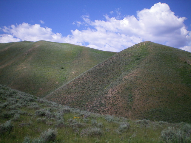
Approaching the summit hump of Peak 7462. Livingston Douglas Photo
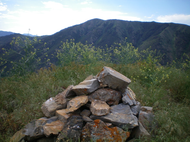
The summit cairn atop Peak 7462. Livingston Douglas Photo
Additional Resources
Regions: EASTERN IDAHO->Pioneer Mountains
Mountain Range: Pioneer Mountains
Longitude: -114.29219 Latitude: 43.64309