Elevation: 7,483 ft
Prominence: 303
This peak is not in the book. Published November 2022
Peak 7483 is a beautiful, steep, ridgeline summit that is located on the west side of Cove Creek. It towers over Driveway Gulch and is most easily climbed via its east ridge from Cove Creek Road/FSR-124. Although there is private land nearby, this climb is entirely on BLM land. USGS Hyndman Peak
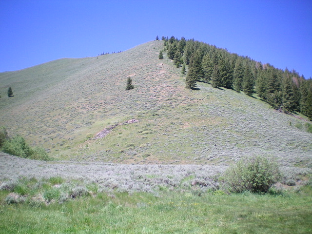
Peak 7483 and its magnificent east ridge (dead center) as viewed from the base of the east ridge. The summit is left of center on the flat, high summit ridge. Livingston Douglas Photo
Access
From ID-75, drive 7.9 miles northeast up East Fork Road to an unsigned junction with Cove Creek Road/FSR-124. Turn right/south onto Cove Creek Road drive 1.4 miles to an unsigned junction (not shown on maps) with a 2-track road heading right/southwest up Driveway Gulch. Drive about 75 yards up this 2-track road and park in a pullout area. This pullout sits at the base of the magnificent east ridge of Peak 7483. Park here (6,370 feet). GPS coordinates: 43⁰37’50”N, 114⁰11’54”W. A popular hiking/horseback riding trail continues up into forested Driveway Gulch.
East Ridge, Class 2
The Climb
From the parking pullout, scramble west directly up the relatively easy sagebrush on the rounded ridge with some loose underlying shale to contend with. The ridge crest is open terrain all the way up to the summit ridge and a ridge corner at 7,200 feet. Follow the ridge crest left-ish/southwest, staying in open scrub just to the left of a pine forest. In contrast to the steep climb required to reach the summit ridge, the summit ridge itself is of moderate grade and goes quickly. The summit hump has a small cairn on top.
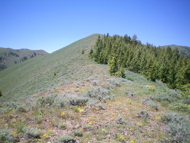
The final push to the summit high on the east ridge. Livingston Douglas Photo
The grassy summit and small cairn atop Peak 7483. Livingston Douglas Photo
Additional Resources
Regions: EASTERN IDAHO->Pioneer Mountains
Mountain Range: Pioneer Mountains
Longitude: -114.21049 Latitude: 43.62929