Elevation: 7,486 ft
Prominence: 346
This peak is not in the book. Published November 2022
Peak 7486 is located near the head of the Cove Creek drainage and south of The Narrows. It is most easily climbed via Cove Creek Road to its north. This area is a mix of private and public land, so be careful which route you take. I encountered no signage or fencing to prohibit hiking here. I describe routes from both the north and the south. USGS Baugh Creek SW
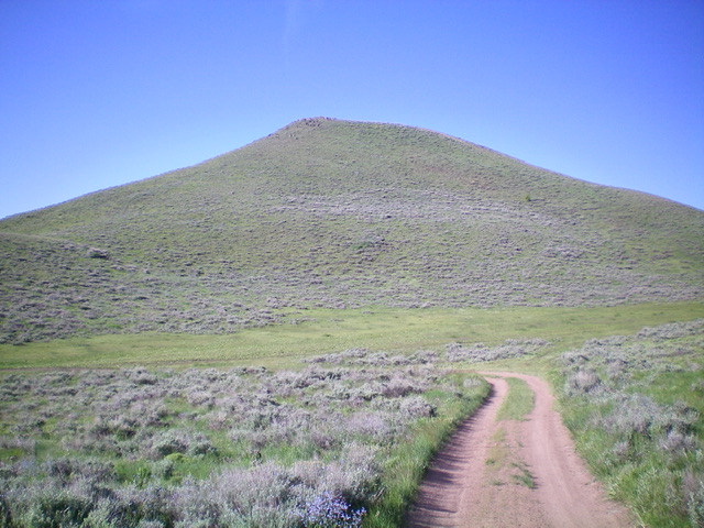
Peak 7486 and its sagebrush-covered north face. Livingston Douglas Photo
Access from the South (Quigley Road)
From its genesis at East Ridge Drive in Hailey, drive northeast up [signed] Quigley Road. At 6.1 miles, reach an unsigned junction where Quigley Road turns right/east and begins a rugged climb to a 7,095-foot saddle. At 7.6 miles, reach an unsigned junction with Slaughterhouse Creek Road. Go left/north here. At 8.4 miles, reach a large, open, grassy saddle. Park here (7,095 feet).
East Face/South Ridge, Class 2
The Climb
From the 7,095-foot saddle, bushwhack northwest diagonally up through sagebrush to reach a saddle on the south ridge between Point 7365 and Peak 7486. Move higher to avoid multiple gully crossings as you do this upward traverse. Once at the ridge saddle, follow the ridge crest north to the summit on easy scrub. The summit of Peak 7486 is a small perch with a torn-down cairn on the rocky outcrop that is the high point.
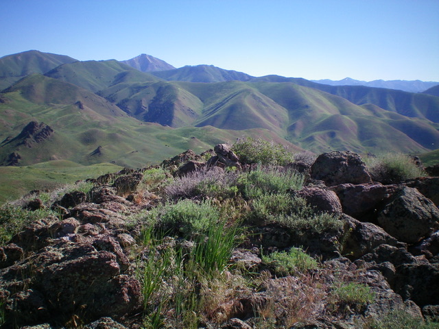
The rock-and-scrub summit of Peak 7486. Livingston Douglas Photo
North Face, Class 2
The Descent
From the summit, descend north down the sagebrush face (not too bad) to reach Cove Creek Road. Follow the road north then west as it skirts the base of Point 7435 and reaches a sharp turn at the 7,140-foot saddle at the base of Peak 7620. This concludes the first leg of today’s 2-peak journey. Peak 7620 is up next.
Access from the North (Cove Creek Road)
From its junction with East Fork Road, drive 4.2 miles south up [unsigned] Cove Creek Road/FSR-124 to The Narrows and park alongside the road just before it steepens and gets rougher (6,674 feet). This point is 0.8 miles up from the meadow junction (and creek crossing) at 3.4 miles. GPS coordinates at the parking pullout: 43⁰35’40”N, 114⁰11’09”W.
North Ridge, Class 1
The Ascent
From the parking pullout at The Narrows, hike south up Cove Creek Road to a gully on the north side of the peak and an unsigned road junction. Follow a 2-track road right/southwest up onto the north ridge. Hike south up a weak 2-track road to the summit.
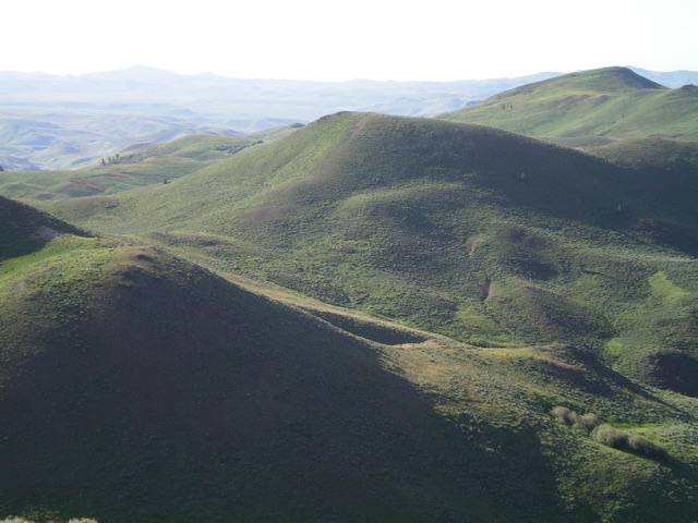
Peak 7486 (in mid-ground, center of photo) as viewed from Peak 7620 to its northwest. Livingston Douglas Photo
Additional Resources
Regions: EASTERN IDAHO->Pioneer Mountains
Mountain Range: Pioneer Mountains
Longitude: -114.17679 Latitude: 43.57669