Elevation: 7,493 ft
Prominence: 443

This peak is not in the book. Published November 2023
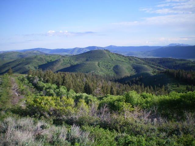
Peak 7493 is a forested summit on Schmid Ridge in the Aspen Range. It is on posted, private land that is monitored by surveillance cameras. Peak 7493 is closed to the public. USGS Dry Valley

Peak 7493 (dead center in mid-ground) as viewed from Peak 7568 to its south. Livingston Douglas Photo
Access
There is an active phosphate mining operation on the west slopes of Peak 7493. There is a well-graded mining road coming up Caldwell Canyon from Slug Creek Road but it is gated and posted. There is an operational facility at the junction of Caldwell Canyon and Slug Creek Road. Perhaps when this mining operation is completed, access may be granted to hikers in the future. However, this area is private land and may never be accessible. The USGS topo map shows a jeep road heading up Caldwell Canyon. However, the road has been upgraded significantly to accommodate the phosphate mining trucks operating in the area.
Knowing about the mining operation, I attempted to climb the peak from the south via an old 2-track road on the west face of Schmid Ridge. But this old 2-track is posted as you approach a west shoulder that separates Peak 7493 from Peak 7568 to its south. It is aggressively posted with threats of surveillance cameras and lots of orange paint. This line is the demarcation point between BLM land to the south and private land to the north. I gave up and retraced my steps to climb the west shoulder of nearby Peak 7568 and then Peak 7550 to its south.
Additional Resources
Regions: Aspen Range->Peale Mountains->SOUTHERN IDAHO
Mountain Range: Peale Mountains
Longitude: -111.3394 Latitude: 42.7254