Elevation: 7,495 ft
Prominence: 315
This peak is not in the book. Published November 2020
Peak 7495 is a gentle scrub hump on the south side of Dry Canyon in the White Knob Mountains that are located on the west side of the Antelope Creek drainage. Its east and north aspects can be easily climbed from the decent jeep road that goes up Dry Canyon from Antelope Creek Road. USGS Miller Peak
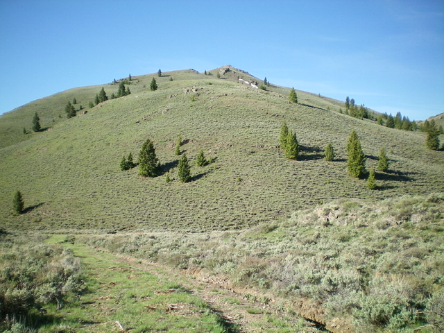
The gentle north ridge of Peak 7495 as viewed from its base on Dry Canyon Road. Livingston Douglas Photo
Access
Antelope Creek Road/FSR-137 is located 11.5 miles north of the Conoco gas station at the south end of Arco, ID on US-93. The junction is poorly signed, so look for the road itself. Drive 19.5 miles southwest on FSR-137 to a signed junction with Dry Canyon Road/FSR-575. Turn right/west onto FSR-575 and drive 0.9 miles up the road. Park in a small pullout at a gully on the left/south side of the road (6,700 feet). Better parking is found earlier on the road (at the 0.5-mile point) at a grassy cattle trough.
Northeast Ridge, Class 2
The Climb
From the base of the gully, bushwhack southeast up a slope of sagebrush to reach the crest of the northeast ridge of Peak 7495. Follow the ridge on shorter scrub to Point 7112 then drop slightly to a saddle. Continue southwest up short scrub to the gentle hump that is the official/south summit of Peak 7495.
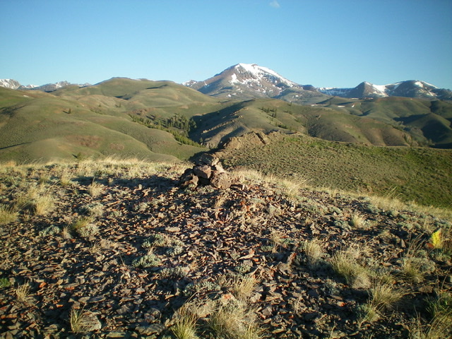
The summit of Peak 7495, looking northwest. Snow-covered Smiley Mountain is in the distance. Livingston Douglas Photo
North Ridge, Class 2
The Descent
From the south summit, descend northwest 35 vertical feet to a minor saddle on the summit ridge. Scramble north up the ridge to the north summit which measures identical height (by altimeter) to the south summit but appears to be higher than the south summit. Descend the magnificent north ridge north then northeast then north down to Dry Canyon Road. The ridge is open terrain of scrub/sagebrush and some scree/gravel—not bad at all. Either return to your parked vehicle down Dry Canyon Road or begin your assault on Peak 7780 to the north from here.
Additional Resources
Regions: EASTERN IDAHO->Pioneer Mountains
Mountain Range: Pioneer Mountains
Longitude: -113.71759 Latitude: 43.65129