Elevation: 7,496 ft
Prominence: 586
This peak is not in the book. Published November 2020
Peak 7496 is a forested peak north of Kilgore, ID that sits above Pasture Creek (to the north), Cottonwood Creek (to the east), and East Camas Creek (to the west). A forest bushwhack is required as there are no trails or roads on this peak. The easiest climb is from a bridge crossing of Cottonwood Creek at the base of the east side of Peak 7496. This area is a mix of private and public land so be careful with the specific route that you take. The two routes described here are entirely on National Forest land. USGS Kilgore
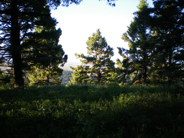
The summit area of Peak 7496. Livingston Douglas Photo
Access
From the north side of Kilgore, ID, drive north on [signed] Cottonwood Creek Road/FSR-026. At 3.9 miles, reach a [signed] junction with East Camas Creek Road. Continue straight on Cottonwood Creek Road. At 5.8 miles, reach the National Forest boundary. At 6.2 miles, reach a bridge crossing of Cottonwood Creek. Park in a pullout at this crossing (6,706 feet).
East Shoulder, Class 2
The Climb
From the bridge crossing, bash your way west through tall, thick brush and forest to reach the base of the mountain. Reach the forest line just right/north of a large dispersed campsite that is at the end of a muddy side road that leads there from Cottonwood Creek Road just south of the bridge crossing. This area is at the base of a forested shoulder and is just right/north of a gully that is not visible from here. Bushwhack west, straight uphill through a somewhat open pine forest with tall, difficult brush/veg and some blowdown. This is not pleasant.
Stay right/north of the gully as it emerges. The gully eventually dies out and becomes a steep face. The brush only thins out much higher up the rounded shoulder. The shoulder bends left-ish/southwest as you gain elevation. Just keep going uphill and you will reach the semi-open summit of Peak 7496. Views are limited and there was no summit cairn, so I built one.
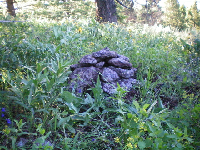
The newly-built summit cairn atop Peak 7496. Livingston Douglas Photo
Southeast Ridge/South Spur, Class 2
The Descent
From the summit, descend southeast down an ill-defined, forested ridge. The pine forest is fairly dense here, with lots of blowdown and brush. Reach a minor saddle at 7,030 feet and pick up a fence row here. This fence row is a godsend because it leads south down to the critical connecting saddle with Peak 6964. The fence row heads southeast up over Point 7170. Either follow the fence row there and descend south from there OR skirt the right/west side of Point 7170 (as I did) to minimize your uphill effort. Angle left/southeast to rejoin the fence row on the ridge crest south of Point 7170.
Cruise south on the rounded, ill-defined ridge using a foot path on the left/east side of the fence row to reach the wide saddle at the base of Peak 6984. At the south end of the saddle, reach a junction of the north-south cattle fence (that you have been following) and an east-west cattle fence that crosses the saddle. There is no signage or orange paint on any of these fences. The north-south fence row ends here. This is the conclusion of the first leg of a 2-peak journey. Peak 6984 is next.
Additional Resources
Regions: Centennial Range->EASTERN IDAHO
Mountain Range: Centennial Range
Longitude: -111.91479 Latitude: 44.49019