Elevation: 7,536 ft
Prominence: 396
This peak is not in the book. Published December 2019
Peak 7536 is a beautiful peak that quickly rises almost 2,000 vertical feet from Croy Creek Road on the east side of Red Elephant Gulch. Its south ridge makes for a good early-season climb when the mountains around Ketchum are still snow-laden. There is a lot of private property in this area so be careful. Consult the BLM Fairfield map to stay out of trouble. USGS Richardson Summit
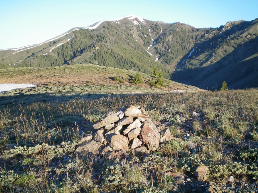
The summit cairn atop Peak 7536 with snow-clad Kelly Mountain (8,826 feet) in the distance. Livingston Douglas Photo
West Face, Class 2
Access
From the junction of ID-75 and Bullion Street in downtown Hailey, drive west on Bullion Street. It becomes Bullion Road and then Croy Creek Road. It bends southwest to follow Croy Creek upstream for quite a number of miles. From ID-75, drive west on Bullion Street/Bullion Road/Croy Creek Road for 6.8 miles to the unsigned junction with Red Elephant Gulch Road. Turn right/northwest onto this unsigned dirt road. At 0.4 miles, enter public lands (sign). At 1.5 miles, go straight at an unsigned junction to remain on Red Elephant Gulch Road. At 2.1 miles, go straight on a spur road to reach a turnaround/campsite at a gravel pit area. The elevation here is 6,247 feet.
The Climb
From the parking area/campsite, scramble up the very steep west face through thick sagebrush with a loose shale base. You will find enough gaps in the sage to make the going feasible. You will soon reach a mining road. Walk briefly north on the mining road to find a shoulder heading up the west face. Leave the road the climb up the shoulder. The face is not as steep here as it was early on. The terrain on the shoulder is more sage and loose shale. Grind your way higher until you reach the summit area. The east summit is the high point.
Southwest Ridge, Class 2
Access
Same as for the west face. This is the final leg in a loop route that begins and ends along Red Elephant Gulch Road.
The Descent
From the summit, descend west to the false summit. From there, follow the southwest ridge down to Point 6881. From Point 6881, continue south-southwest down the narrow ridge to reach Red Elephant Road at the toe of the ridge. The ridge terrain is mostly short scrub with some sagebrush to weave around. No rocky outcrops to contend with. Once on the road, hike north for 0.8 mile to the parking turnaround/campsite and your vehicle.
Additional Resources
Regions: Smoky Mountains->WESTERN IDAHO
Mountain Range: Smoky Mountains
Longitude: -114.42079 Latitude: 43.49249