Elevation: 7,540 ft
Prominence: 280
This peak is not in the book. Published November 2021
North Arco Peak is a soft-ranked hump located due north of Arco Peak (7,547 feet) and is only seven feet lower than its brother to the south. It is best climbed in combination with Arco Peak. If climbed solo, the east shoulder makes for a fun scramble from Arco Pass Road. USGS Arco North
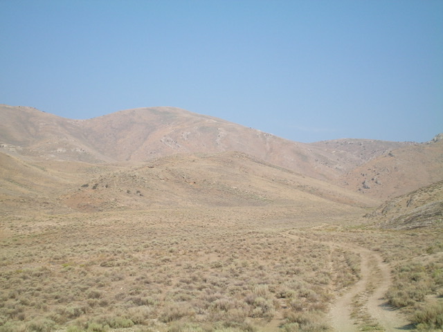
North Arco Peak (left of center) as viewed from the east. Livingston Douglas Photo
Access
At the south end of Arco, there is a frontage road (Highway Drive) on the east side of the US-20. Just north of the Conoco gas station, look for the Lost River Motel on the right/east side of the highway. Find an access road here that goes east to intersect Highway Drive. There is a public park of sorts here with a picnic table. When you reach the “T” junction with [signed] Highway Drive, turn right/south and drive 0.3 miles to a [signed] junction. Go left/east here onto 2450N. This junction is directly east of the Conoco gas station. Drive 1.0 mile on 2450N to a signed road junction. Go left/north here. This is the start of Arco Pass Road. Reset your odometer here. At 2.6 miles, the road crosses a cattle guard. Park in large pullout on theleft/west side of the road just after passing the cattle guard (5,563 feet).
East Shoulder, Class 2
The Climb
From the parking pullout, follow a decent 2-track jeep road heading west on the right/north side of a fence row. This fence row is the dividing line between public land and private land, so be sure to stay on its right/north side. When you reach a fence corner, continue right-ish/northwest on the 2-track road all the way to its terminus at the mouth of a narrow, dry gulch at the base of the east face of North Arco Peak. From here, there are two options: bushwhack up the narrow gulch on a cattle trail to the [obvious] base of the east shoulder and then climb the east shoulder to the summit (my descent route) OR leave the gulch immediately and scramble left/south a short distance up onto a rib that leads up to the east shoulder higher up (my ascent route).
I chose the latter for my ascent since it is takes a more direct line to the summit. Just for variety, I did the first option for my descent route. From the mouth of the gulch, scramble left/south up scrub/gravel for about 50 yards up onto the rib. Scramble due west up the rib, working through a few rocky outcrops early on then grind up through short grass/scrub and gravel to intercept the east shoulder. Once on the east shoulder, follow it southwest then west up to the summit area. The shoulder becomes a face as you approach the summit cap. If you reach the summit area just south of the high point (as I did), follow a foot path on the ridge right/north to the summit high point. The high point of North Arco Peak is a collection of ground boulders that protrude noticeably from the flat summit area. There is no summit cairn.
North Arco Peak has a west summit and it appears to be of similar height. I investigated it but it measures at five feet lower in elevation, according to my altimeter. It appears to be slightly lower when viewed from the true/east summit rocks. From the summit, descend the east shoulder east then northeast then east down into the dry gulch. Follow a cattle trail south for a short distance to reach the mouth of the gulch and the 2-track road. Follow the 2-track road back to Arco Pass Road and your parked vehicle.
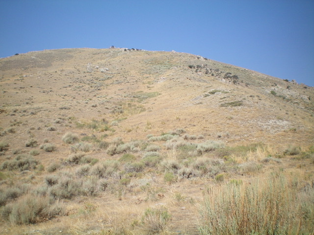
The east side of North Arco Peak as viewed from the base of the east shoulder. Livingston Douglas Photo
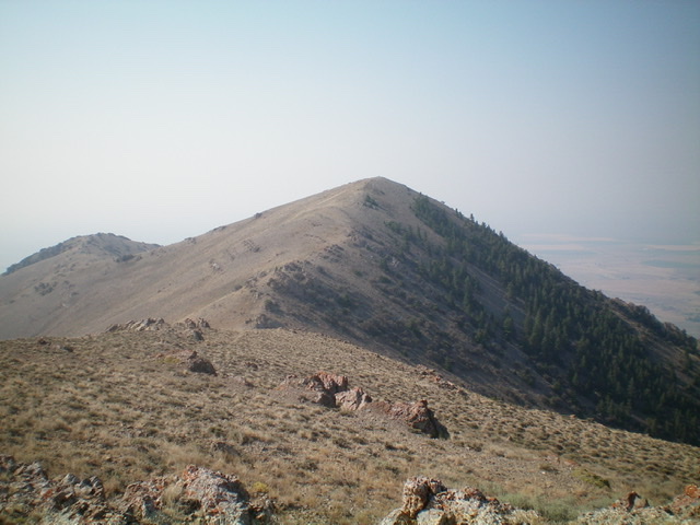
Arco Peak as viewed from the summit of North Arco Peak. Livingston Douglas Photo
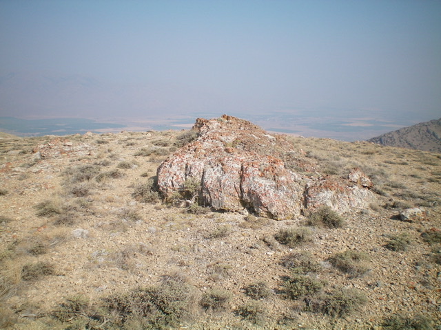
The summit boulders atop North Arco Peak. Livingston Douglas Photo
Additional Resources
Regions: EASTERN IDAHO->Lost River Range
Mountain Range: Lost River Range
Longitude: -113.30029 Latitude: 43.67359